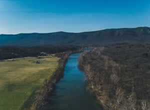
Top Spots in and near Shenandoah National Park
-
Luray, Virginia
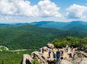
Skyline Dive runs through the heart of Shenandoah National Park. Consisting of 72 overlooks over 105 miles, Skyline Drive offers great views of the surrounding Blue Ride Mountains and valleys. Hazel Mountain Overlook is located at mile marker 33 along Skyline Drive and is one of a handful of ov...
Read more
-
Hinton, Virginia
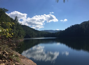
Directly off of Interstate 81, headed toward West Virginia on Rt 33 is a beautiful lake only known by the locals. Switzer Lake, named because Switzer Dam was placed on the Dry River years ago to aid Harrisonburg and the surrounding area with its increased need for drinking water. The lake is seld...
Read more
-
Luray, Virginia
Buck Hollow Overlook is one of 72 beautiful overlooks that are on Skyline Drive. Skyline Dive is the road that winds through the heart of Shenandoah National Park. Over 105 miles long, Skyline Drive offers great views of the surrounding Blue Ride Mountains and valleys while simultaneously offeri...
Read more
-
Hinton, Virginia
Switzer Lake is a great spot outside of Harrisonburg, Virginia for fly fishing during the spring, summer, and fall. The lake is pretty decently sized, so you shouldn't have any problems finding a place along the shores to wade out and cast. Small boats are also allowed on the lake as well. Make s...
Read more
-
Lyndhurst, Virginia
4.6
14.2 mi
/ 3960 ft gain
From the parking area at Reids Gap, start off on the white-blazed A.T heading south as the trail begins on the left side of a clearing. You will begin climbing Meadow Mountain shortly and in .8 miles arrive at the top of the ridge, where you will continue on downhill for another .8 miles until y...
Read more
-
Roseland, Virginia
Note: We usually get a chance to take this trip in the summer, so please pay attention to the weather and pack accordingly. This description is for a July/August hike and the temperatures were in the 80s during the day and 60s at night. During this time of year rain showers are always a possibili...
Read more
-
Luray, Virginia
If you're driving south on Skyline Drive, park in the lot on the right side of Skyline Drive immediately after you cross Route 211/Thornton Gap entrance. If you're driving north on Skyline Drive, the lot will be on the left side immediately before the Thornton Gap entrance.
The trailhead is at t...
Read more
-
Roseland, Virginia
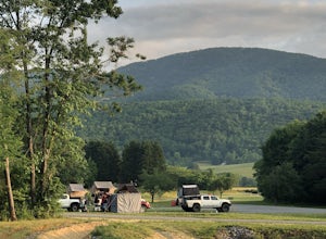
This place has it all : a bomb fire pit, live music, distillery, restaurant, 48 taps, mountain views, and more! Not to mention, it’s in a great location for exploring. It’s close to tons of breweries, wineries, and cideries, it’s just a few miles from the Appalachian trail, and close to Shenando...
Read more
-
Brandywine, West Virginia
4.5
2.46 mi
/ 630 ft gain
High Knob Tower Trail is an out-and-back trail that takes you through a nice forest located near Brandywine, West Virginia.
Read more
-
Vesuvius, Virginia
Park in The Slacks Overlook parking lot on the Blue Ridge Parkway, around milepost 20. From there exit the parking lot back onto the road and head left. About 300 feet from the parking lot there is the trail entrance. It isn't too hard to find if you are looking for it, but there aren't any marki...
Read more
-
-
Vesuvius, Virginia
Located at mile marker 19 along the Blue Ridge Parkway, 20 Minute Cliff Overlook is super easy to access and has an amazing 180 degree panoramic view. Looking West over the Blue Ridge Mountains, this 2,715 foot overlook has a great view of the Priest to the South, Maintop Mountain and Fork Mounta...
Read more
-
Raphine, Virginia
4.5
6.03 mi
/ 538 ft gain
Saint Mary's Wilderness is an out-and-back trail that takes you by a waterfall located near Vesuvius, Virginia.
Read more
-
Raphine, Virginia
Saint Mary's Wilderness is one of Virginia's largest designated wilderness areas and is an old iron ore mining area. There are two ways to get to Saint Mary's Falls and this Blue Ridge adventure will start you off at the parking area off Saint Mary's Road.
Once on Saint Mary's Road, you will dr...
Read more
-
Johnny's Road, Virginia
From Luray, follow Bixler's Ferry Road until you cross the river. The road will then T, go to the right along South Page Valley Road. Follow this road for about 6.5 miles until you pass Shenandoah River Outfitters. Shortly after this it will turn into a gravel road. Drive along the gravel road fo...
Read more
-
Rileyville, Virginia
This hike is best done as a two-day, one-night backpacking trip, however it can be done as a day hike if you don't wish to backpack.Jeremy’s Run is a beautifully forested 10 mile roundtrip hike with numerous stream-crossing. The trailhead starts at the Elkwallow Picnic area, at about mile 24 of S...
Read more


