Purcellville, Virginia
Top Spots in and near Purcellville
-
Berkeley Springs, West Virginia
Soak at Berkeley Springs State Park
5.0Berkeley Springs State Park is the only government-run spa in the United State and worth a weekend excursion. The hot springs here flow at a constant 74.3 degrees and have long been thought to possess restorative and healing powers for both body and mind. On one end of the park you'll find the ...Read more -
Washington, District of Columbia
Visit Kenilworth Aquatic Gardens
4.51.5 miThe Kenilworth Aquatic Gardens are a unique spot in Washington, D.C. The grounds are full of ponds, boardwalks, and a trail that connects you to the Anacostia River Trail. The main draw of this park are the ponds full of lotus flowers. During the summer months, they grow tall with colors ranging ...Read more -
Johnny's Road, Virginia
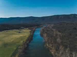
Camp along the South Fork Shenandoah River
3.0From Luray, follow Bixler's Ferry Road until you cross the river. The road will then T, go to the right along South Page Valley Road. Follow this road for about 6.5 miles until you pass Shenandoah River Outfitters. Shortly after this it will turn into a gravel road. Drive along the gravel road fo...Read more -
Lorton, Virginia
Woodmarsh Trail
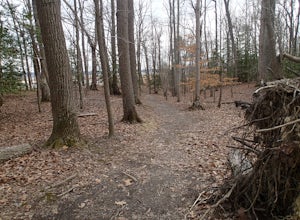
4.02.83 mi / 154 ft gainJust at the entrance to Mason Neck State Park is the Woodmarsh Trail. The entire loop is about 3 miles. This is a pleasant easy hike that is relatively flat with no rocks to speak of. The trail wanders through a forest and passes by a large swamp along the Potomac River. There is one well built o...Read more -
Luray, Virginia
Mary's Rock via Appalachian Trail
3.36 mi / 1214 ft gainIf you're driving south on Skyline Drive, park in the lot on the right side of Skyline Drive immediately after you cross Route 211/Thornton Gap entrance. If you're driving north on Skyline Drive, the lot will be on the left side immediately before the Thornton Gap entrance. The trailhead is at t...Read more -
Eldersburg, Maryland
Mineral Hill Trail
4.02.04 mi / 282 ft gainMineral Hill Trail is an out-and-back trail that takes you by a lake located near Finksburg, Maryland.Read more -
Luray, Virginia
Photograph Buck Hollow Overlook
Buck Hollow Overlook is one of 72 beautiful overlooks that are on Skyline Drive. Skyline Dive is the road that winds through the heart of Shenandoah National Park. Over 105 miles long, Skyline Drive offers great views of the surrounding Blue Ride Mountains and valleys while simultaneously offeri...Read more -
Luray, Virginia
Photograph Hazel Mountain Overlook
4.0Skyline Dive runs through the heart of Shenandoah National Park. Consisting of 72 overlooks over 105 miles, Skyline Drive offers great views of the surrounding Blue Ride Mountains and valleys. Hazel Mountain Overlook is located at mile marker 33 along Skyline Drive and is one of a handful of ov...Read more -
Luray, Virginia
Mary's Rock via Meadow Spring Parking Area
4.62.75 mi / 640 ft gainMary’s Rock is just south of the Thornton Gap Entrance in Shenandoah National Park’s Central District. This write-up details the hike from the Meadow Spring Parking area, but there are alternate routes starting from the Panorama parking area (3.7 miles round trip), Jewell Hollow Overlook (6 mile...Read more -
Luray, Virginia
Hike to Hazel Falls in Shenandoah National Park
5.05.2 mi / 100 ft gainThe trail to Hazel Falls may not be the most "wow" trail in Shenandoah but it is well worth it to reach the beautiful gorge where Hazel River falls over big boulders. You should park at the Meadow Spring parking lot at mile 33 on Skyline Drive. You will see the trail post to the right of the par...Read more -
Wardensville, West Virginia
White Rocks Loop, George Washington NF
4.59.26 mi / 1690 ft gainThe trail begins near the upper parking area next to a closed gate. If you park in the lower parking area, you'll have to walk about .3 miles up the road to get to this gate. Start out on the forest service (FS) orange-blazed trail, following it for about a quarter mile. From there head onto Old...Read more -
Luray, Virginia
Photograph Pinnacles Overlook
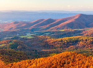
5.0Pinnacles Overlook in Shenandoah National Park is a southern facing overlook in the Central District that provides one of the best views of Old Rag. Looking south over the Blue Ridge Mountains, this 3,320 foot overlook has a great view of the southern Blue Ridge Mountains as well as a valley th...Read more -
Luray, Virginia
Photograph Jewell Hollow Overlook
One of Shenandoah National Park’s 72 overlooks, Jewell Hollow is a great place for people to stop while they are traveling through the park along Skyline Drive. Skyline Drive is the road that winds through the heart of Shenandoah National Park, starting at Front Royal in the north and ending at ...Read more -
Oldtown, Maryland
Hike to Paw Paw Tunnel
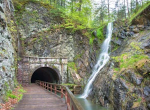
3.82.4 miThis hike is short and sweet, with it only being 2.4 miles to the other side of the tunnel and back. It's easily accessible, located right off the highway at the Paw Paw Tunnel Campground on the Potamac River at the border of Maryland and West Virgina. The town of Paw Paw is on the West Virgina s...Read more -
Luray, Virginia
Hike to The Pinnacle in Shenandoah NP
4.52.2 mi / 400 ft gainThe Pinnacle is a little-known outcrop on the Appalachian Trail in Shenandoah National Park. You will not find it marked on the park map, but that doesn’t make it any less-worthy of your time. The Pinnacle can be reached by a quick, easy hike with the family (and dog!), or you can combine it wit...Read more -
Laurel, Maryland
Hike the South Tract Trails at Patuxent Research Refuge
5 miFrom the visitors center, start on the Fire Road trail. From there, it's a choose-your-own adventure (choose-your-own ecosystem, actually). Pick the Laurel and Valley Trails to stay in the quiet (and maybe enchanted? It felt enchanted) forest. Goose Pond trail is a short jut to a--yup--pond, wher...Read more

