Purcellville, Virginia
Top Spots in and near Purcellville
-
Sky Meadows State Park, Virginia
Camp at Sky Meadows State Park
5.02 miCamping at Sky Meadows State Park is a great location to backpack with young kids or if you are new to backpacking. The campground has 18 primitive walk-in campsites located 1.03 miles from the overnight parking lot at the park entrance. Reservations can be made online. After checking-in and park...Read more -
Sterling, Virginia
Washington & Old Dominion Trail and Broadlands Ramble
5.019.55 mi / 863 ft gainWashington & Old Dominion Trail and Broadlands Ramble is a point-to-point trail where you may see local wildlife located near Ashburn, Virginia.Read more -
Boyce, Virginia
Trail Run the AT in the G.R. Thompson
7 mi / 900 ft gainTake Fire Trail Road and start your run at the parking area (labeled in the map). The trail puts you directly onto the AT, where you will turn right (southbound) to start the run (or hike). You'll stay on the AT for roughly 3.5 miles down to the Trillium Trail Parking area. At that point, turn ar...Read more -
Delaplane, Virginia
Relax at Lake Thompson
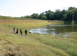
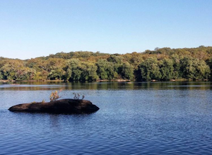
Lake Thompson is a great spot for fishing, walking, or just exploring the area with your dog. I've never had a problem with parking, but you're unlikely to find yourself alone at the lake on a nice weekend day. Its a 10-acre lake, however, so you shouldn't have a problem carving out a little bit...Read more -
Dickerson, Maryland
Hike the Sugarloaf Mountain Trail
4.76.05 mi / 1509 ft gainPark on Sugarloaf Mountain Drive (as indicated on the map below) to access the trail. It is open from March-November and is dog friendly.Read more -
Front Royal, Virginia
Snowshoe the AT in G.R. Thompson
3 miThe G.R. Thompson is a piece of public land in Linden, VA, thats primarily used by hunters. The Appalachian Trail runs right through this section and visiting during a fresh snowfall can make for a great adventure. Only 60 minutes drive from greater Washington DC area, this is an easy adventure! ...Read more -
Sharpsburg, Maryland
Antietam National Battlefield Trail
3 mi / 358 ft gainAntietam National Battlefield Trail is a loop trail that takes you by a river located near Sharpsburg, Maryland.Read more -
Boyds, Maryland
Hike or Bike the Hoyles Mill Trail
9.16 mi / 390 ft gainPark on Clarksburg Road (see map) and head onto the marked trail. It can get muddy at times so pack accordingly. Great for kids, and dog friendly too.Read more -
Boyds, Maryland
Black Hill Regional Park Loop
5.02.78 mi / 312 ft gainThe Black Hill Regional Park has 1300 acres of oak forests that have views of the Little Seneca Lake. This lake offers a place for visitors to canoe and stand up paddle board. This trail is open to hiking and mountain biking. In addition, dogs are welcome to use the trail but must be on leash a...Read more -
Manassas, Virginia
Hike and Explore Bull Run Battlefield
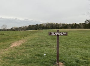
4.31.2 miLocated about 40 minutes from D.C. just off I-66 in Manassas, VA. Henry Hill is the starting point and headquarters that can lead you to multiple trails ranging from 1-5 miles depending on the route you choose here. Ample parking at HQ as well as clean restrooms. Tours are available here. Rolling...Read more -
Manassas, Virginia
Trail Run at Bull Run
5.04 miGreat spot for a run! Very accessible for those in the DC region. A good starting point is the Henry Hill Visitor Center. If you want to avoid any crowds, start early. From the Henry Hill Visitor Center, you can't really go wrong (as far as direction is concerned) since most trails can be linke...Read more -
Great Falls, Virginia
Hike from Riverbend Regional Park to Great Falls National Park
5.02.5 mi / 75 ft gainThis hike utilizes the Potomac Heritage Trail from Riverbend Park to Great Falls National Park. This section is an easy, mostly flat trail that will take you along the Potomac until you reach Great Falls National Park. When you reach Riverbend Park turn right into the parking lot. At the end of t...Read more -
Great Falls, Virginia
Canoe from Algonkian Regional Park to Riverbend Park
4.0Starting at Algonkian Regional Park and ending at Riverbend Park, this 8.5 mile canoe trip is a perfect way to get away from the traffic that is Northern Virginia. Paddling hard, people have completed it in 4 hours. It can easily be turned into an all day trip lasting 8 or more hours, if paddli...Read more -
McLean, Virginia
Photograph Great Falls of the Potomac
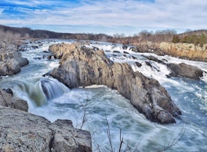
5.00.69 mi / 131 ft gainViewing Great Falls is easy which makes this adventure great for all levels of adventurers. There is a ~$10 entrance fee, there you will receive a map of the park. There are 3 platforms of viewing Great Falls, each platform has stunning panoramic views. Make sure you do not forget to bring your ...Read more -
Potomac, Maryland
Great Falls and the Billy Goat Trail
4.54.61 mi / 272 ft gainJust outside of Washington DC is a great hike and rock scramble you don't want to miss. Great Falls lies in both Virginia and Maryland and has beautiful views of the Potomac River. Start out at the Great Falls Tavern parking lot (Maryland side), and keep in mind it is $10 to park here if you don...Read more -
Montgomery Village, Maryland
Hike the Seneca Creek Greenway Trail Upper Section
5.014.86 mi / 836 ft gainPark in the lot off of Watkins Mill Road to access the trail. This hike is dog friendly and is accessible from March until November.Read more

