Marshall, Virginia
Looking for the best hiking in Marshall? We've got you covered with the top trails, trips, hiking, backpacking, camping and more around Marshall. The detailed guides, photos, and reviews are all submitted by the Outbound community.
Top Hiking Spots in and near Marshall
-
Luray, Virginia
Hike Around Lake Arrowhead Recreation Park
5.01 mi / 10 ft gainA few miles east of the town of Luray and just a couple miles outside of the Thorton Gap entrance to Shenandoah National Park sits Lake Arrowhead Recreation Park. This small lake and park features fishing, swimming, picnic areas, and other recreational park type of activities. Use of the faciliti...Read more -
Luray, Virginia
Little Stony Man, Shenandoah National Park
4.71.23 mi / 433 ft gainThe parking lot for the trail is right before mile 40 on Skyline drive in Shenandoah National Park. The entire out and back is only .9 miles, so it's the perfect hike to take in a sunset after a long day, take a break from driving, or just pick a hike that is family and dog friendly as Stoney Ma...Read more -
Knoxville, Maryland
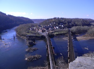
Hike to Maryland Heights
4.82.8 mi / 900 ft gainMaryland Heights is at the convergence of Maryland, West Virginia and Virginia, as well as the Potomac and Shenandoah Rivers. The Appalachian Trail and C&O Canal Towpath are also easily accessible from the trailhead parking lot. The parking lot holds about 16 cars and is between Locks 33 and ...Read more -
Knoxville, Maryland
Hike Maryland Heights Trail Loop
5.3 mi / 1600 ft gainLearn Civil War history as you hike through forts and read signs about the war. Enjoy beautiful lookouts, including one with a great view of Harpers Ferry. The 5.3 mile hike is relatively easy and offers an interesting opportunity to learn history in one of the most important historical areas i...Read more -
Knoxville, Maryland
Explore Point of Rocks/ Potomac River Overlook
4.00.2 mi / 95 ft gainPark at the Chesapeake and Ohio Canal parking lot. Walk to the US 15 and cross the road. Trail is not marked, though its faint traces can be detected as you continue on. GPS is recommended. Enjoy the overlook and when you're ready to go back, retrace your steps.Read more -
Luray, Virginia
Stony Man Trail, Shenandoah National Park
4.51.47 mi / 279 ft gainThis short, easy hike will take you to some of the best views in Shenandoah National Park. As an added bonus, it’s perfect for catching the sunset without a long walk back to your car in the dark. If you’re looking to increase the level of difficulty, there is an alternate, moderate trail option ...Read more -
McLean, Virginia
Difficult Run, Ridge, and River Trails
4.53.28 mi / 463 ft gainDifficult Run is a popular hiking location right down the street from Great Falls National Park. Starting at the Difficult Run parking lot you head to the trail at the far end of the lot. The trail will split. The green blazes will take you to the left but you can also stay to the right and hike ...Read more -
McLean, Virginia
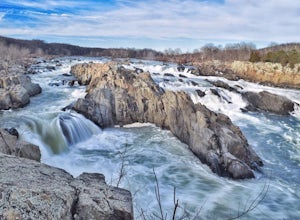
Photograph Great Falls of the Potomac
5.00.69 mi / 131 ft gainViewing Great Falls is easy which makes this adventure great for all levels of adventurers. There is a ~$10 entrance fee, there you will receive a map of the park. There are 3 platforms of viewing Great Falls, each platform has stunning panoramic views. Make sure you do not forget to bring your ...Read more -
Knoxville, Maryland
Hike the AT to Weverton Cliffs
4.93 mi / 1500 ft gainThe trailhead is located right off Weverton Cliff's Road in Knoxville, Maryland. Park at a Park and Ride on the right side of the road, then walk right out of the parking lot down Weverton Cliff's Road until you see the white blazes of the Appalachian Trail. Follow that trail for 1.5 miles along ...Read more -
Potomac, Maryland
Great Falls and the Billy Goat Trail
4.54.61 mi / 272 ft gainJust outside of Washington DC is a great hike and rock scramble you don't want to miss. Great Falls lies in both Virginia and Maryland and has beautiful views of the Potomac River. Start out at the Great Falls Tavern parking lot (Maryland side), and keep in mind it is $10 to park here if you don...Read more -
Luray, Virginia
White Oak Trail to Lower Falls
5.06.68 mi / 1982 ft gainThe round trip is a total of 6.7 miles (10.8 km) from the Skyline Drive parking lot to the Whiteoak Canyon Trailhead parking lot (mile 42.6) to the final waterfall of the lower three. The elevation is moderate with a 900-foot drop to the upper falls, but an additional 1,100 feet to the lower fall...Read more -
Luray, Virginia
White Oak Canyon to Upper Falls
4.84.28 mi / 866 ft gainBetween mile 42 and 43 of Skyline Drive in Shenandoah National Park is the trailhead for WhiteOak Canyon. Begin at the trailhead from the parking lot and cross the Limberlost Trail in .3 miles. Continue on and you will cross your first footbridge shortly. After another mile you will cross the s...Read more -
Luray, Virginia
Hike Robertson Mountain in Shenandoah NP
6 mi / 1200 ft gainRobertson Mountain is often overshadowed by the nearby Old Rag Mountain, but standing 5 feet taller than Old Rag, this hike offers seclusion and gorgeous views to the south. Starting from the Limberlost Trailhead parking lot at MP 43 on the Skyline Drive, take the chained off Old Rag Fire Road. ...Read more -
Luray, Virginia
Hike Limberlost Trail in Shenandoah National Park
5.01.3 mi / 114 ft gainThe Limberlost Trail is a loop trail within Shenandoah National Park. It is classified as 'accessible' as the trail is flat and has features that would help those in a wheelchair or with other needs access the trail (boardwalk, bridge, benches). There is little-to-no elevation change and the pat...Read more -
Great Falls, Virginia
Hike from Riverbend Regional Park to Great Falls National Park
5.02.5 mi / 75 ft gainThis hike utilizes the Potomac Heritage Trail from Riverbend Park to Great Falls National Park. This section is an easy, mostly flat trail that will take you along the Potomac until you reach Great Falls National Park. When you reach Riverbend Park turn right into the parking lot. At the end of t...Read more -
Syria, Virginia
White Oak Canyon Cedar Run Loop
4.07.67 mi / 2257 ft gainThis route combines Cedar Run Falls and White Oak Canyon Trail (one of the more popular hikes in SNP, with separate adventures detailing those hikes). Parking is easy, but gets very crowded due to the popularity of White Oak Canyon (WOC). When starting from the parking area/Shenandoah ranger stat...Read more


