Manassas, Virginia
Top Spots in and near Manassas
-
Purcellville, Virginia
Explore Potomac Wayside Park
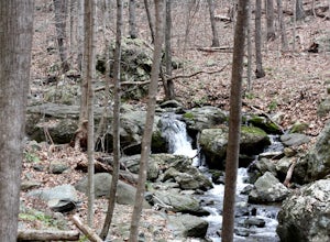
4.00.25 mi / 75 ft gainThis is a small park along route 340 in Purcellville, Virginia near Harper's Ferry. After you have parked, look for the park sign which will be a few feet behind you. There is a trail that will take you down to the bottom of the waterfall and eventually to the Potomac River. There is also a trail...Read more -
Knoxville, Maryland
Hike the AT to Weverton Cliffs
4.93 mi / 1500 ft gainThe trailhead is located right off Weverton Cliff's Road in Knoxville, Maryland. Park at a Park and Ride on the right side of the road, then walk right out of the parking lot down Weverton Cliff's Road until you see the white blazes of the Appalachian Trail. Follow that trail for 1.5 miles along ...Read more -
Harpers Ferry, West Virginia
Hike Weverton Cliffs Overlook from Harpers Ferry
5.08.2 mi / 925 ft gainParking and trail head: Park at the Harpers Ferry Visitors Center for $10 (171 Shoreline Dr, Bolivar, WV 25425) and take the shuttle a mile and a half to lower town (free). Walk straight from the shuttle to the large bridge. Cross the bridge to hop on the C&O canal trail. This is the point w...Read more -
Harpers Ferry, West Virginia
Hike Maryland Heights via Harpers Ferry
4.54.2 mi / 800 ft gainParking and trail head: Park at the Harpers Ferry Visitors Center for $10 (171 Shoreline Dr, Bolivar, WV 25425) and take the shuttle a mile and a half to lower town (free). Walk straight from the shuttle to the large bridge. Cross the bridge and take a left on the C&O Canal trail. You will s...Read more -
Washington, Virginia
Hike Little Devil Stairs
4.75.5 mi / 1480 ft gainThis hike starts with an immediate stream crossing -- how wet your feet get depends on the water level but bring an extra pair of socks! The first mile consists of a typical Shenandoah hike -- uphill on a dirt path and along a stream. But soon you reach the base of Little Devil Stairs. This po...Read more -
Knoxville, Maryland
Hike to Maryland Heights
4.82.8 mi / 900 ft gainMaryland Heights is at the convergence of Maryland, West Virginia and Virginia, as well as the Potomac and Shenandoah Rivers. The Appalachian Trail and C&O Canal Towpath are also easily accessible from the trailhead parking lot. The parking lot holds about 16 cars and is between Locks 33 and ...Read more -
Knoxville, Maryland
Hike Maryland Heights Trail Loop
5.3 mi / 1600 ft gainLearn Civil War history as you hike through forts and read signs about the war. Enjoy beautiful lookouts, including one with a great view of Harpers Ferry. The 5.3 mile hike is relatively easy and offers an interesting opportunity to learn history in one of the most important historical areas i...Read more -
Rileyville, Virginia
Hike to Overall Run Falls
5.06.1 mi / 1700 ft gainStart at the Hogback parking lot at MP 21.1 on the Skyline Drive. Take the Appalachian Trail south for 0.8 miles, and turn right onto the Tuscarora-Overall Run Trail. After 0.5 miles you will come to another intersection-keep right to stay on the Tuscarora-Overall Run Trail. A final intersection...Read more -
Huntingtown, Maryland
Paddle the Patuxent River through Maryland
While there are many parks along its length, one of the best places to explore along the 115 mile long Patuxent River is by putting in at Kings Landing Park. There is ample parking near the launch, and while vehicles are not allowed to park near the water, vehicles are encouraged to open the gat...Read more -
Rileyville, Virginia
Backpack Jeremy's Run Trail, Shenandoah NP
3.310 miThis hike is best done as a two-day, one-night backpacking trip, however it can be done as a day hike if you don't wish to backpack.Jeremy’s Run is a beautifully forested 10 mile roundtrip hike with numerous stream-crossing. The trailhead starts at the Elkwallow Picnic area, at about mile 24 of S...Read more -
Luray, Virginia
Photograph Buck Hollow Overlook
Buck Hollow Overlook is one of 72 beautiful overlooks that are on Skyline Drive. Skyline Dive is the road that winds through the heart of Shenandoah National Park. Over 105 miles long, Skyline Drive offers great views of the surrounding Blue Ride Mountains and valleys while simultaneously offeri...Read more -
Etlan, Virginia
Old Rag Mountain Loop
4.78.95 mi / 2510 ft gainBe prepared to deal with crowds, especially on the rock scrambles, which tend to cause a bottle neck on this trail in Shenandoah National Park. I would recommend starting out early on this loop hike, around 6 or 7 am to avoid the crowds. Definitely arrive no later than 9:30am, as the parking lot ...Read more -
Etlan, Virginia
Hike to the Summit of Mt. Robertson in Shenandoah NP
9 mi / 2500 ft gainThis hike is one of the lesser known hikes in Shenandoah. While everyone else is headed to Old Rag, hikers will find themselves on a peaceful hike to the summit of Mt. Robertson. Hikers should park in the Old Rag Parking lot and make sure to pay the daily fee ($25). If you have a yearly pass, be ...Read more -
Luray, Virginia
Photograph Hazel Mountain Overlook
4.0Skyline Dive runs through the heart of Shenandoah National Park. Consisting of 72 overlooks over 105 miles, Skyline Drive offers great views of the surrounding Blue Ride Mountains and valleys. Hazel Mountain Overlook is located at mile marker 33 along Skyline Drive and is one of a handful of ov...Read more -
Bentonville, Virginia
Hike the Shenandoah River State Park Loop
5.08 mi / 650 ft gainShenandoah River State Park is located in the heart of the Shenandoah Valley. The park is full of well-maintained trails great for hiking and mountain biking. The trails both parallel the banks of the river as it snakes through the Shenandoah Valley and through the rolling hills, which provides...Read more -
Luray, Virginia
Mary's Rock via Meadow Spring Parking Area
4.62.75 mi / 640 ft gainMary’s Rock is just south of the Thornton Gap Entrance in Shenandoah National Park’s Central District. This write-up details the hike from the Meadow Spring Parking area, but there are alternate routes starting from the Panorama parking area (3.7 miles round trip), Jewell Hollow Overlook (6 mile...Read more

