Manassas, Virginia
Top Spots in and near Manassas
-
Bluemont, Virginia
Hike to Bears Den Overlook
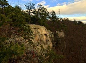
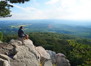
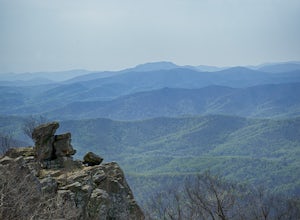
4.41.31 mi / 164 ft gainBears Den is a collection of rocks and boulders that overlooks the Shenandoah Valley in northern Virginia, just off the Appalachian Trail. You have two options to access this overlook: park at the bottom of the mountain and hike up to the overlook via the trail, or drive to the top and access the...Read more -
Boyds, Maryland
Black Hill Regional Park Loop
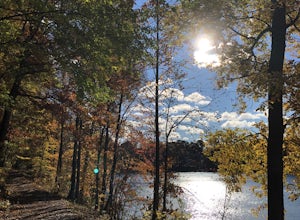
5.02.78 mi / 312 ft gainThe Black Hill Regional Park has 1300 acres of oak forests that have views of the Little Seneca Lake. This lake offers a place for visitors to canoe and stand up paddle board. This trail is open to hiking and mountain biking. In addition, dogs are welcome to use the trail but must be on leash a...Read more -
Bluemont, Virginia
Hike to Hollow Brook Falls
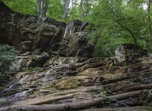
4.32 mi / 300 ft gainThis hike will start on the Appalachian Trail and will take you to a beautiful set of falls. When you arrive at the location you will see numerous spots along the side of the road to park. You'll need to look for the white blaze for the Appalachian Trail (it will head up from the parking area). ...Read more -
Bluemont, Virginia
Hike to Raven Rock
4.35 mi / 1000 ft gainStarting at a small parking lot right off of Route 7 (wuick right onto Pine Grove Road) this hike takes you North on the Appalachian Trail in a very hilly/rocky part of the trail. Expect to gain and lose 300 feet+ multiple times! It's about 2.5 miles each way so budget at least a few hours to go ...Read more -
Boyce, Virginia
Trail Run the AT in the G.R. Thompson
7 mi / 900 ft gainTake Fire Trail Road and start your run at the parking area (labeled in the map). The trail puts you directly onto the AT, where you will turn right (southbound) to start the run (or hike). You'll stay on the AT for roughly 3.5 miles down to the Trillium Trail Parking area. At that point, turn ar...Read more -
Front Royal, Virginia
Snowshoe the AT in G.R. Thompson
3 miThe G.R. Thompson is a piece of public land in Linden, VA, thats primarily used by hunters. The Appalachian Trail runs right through this section and visiting during a fresh snowfall can make for a great adventure. Only 60 minutes drive from greater Washington DC area, this is an easy adventure! ...Read more -
Montgomery Village, Maryland
Hike the Seneca Creek Greenway Trail Upper Section
5.014.86 mi / 836 ft gainPark in the lot off of Watkins Mill Road to access the trail. This hike is dog friendly and is accessible from March until November.Read more -
Cool Spring Path South Parking, Virginia
Hike Cool Spring Path
4.02 mi / 70 ft gainThe Cool Spring Path South is an old golf course that has been and still is in the process of being returned to its natural state by Shenandoah University. The paved paths from the golf course make this an easy hike for anyone. For those who may be in a wheelchair, this loop should be fully acces...Read more -
Dickerson, Maryland
Hike the Sugarloaf Mountain Trail
4.76.05 mi / 1509 ft gainPark on Sugarloaf Mountain Drive (as indicated on the map below) to access the trail. It is open from March-November and is dog friendly.Read more -
Knoxville, Maryland
Explore Point of Rocks/ Potomac River Overlook
4.00.2 mi / 95 ft gainPark at the Chesapeake and Ohio Canal parking lot. Walk to the US 15 and cross the road. Trail is not marked, though its faint traces can be detected as you continue on. GPS is recommended. Enjoy the overlook and when you're ready to go back, retrace your steps.Read more -
South River, Virginia
Hike to Compton Peak
5.0This unique hike on the Appalachian Trail in Shenandoah National Park is 2.4 miles round trip with an 835' elevation gain, and leads you to two viewpoints as well as a cool rock outcrop.Access this hike from the Compton Gap parking area (elevation 2,145') on the Skyline Drive at Mile 10.4. Cross ...Read more -
Appalachian Trail, Virginia
Hike North Mount Marshall in Shenandoah NP
1 mi / 350 ft gainPark at the Mount Marshall parking area at ~MP 15.6 on the Skyline Drive. From the back of the parking lot, take the white-blazed Appalachian Trail north for a short 0.4 miles to a large rock outcrop with views south. After finished exploring this outcrop, continue on the AT for another 0.1 mil...Read more -
Front Royal, Virginia
Explore Skyline Drive In Winter
4.5Skyline Drive is a winding highway that cuts straight through Shenandoah National Park. Being that we are in the south, you will find that the road is closed for the majority of the winter, and usually at the very mention of snow. The first few years of living here it was incredibly frustrating...Read more -
Bentonville, Virginia
Photograph Range View Overlook
5.0Range View Overlook in Shenandoah National Park is an amazing spot to watch the sunrise and sunset where the Blue Ridge Mountains meet the rolling hills. Range View Overlook has views of Jenkins Mountain to the south, Pignet Mountain and Mary’s Rock to the southwest, and Hogback Mountain to the w...Read more -
Laurel, Maryland
Hike the South Tract Trails at Patuxent Research Refuge
5 miFrom the visitors center, start on the Fire Road trail. From there, it's a choose-your-own adventure (choose-your-own ecosystem, actually). Pick the Laurel and Valley Trails to stay in the quiet (and maybe enchanted? It felt enchanted) forest. Goose Pond trail is a short jut to a--yup--pond, wher...Read more -
Front Royal, Virginia
Explore Skyline Caverns
Skyline Caverns is located right off Stonewall Jackson Highway with plenty of parking. The cave tour is about 60 minutes with little walking and minimal elevation gain. If you time it right you and your friends can get the whole tour to yourselves. The backstory the tour guide gives you, is inte...Read more

