Great Falls, Virginia
Top Spots in and near Great Falls
-
Sky Meadows State Park, Virginia
Camp at Sky Meadows State Park
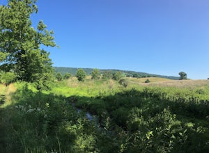
5.02 miCamping at Sky Meadows State Park is a great location to backpack with young kids or if you are new to backpacking. The campground has 18 primitive walk-in campsites located 1.03 miles from the overnight parking lot at the park entrance. Reservations can be made online. After checking-in and park...Read more -
Owings Mills, Maryland
Serpentine Trail
4.52.39 mi / 226 ft gainPark in the area off of Deer Park road to access the trail. Dogs are welcome on leash. Trail can get muddy in the spring, and there are some stream crossings.Read more -
Owings Mills, Maryland
Soldiers Delight Loop
4.75.33 mi / 466 ft gainFrom Deer Park Road, parking is available at the nature center or the scenic overlook (about 100 yards up the road). I typically park at the overlook as this affords the ability to hike trails on either side of the road, and always finish the hike back at the car. From the parking area you are ju...Read more -
Delaplane, Virginia
Relax at Lake Thompson
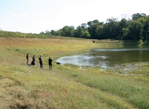
Lake Thompson is a great spot for fishing, walking, or just exploring the area with your dog. I've never had a problem with parking, but you're unlikely to find yourself alone at the lake on a nice weekend day. Its a 10-acre lake, however, so you shouldn't have a problem carving out a little bit...Read more -
Boyce, Virginia
Trail Run the AT in the G.R. Thompson
7 mi / 900 ft gainTake Fire Trail Road and start your run at the parking area (labeled in the map). The trail puts you directly onto the AT, where you will turn right (southbound) to start the run (or hike). You'll stay on the AT for roughly 3.5 miles down to the Trillium Trail Parking area. At that point, turn ar...Read more -
Sharpsburg, Maryland
Antietam National Battlefield Trail
3 mi / 358 ft gainAntietam National Battlefield Trail is a loop trail that takes you by a river located near Sharpsburg, Maryland.Read more -
Front Royal, Virginia
Snowshoe the AT in G.R. Thompson
3 miThe G.R. Thompson is a piece of public land in Linden, VA, thats primarily used by hunters. The Appalachian Trail runs right through this section and visiting during a fresh snowfall can make for a great adventure. Only 60 minutes drive from greater Washington DC area, this is an easy adventure! ...Read more -
Myersville, Maryland
Hike to Annapolis Rock and Black Rock Cliff
4.48 mi / 840 ft gainHike along the Appalachian Trail as it passes through South Mountain State Park, taking you to a number of very scenic lookout spots.From the parking area, take the connector trail a short distance until you see blue blazes on the left – these will lead you to the Appalachian Trail (white blazes)...Read more -
Baltimore, Maryland
Hike the Fort McHenry Trail
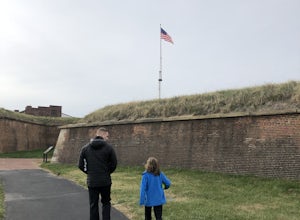
3.50.9 mi / 16 ft gainPark in the lot and head out either direction on this short loop trail. Trail can get crowded, so be prepared to share the space.Read more -
Annapolis, Maryland
Kayak into downtown Annapolis via Spa Creek
There is no better way to travel into Annapolis then by under your own power on water. Put in your kayak, canoe, or stand up paddle board at the Truxton Park Boat Launch (run by the City Parks Department) and paddle into downtown Annapolis on Spa Creek. Pass other boaters, beautiful waterfront ...Read more -
Huntingtown, Maryland
Paddle the Patuxent River through Maryland
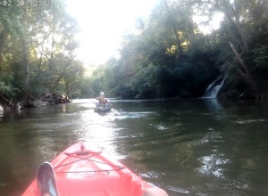
While there are many parks along its length, one of the best places to explore along the 115 mile long Patuxent River is by putting in at Kings Landing Park. There is ample parking near the launch, and while vehicles are not allowed to park near the water, vehicles are encouraged to open the gat...Read more -
Thurmont, Maryland
Cat Rock via Old Misery Trail
3.02.89 mi / 797 ft gainThe best place to park is on Catoctin Hollow Road in the parking lot that's on the same side of the road as the lake. It's not a huge lot but we were here mid-summer around 10 am and found a spot easily. The trailhead is on the other side of the street from this parking lot; there is a sign letti...Read more -
Smithsburg, Maryland
Hike to Cunningham Falls
4.22.8 miThis 78-foot waterfall, among the largest in the state, is easily accessible by two short trails. Lower Trail (0.5 miles) leads directly to the falls, whereas Cliff Trail (0.75 miles) has slightly more difficult terrain and takes you to a viewing platform. To lengthen the adventure, Hunting Creek...Read more -
Thurmont, Maryland
Hike Catoctin Mountain
4.58.4 mi / 1370 ft gainPark at Catoctin Mountain Visitor Center. The hike starts at the end of the gravel parking lot across from the visitor center. This is definitely a popular hiking location, so come early on the weekends to guarantee a parking spot and to avoid the crowds. To start, take the right trail towards th...Read more -
Thurmont, Maryland
Hike Chimney Rock at Catoctin Mountain Park
4.25 mi / 600 ft gainChimney Rock is the quintessential breathtaking view that makes a hike worthwhile. By parking at the most northeast parking lot on the trail map you are able to include the sweeping views of Thurmont Vista, and Wolf Rock on your way to Chimney Rock. Highly recommend visiting in the fall, and on w...Read more -
Thurmont, Maryland
Hike the Catoctin Mountain Extended Loop Trail
4.58.6 mi / 1696 ft gainThis 8.6 mile loop trail in Catoctin Mountain Park is good for both hikers and trail runners. This loop is the larger loop in the park, comprised of Cunningham Falls, Hog Rock, Blue Ridge Summit, Thurmont Vista, Wolf Rock, and Chimney Rock. The trail gets a moderate rating because it's mostly roc...Read more

