Weathersfield, Vermont
Looking for the best hiking in Weathersfield? We've got you covered with the top trails, trips, hiking, backpacking, camping and more around Weathersfield. The detailed guides, photos, and reviews are all submitted by the Outbound community.
Top Hiking Spots in and near Weathersfield
-
368 Weathersfield Trail, Vermont
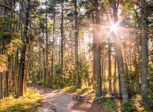
Hike Mount Ascutney
3.05.2 mi / 2326 ft gainThis route to the top of Mount Ascutney is completed via the Weathersfield Trail. This trail goes past gorgeous Cascade Falls - often frozen in the winter months. There is a great spot to eat lunch at the top of Mount Ascutney to the side of the hang glider landing. While the summit itself does n...Read more -
Hartford, Vermont
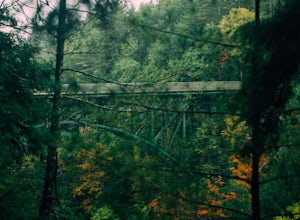
Camp at Quechee State Park
4.0Located on the Ottauquechee River, Quechee State Park offers camping options right beside one of Vermont's most famous gorges—Quechee Gorge. The steel bridge that passes over the 165 ft. gorge is just one of many spectacular views in this area. Quechee State Park is on Route 4 and easily accessi...Read more -
Woodstock, Vermont
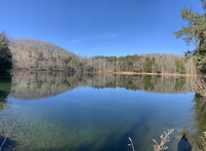
The Pogue and Mount Tom Trail
4.38 mi / 751 ft gainThe Pogue and Mount Tom Trail is a loop trail that takes you by a lake located near Woodstock, Vermont.Read more -
Newbury, New Hampshire
Hike to Lake Solitude, NH
4.04.8 mi / 2510 ft gainThe two most popular routes to Lake Solitude are the Newbury Trail and Andrew Brook Trail. The round-trip distance of the hikes are 4.8 miles and 3.8 miles. Both could be described as moderate in terms of difficulty. The Newbury trail is accessed from Lakeview Ave and Andrew Brook Trail can be a...Read more -
Appalachian Trail, Vermont
Hike to Thundering Brook Falls
4.50.4 mi / 29 ft gainThe hike to Thundering Brook Falls is kid friendly and fun for the whole family. At only .4 miles roundtrip, this is an excellent quick workout. Dogs are allowed on this trail but must be kept on leash. This trail is hiked year-round but is best used in the spring, summer, or during fall colors.Read more -
Wallingford, Vermont
Hike the White Rocks Ice Beds Trail
1.6 mi / 180 ft gainThis 1.6 mile round trip hike starts from the Ice Beds parking lot in the Green Mountain National Forest in Vermont. The trailhead is close to the parking lot entrance, following the blue-blazed trail. Be sure to read the signs, as the far trailhead is a hike to the cliffs, not the ice beds. Af...Read more -
285 Salmon Hole Lane, Vermont
Hike Hamilton Falls
3.56.8 mi / 889 ft gainThe hike to Hamilton Falls is an enjoyable 6.8 miles roundtrip voyage through gorgeous forest scenery alongside a babbling brook. Be sure to visit the upper and lower falls! This trail is kid and dog friendly, so why not bring both?! If you are visiting the falls in the summer, bring a towel and ...Read more -
Orange, New Hampshire
Hike Cardigan Mountain via the West Ridge Trail
4.73 mi / 1200 ft gainCardigan Mountain is located in Cardigan Mountain State forest just outside of Canaan, New Hampshire. Just make sure to go to The Cardigan Mountain state park parking lot, via Cardigan Mountain Road and not the AMC Cardigan Lodge. The trail begins right from the parking lot where there is a port...Read more -
Mendon, Vermont
Hike to Killington Peak
5.03.4 miThe trail head (Bucklin Trail) is found a couple of miles up Wheelerville Road on the left. Wheerlerville is a dirt road that will be muddy in the spring and summer. The drive is long enough that you will think you did something wrong, but you haven't! the trail head will eventually pop up.The tr...Read more -
Alexandria, New Hampshire
High Cabin
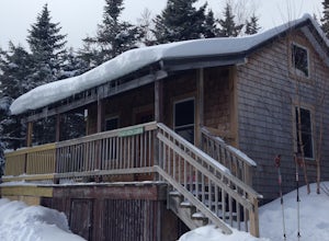
5.04 mi / 1275 ft gainHigh Cabin, located in Cardigan State Forest, is owned and operated by the Appalachian Mountian Club (AMC). It was originally built in 1931 and since renovated in 2004. Renovations included a new roof, siding, bunk beds, a wood stove, and a composting toilet. It comes supplied with wood, bunks(st...Read more -
Glen Road, Vermont
Hike the Lye Brook Falls Trail
4.04.7 mi / 938 ft gainThe Lye Brook Falls Trail is a 4.7 mile hike through scenic trails just outside of Manchester Center, Vermont. The trail is open year-round, but the best time to go is during spring blooms or to see the fall colors. This hike is family friendly and fun for all ages. Dogs are allowed on this trail...Read more -
Dorset, Vermont
Hike 'The Merck'
4.02.5 miOf the 10 trails at The Merck, The Wildlife Trail is a great hike through the forest that offers you the best way to see wildlife, streams and tracks. You can do the whole hike as a loop in about 2-2 1/2 hours or shorten it up with some shortcuts if you just want a quick hike. Great for family ...Read more -
Poultney, Vermont
Camp on Mount St. Catherine
5.0Looking for the best view in all of Poultney, Vermont? Look no further than Lake St. Catherine Mountain. Located within Deane's Nature Preserve, this fast and easy hike tops as one of the best views and camping spots for the little time and energy needed to reach the summit. Only 30-45 minutes fr...Read more -
Jaffrey, New Hampshire
Summit Mt. Monadnock via Marlboro Trail
5.04 mi / 2300 ft gainStart at the Marlboro Trailhead (you can enter this in Google maps) off Shaker Road. There's parking and porta-potty bathrooms. The trail is well-marked with white dashes/M marks all the way up. Once on trail, the initial 800 ft climb is through forested terrain with a few brooks and streams alon...Read more -
Jaffrey, New Hampshire
Mount Monadnock via White Dot Trail
4.43.46 mi / 1699 ft gainMonadnock State Park is located in and around the 3,165-ft. Mount Monadnock. Mount Monadnock is crisscrossed by many miles of well-maintained hiking trails. The popular White Dot Trail (2.2 miles) is the shortest but steepest ascent to the summit, accessible from the Monadnock State Park headquar...Read more -
Jaffrey, New Hampshire
Mount Monadnock via White Dot & White Cross Loop
4.53.7 mi / 1686 ft gainThe White Dot Trail is the shortest, steepest ascent to the summit, while White Cross has a slightly easier grade down with very little difference in distance. Therefore, per the park's rangers, the best way to conquer this loop is White Dot up, White Cross down.The White Dot Trail begins at Mon...Read more

