Corinth, Vermont
Looking for the best hiking in Corinth? We've got you covered with the top trails, trips, hiking, backpacking, camping and more around Corinth. The detailed guides, photos, and reviews are all submitted by the Outbound community.
Top Hiking Spots in and near Corinth
-
Duxbury, Vermont
Camel's Hump Summit via Monroe Trail
4.86.22 mi / 2572 ft gainYou'll begin your Monroe Trail hike at approximately 1500', parking in one of three designated gravel lots along Camel's Hump Road in Duxbury. This trail is 6.8 miles round trip, and gains approximately 2583' in elevation. It is located on the east side of the mountain. Much of your hike will ...Read more -
Thornton, New Hampshire
Hike the Welch Mountain and Dickey Mountain Loop
5.04.1 mi / 1807 ft gainThis is a very well-marked and traveled trail, marked with yellow blazes. Start off at the trailhead (easy parking, $3 fee) and be sure to go counter-clockwise for the best route. The beginning of the trail meanders along next to a babbling brook and through forested terrain. The climb gets stead...Read more -
Lincoln, New Hampshire
Summit Mount Hancock and South Hancock
9.8 mi / 2220 ft gainThe Hancock trailhead is located at the infamous hairpin turn of the Kancamagus Highway in the White Mountains. The trail itself crosses the road and starts at 2000 feet of elevation on the Hancock Notch trail. It remains fairly flat for the first 3 miles of the trail. After 1.8 miles you will hi...Read more -
Wolcott, Vermont
Hike to Elmore Mountain Fire Tower
4.05.6 mi / 1485 ft gainIf hiking in off season when the park is closed, begin from the lower parking lot or the "day use area". If hiking while the park is open you can drive to the upper parking lot (subtract about 1.4 miles from total distance)Beginning from the lower parking lot make you way through the gate and int...Read more -
Thornton, New Hampshire
Hike the Lafayette-Lincoln Loop
2.35.2 miBegin at the Mt. Tecumseh trailhead. You will hike for 1.2 miles before your first vista. Continue from there another mile until you arrive at the junction with the Sosman Trail. Stay right and continue another 0.3 miles to reach the summit of Mt. Tecumseh. At just over 4,000' this peak offers in...Read more -
Lincoln, New Hampshire
Osceola Mountain via Greeley Pond
4.06.8 mi / 2677 ft gainStart out at the Greeley Pond trailhead off of the Kancamagus Highway. After 1.3 miles the trail splits--bear right to get onto the Mt. Osceola Trail. Continue 1.5 miles to the summit. This summit hike offers a different kind of reward. Views are limited from the peak of Mt. Osceoloa, which allow...Read more -
Huntington, Vermont
Camel's Hump Summit via the Burrows Trail
4.04.4 mi / 2228 ft gainThis adventure takes you up the Burrows Trail from the Huntington side of Camel's Hump. There are multiple trails to the summit, but this trail is the shortest. It is 2.4 miles to the summit with 2300' elevation gain. The trailhead is accessed from the aptly named Camel's Hump Road out of Huntin...Read more -
Appalachian Trail, Vermont
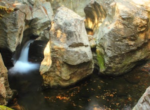
Hike to Thundering Brook Falls
4.50.4 mi / 29 ft gainThe hike to Thundering Brook Falls is kid friendly and fun for the whole family. At only .4 miles roundtrip, this is an excellent quick workout. Dogs are allowed on this trail but must be kept on leash. This trail is hiked year-round but is best used in the spring, summer, or during fall colors.Read more -
Jefferson, New Hampshire
Hike the Sugarloaf Trail
3.3 mi / 1099 ft gainThe Sugarloaf Trail begins at the Sugarloaf trailhead on Zealand Road off of US 302. There are two trails that begin at this trailhead--be sure to cross the bridge over the Ammonoosuc and look for the "Sugarloaf Trail" sign. The trail begins following the Ammonoosuc River for a short while before...Read more -
Stowe, Vermont
Hike to Bingham Falls
4.00.5 miHiking to Bingham Falls is rewarding for many reasons; people not only come to see the falls, but also to swim in the refreshing, icy cold swimming holes as well. The main falls are tucked away along the walls of a deep, rocky gorge that has been formed naturally over time. At the base of these ...Read more -
Jefferson, New Hampshire
Hiking at Pondicherry Wildlife Refuge
4.5As hiking in the White Mountain area goes, this is a pretty easy one. This is a family friendly hike along a rail trail and well maintained forest trails. The main attraction here isn't the difficultly. The main attraction here is the spectacular views and the abundant wildlife.This trail begi...Read more -
Salisbury, Vermont
Camp at Lake Dunmore
The campground office for Branbury state park is on the opposite side of Route 53 from the pin on the map here, but the best campsites are where the pin is. Start by going and talking to the rangers at the office, they are super friendly and very helpful for recommendations of hikes or things to...Read more -
Stowe, Vermont
Mt. Mansfield via the Long Trail
5.05.27 mi / 2743 ft gainThere are several options to reach the summit of Mount Mansfield. The Toll Road (which, appropriately, has a toll to use it), the Laura Cowles trail, the Sunset Ridge trail, Haselton Trail, the Hellbrook Trail… The most popular trail from the east side of the mountain, however, is the section o...Read more -
Mendon, Vermont
Hike to Killington Peak
5.03.4 miThe trail head (Bucklin Trail) is found a couple of miles up Wheelerville Road on the left. Wheerlerville is a dirt road that will be muddy in the spring and summer. The drive is long enough that you will think you did something wrong, but you haven't! the trail head will eventually pop up.The tr...Read more -
Waterville Valley, New Hampshire
Sabbaday Falls
4.70.7 mi / 171 ft gainThis awesome waterfall is located right off of the Kancamagus Highway (rt 112) that runs from Lincoln to North Conway, NH. The highway itself is a very scenic drive through the White Mountains that has pull off spots every couple of miles. From I93 take exit 32 for Lincoln. Drive straight throug...Read more -
Bartlett, New Hampshire
Hike Mt. Carrigain
5.010 mi / 3250 ft gainPark on Sawyer River Road at the Signal Ridge Trailhead. Trail starts out as a mild climb and meanders with the Whiteface Brook. When you arrive at the Carrigain Notch Trail junction, turn left. Enjoy three miles of steep uphill along the mountain's edge. When you reach the the apex of Mt. Carrig...Read more

