Chelsea, Vermont
Looking for the best photography in Chelsea? We've got you covered with the top trails, trips, hiking, backpacking, camping and more around Chelsea. The detailed guides, photos, and reviews are all submitted by the Outbound community.
Top Photography Spots in and near Chelsea
-
Franconia, New Hampshire
Camp at Lafayette Campground, White Mountains
5.08.3 miThe White Mountains offer some of the most prime foliage sightseeing (aka 'leaf peeping') in New England. Tourists flock to the Franconia Notch State Park area and surrounding parts of the White Mountains every October, but camping is generally less common. October can be a cold month in New Hamp...Read more -
Franconia, New Hampshire
Backpack the Franconia Ridge Loop
4.514.5 mi / 3000 ft gainThis is a multi-day backpacking loop in Franconia Notch State Park, New Hampshire (located in the the White Mountains).Leave the car at the Lafayette Place Campground, (about 1700' elevation), then head up 1.4mi to Lonesome Lake. If you start hiking in the evening, as the sun is setting, you can ...Read more -
Franconia, New Hampshire
Hike Falling Waters Trail
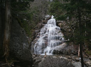
4.03 mi / 1100 ft gainFalling Waters Trail takes you up to the summit of Little Haystack Mountain, and Mount Lincoln and Mount Lafayette if you continue to the Franconia Ridge Trail / Appalachian Trail, then over to Old Bridle Path.Also along Falling Waters Trail are stunning waterfalls. The most popular one is Cloudl...Read more -
Franconia, New Hampshire
Hike to Greenleaf Hut via Old Bridle Path
5.05.5 mi / 3772 ft gainTo hike to the Appalachian Mountain Club's Greenleaf Hut, the best route for a day hike there and back is the Old Bridle Path. This hike is certainly doable in a day if you're interested in just hiking to the Greenleaf Hut. You have a lot of options when hiking this trail. I am going to focus spe...Read more -
Franconia, New Hampshire
Hike to the Summit of Cannon Mountain via Kinsman Ridge trail
5.04 mi / 3000 ft gainDriving north on I-93 in New Hampshire, Cannon Mountain can be seen on the left just a few miles after exit 32. It is a massive cliff that towers over the highway, thousands-of-feet tall. Parking for the trail head is left off of exit 34B. If you look left as you're driving into the paved parking...Read more -
Stowe, Vermont
Hike to Bingham Falls
4.00.5 miHiking to Bingham Falls is rewarding for many reasons; people not only come to see the falls, but also to swim in the refreshing, icy cold swimming holes as well. The main falls are tucked away along the walls of a deep, rocky gorge that has been formed naturally over time. At the base of these ...Read more -
Lincoln, New Hampshire
Hike Mt. Liberty and Camp at Liberty Springs Tent Site
7 mi / 2870 ft gainLiberty Springs Trail is a moderately trafficked out and back trail in the heart of Franconia Notch State Park and the White Mountains. The trail is a part of the Appalachian Trail, which allows it to remain very well maintained throughout the year. The trail is listed as difficult and strenuous ...Read more -
Castleton, Vermont
Hike around Taconic Mountains Ramble State Park
Taconic Mountains Ramble State Park is a unique collection of hiking trails and walking paths that meander more than 204 acres of fields, forests, gorges, cliffs, and gardens. The best way to explore these enchanting trails is to pack a picnic and lace up your hiking boots for a full-day ramble. ...Read more -
Stowe, Vermont
Mt. Mansfield via the Long Trail
5.05.27 mi / 2743 ft gainThere are several options to reach the summit of Mount Mansfield. The Toll Road (which, appropriately, has a toll to use it), the Laura Cowles trail, the Sunset Ridge trail, Haselton Trail, the Hellbrook Trail… The most popular trail from the east side of the mountain, however, is the section o...Read more -
Bristol, New Hampshire
Drive around Newfound Lake
As a kid, I spent many of my summer and winter vacations on Newfound Lake in New Hampshire and can say without a doubt that it is one of the first places to spark my love for the outdoors. If your'e heading up to the White Mountains in the winter time to ski/snowboard, a drive around Newfound Lak...Read more -
Cambridge, Vermont
Sterling Pond Trail
5.02.28 mi / 876 ft gainSterling Pond trail begins across the street from a parking area on Route 108, about 3 miles south of Smugglers' Notch Resort. Keep in mind that the road is closed to vehicles once the snow falls, so if you want to hike this area in the winter, you'll have to park about 40 minutes away and hike ...Read more -
Cambridge, Vermont
Spruce Peak and Sterling Pond Loop
5.03.38 mi / 1204 ft gainIf you're in New England during September or early October, a drive up north into Vermont is an absolute must for prime fall foliage. I-89 brings you through the state from I-93, and is in itself a beautifully scenic drive. Stowe, Vermont is a small ski resort town located just outside of Mt. Man...Read more -
Lincoln, New Hampshire
Franconia Falls
6.77 mi / 459 ft gainFranconia Falls Trail, starting at the Lincoln Woods Trailhead, features natural waterslides, a swimming hole, and fun for all ages. The Franconia Falls Trail is located in White Mountain National Forest, allows dogs, and is a perfect day trip year round! This trail is also frequently used in th...Read more -
Lincoln, New Hampshire
Hike to Bondcliff
5.018 mi / 3110 ft gainPark at the Lincoln Woods Visitors Center off the Kancamagus Highway where the Lincoln Woods Trailhead begins. Because of such a long hike, it's best to start at daybreak, or as early as possible to make it back before dark. The trail starts at the beginning of a suspension bridge crossing the Ea...Read more -
Thornton, New Hampshire
Hike the Welch Mountain and Dickey Mountain Loop
5.04.1 mi / 1807 ft gainThis is a very well-marked and traveled trail, marked with yellow blazes. Start off at the trailhead (easy parking, $3 fee) and be sure to go counter-clockwise for the best route. The beginning of the trail meanders along next to a babbling brook and through forested terrain. The climb gets stead...Read more -
Wallingford, Vermont
Hike the White Rocks Ice Beds Trail
1.6 mi / 180 ft gainThis 1.6 mile round trip hike starts from the Ice Beds parking lot in the Green Mountain National Forest in Vermont. The trailhead is close to the parking lot entrance, following the blue-blazed trail. Be sure to read the signs, as the far trailhead is a hike to the cliffs, not the ice beds. Af...Read more

