Burke, Vermont
Top Spots in and near Burke
-
Lincoln, New Hampshire
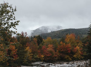
Photograph Fall Foliage on the Kancamagus Highway
4.032 mi / 2855 ft gainDriving the Kancamagus Highway is something you can do as a way to cross the White Mountain National Forest quickly from I-93 in the east to Conway, or it can be an entire day's activity. In the fall, it's almost impossible not to stop at every turn-off on the scenic highway as it winds through t...Read more -
Jackson, New Hampshire
Drive Mt. Washington Auto Road
3.0Starting at roughly 3,000ft above sea level the Mt. Washington Auto Road will take you up nearly eight miles of beautiful, scenic, and well maintained mountain auto roads to The Mount Washington Summit. The summit sits at 6,289 and offers stunning 360° views of New Hampshire's Presidential Range,...Read more -
Jackson, New Hampshire
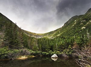
Hike Tuckerman's Ravine Trail on Mt. Washington
4.99 miWhile this trail is open year round with winter hiking/skiing down the ravine walls, this entry will focus on hiking in the warmer months.Your hike starts behind the Pinkham Notch AMC Center in Jackson, NH at an elevation of approximately 2050 ft. There is plenty of parking at the visitors cente...Read more -
Jackson, New Hampshire
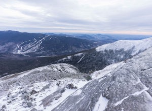
Winter Ascent of Mt. Washington Via Lion Head Trail
8 mi / 4200 ft gainPark at the Pinkham Notch visitor center off of Route 16, your stopping point for all things Tuckerman’s Ravine and Mt. Washington related. The ranger station is open year round and there is food and up to date weather conditions from the summit. There is also a locker room with showers available...Read more -
Lincoln, New Hampshire
Franconia Brook Trail
15.94 mi / 1122 ft gainThe Franconia Brook Trail is a 16 mile out and back trail in White Mountain National Forest. The trail features a river, and is primarily used for hiking. This trail is also great for cross country skiing or snowshoeing in the winter. The trailhead is approximately eight miles from Thirteen Fall...Read more -
Lincoln, New Hampshire
Franconia Falls
6.77 mi / 459 ft gainFranconia Falls Trail, starting at the Lincoln Woods Trailhead, features natural waterslides, a swimming hole, and fun for all ages. The Franconia Falls Trail is located in White Mountain National Forest, allows dogs, and is a perfect day trip year round! This trail is also frequently used in th...Read more -
Lincoln, New Hampshire
Hike to Bondcliff
5.018 mi / 3110 ft gainPark at the Lincoln Woods Visitors Center off the Kancamagus Highway where the Lincoln Woods Trailhead begins. Because of such a long hike, it's best to start at daybreak, or as early as possible to make it back before dark. The trail starts at the beginning of a suspension bridge crossing the Ea...Read more -
Stowe, Vermont
Mt. Mansfield via the Long Trail
5.05.27 mi / 2743 ft gainThere are several options to reach the summit of Mount Mansfield. The Toll Road (which, appropriately, has a toll to use it), the Laura Cowles trail, the Sunset Ridge trail, Haselton Trail, the Hellbrook Trail… The most popular trail from the east side of the mountain, however, is the section o...Read more -
Cambridge, Vermont
Sterling Pond Trail
5.02.28 mi / 876 ft gainSterling Pond trail begins across the street from a parking area on Route 108, about 3 miles south of Smugglers' Notch Resort. Keep in mind that the road is closed to vehicles once the snow falls, so if you want to hike this area in the winter, you'll have to park about 40 minutes away and hike ...Read more -
Cambridge, Vermont
Spruce Peak and Sterling Pond Loop
5.03.38 mi / 1204 ft gainIf you're in New England during September or early October, a drive up north into Vermont is an absolute must for prime fall foliage. I-89 brings you through the state from I-93, and is in itself a beautifully scenic drive. Stowe, Vermont is a small ski resort town located just outside of Mt. Man...Read more -
Warren, New Hampshire
Hike the Mt. Moosilauke Glencliff Trail
5.07.1 mi / 2454 ft gainTo get to the trailhead, take the 25N, turn right onto High Street and continue along this road until it comes to an end. The Mt Moosiulauke Glencliff Trail takes you through seven miles of forest and mountain scenery. The trail features impressive vistas and eye-catching wildflowers, which might...Read more -
Hart's Location, New Hampshire
Hike to Frankenstein Cliffs
4.35 mi / 1400 ft gainThe Frankenstein Cliff trailhead is located in Crawford Notch State Park directly off of Route 302. If you're traveling from the south (Bartlett/North Conway) the parking lot for the trailhead is on your left hand side about 12 miles from Bartlett. There are signs for Arethusa Falls/Frankenstein ...Read more -
Arethusa Falls Road, New Hampshire
Snowshoe to Arethusa Falls via Bemis Brook Trail
2.8 mi / 853 ft gainArethusa Falls is a popular hike in the White Mountains, and come winter it is a popular spot for ice climbing. The falls are located in Crawford Notch State Park and is the tallest waterfall in New Hampshire (between 140-200 feet). Following the Bemis Brook Trail to Arethusa Falls will add a few...Read more -
Woodstock, New Hampshire
Hike Mount Moosilauke via Gorge Brook Trail
4.87.4 mi / 2400 ft gainMount Moosilauke is a 4000 footer located in the White Mountain Range of New Hampshire. The summit peaks at 4,802 feet with a prominence of 2,933 feet.If you're new to exploring the White Mountain range this will definitely be a great introduction to what it can offer. The Gorge Brook Trail is th...Read more -
Lincoln, New Hampshire
Summit Mount Hancock and South Hancock
9.8 mi / 2220 ft gainThe Hancock trailhead is located at the infamous hairpin turn of the Kancamagus Highway in the White Mountains. The trail itself crosses the road and starts at 2000 feet of elevation on the Hancock Notch trail. It remains fairly flat for the first 3 miles of the trail. After 1.8 miles you will hi...Read more -
Hart's Location, New Hampshire
Hike Mt. Crawford
5.05 miDon't let the relatively short 2.5 mile hike up Mt. Crawford fool you, you certainly work for the amazing views from the summit. Located in Crawford Notch, park in the Davis Path lot almost directly across from the Notchland Inn on Rt. 302. The trail starts by going over a footbridge crossing the...Read more

