Burke, Vermont
Looking for the best hiking in Burke? We've got you covered with the top trails, trips, hiking, backpacking, camping and more around Burke. The detailed guides, photos, and reviews are all submitted by the Outbound community.
Top Hiking Spots in and near Burke
-
Lincoln, New Hampshire
Franconia Brook Trail
15.94 mi / 1122 ft gainThe Franconia Brook Trail is a 16 mile out and back trail in White Mountain National Forest. The trail features a river, and is primarily used for hiking. This trail is also great for cross country skiing or snowshoeing in the winter. The trailhead is approximately eight miles from Thirteen Fall...Read more -
Lincoln, New Hampshire
Franconia Falls
6.77 mi / 459 ft gainFranconia Falls Trail, starting at the Lincoln Woods Trailhead, features natural waterslides, a swimming hole, and fun for all ages. The Franconia Falls Trail is located in White Mountain National Forest, allows dogs, and is a perfect day trip year round! This trail is also frequently used in th...Read more -
Lincoln, New Hampshire
Hike to Bondcliff
5.018 mi / 3110 ft gainPark at the Lincoln Woods Visitors Center off the Kancamagus Highway where the Lincoln Woods Trailhead begins. Because of such a long hike, it's best to start at daybreak, or as early as possible to make it back before dark. The trail starts at the beginning of a suspension bridge crossing the Ea...Read more -
Stowe, Vermont
Mt. Mansfield via the Long Trail
5.05.27 mi / 2743 ft gainThere are several options to reach the summit of Mount Mansfield. The Toll Road (which, appropriately, has a toll to use it), the Laura Cowles trail, the Sunset Ridge trail, Haselton Trail, the Hellbrook Trail… The most popular trail from the east side of the mountain, however, is the section o...Read more -
Cambridge, Vermont
Sterling Pond Trail
5.02.28 mi / 876 ft gainSterling Pond trail begins across the street from a parking area on Route 108, about 3 miles south of Smugglers' Notch Resort. Keep in mind that the road is closed to vehicles once the snow falls, so if you want to hike this area in the winter, you'll have to park about 40 minutes away and hike ...Read more -
Cambridge, Vermont
Spruce Peak and Sterling Pond Loop
5.03.38 mi / 1204 ft gainIf you're in New England during September or early October, a drive up north into Vermont is an absolute must for prime fall foliage. I-89 brings you through the state from I-93, and is in itself a beautifully scenic drive. Stowe, Vermont is a small ski resort town located just outside of Mt. Man...Read more -
Warren, New Hampshire
Hike the Mt. Moosilauke Glencliff Trail
5.07.1 mi / 2454 ft gainTo get to the trailhead, take the 25N, turn right onto High Street and continue along this road until it comes to an end. The Mt Moosiulauke Glencliff Trail takes you through seven miles of forest and mountain scenery. The trail features impressive vistas and eye-catching wildflowers, which might...Read more -
Hart's Location, New Hampshire
Hike to Frankenstein Cliffs
4.35 mi / 1400 ft gainThe Frankenstein Cliff trailhead is located in Crawford Notch State Park directly off of Route 302. If you're traveling from the south (Bartlett/North Conway) the parking lot for the trailhead is on your left hand side about 12 miles from Bartlett. There are signs for Arethusa Falls/Frankenstein ...Read more -
Arethusa Falls Road, New Hampshire
Snowshoe to Arethusa Falls via Bemis Brook Trail
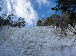
2.8 mi / 853 ft gainArethusa Falls is a popular hike in the White Mountains, and come winter it is a popular spot for ice climbing. The falls are located in Crawford Notch State Park and is the tallest waterfall in New Hampshire (between 140-200 feet). Following the Bemis Brook Trail to Arethusa Falls will add a few...Read more -
Woodstock, New Hampshire
Hike Mount Moosilauke via Gorge Brook Trail
4.87.4 mi / 2400 ft gainMount Moosilauke is a 4000 footer located in the White Mountain Range of New Hampshire. The summit peaks at 4,802 feet with a prominence of 2,933 feet.If you're new to exploring the White Mountain range this will definitely be a great introduction to what it can offer. The Gorge Brook Trail is th...Read more -
Lincoln, New Hampshire
Summit Mount Hancock and South Hancock
9.8 mi / 2220 ft gainThe Hancock trailhead is located at the infamous hairpin turn of the Kancamagus Highway in the White Mountains. The trail itself crosses the road and starts at 2000 feet of elevation on the Hancock Notch trail. It remains fairly flat for the first 3 miles of the trail. After 1.8 miles you will hi...Read more -
Hart's Location, New Hampshire
Hike Mt. Crawford
5.05 miDon't let the relatively short 2.5 mile hike up Mt. Crawford fool you, you certainly work for the amazing views from the summit. Located in Crawford Notch, park in the Davis Path lot almost directly across from the Notchland Inn on Rt. 302. The trail starts by going over a footbridge crossing the...Read more -
Lincoln, New Hampshire
Osceola Mountain via Greeley Pond
4.06.8 mi / 2677 ft gainStart out at the Greeley Pond trailhead off of the Kancamagus Highway. After 1.3 miles the trail splits--bear right to get onto the Mt. Osceola Trail. Continue 1.5 miles to the summit. This summit hike offers a different kind of reward. Views are limited from the peak of Mt. Osceoloa, which allow...Read more -
Bartlett, New Hampshire
Hike Mt. Carrigain
5.010 mi / 3250 ft gainPark on Sawyer River Road at the Signal Ridge Trailhead. Trail starts out as a mild climb and meanders with the Whiteface Brook. When you arrive at the Carrigain Notch Trail junction, turn left. Enjoy three miles of steep uphill along the mountain's edge. When you reach the the apex of Mt. Carrig...Read more -
Thornton, New Hampshire
Hike Mount Tecumseh via Tripoli Road
6.2 mi / 2545 ft gainThis short hike starts out from the Tecumseh Trailhead parking lot along Tripoli Road at an elevation of 1,820 feet. The trail heads south from the parking area and almost immediately crosses a few brooks which may be difficult at high water. The first mile or so is a relatively gradual ascent. O...Read more -
Maine 26, Maine
Hike Eyebrow Trail to Old Speck Mountain Loop
7.8 mi / 3000 ft gainThe first time I attempted this trail was in mid April, and the slush and mud I encountered was absolutely unbelievable. Snowshoes were useless. Crampons were useless. Boots alone meant dirty, wet, muddy feet. So, I had to bail. But I came back in October and I’m so glad I did because the views o...Read more

