Saratoga Springs, Utah
Top Spots in and near Saratoga Springs
-
Salt Lake City, Utah
Hike Clayton Peak in Utah's Wasatch Mountains
4.03 mi / 1600 ft gainClayton Peak is approximately 1.5 miles from Guardsman Pass (3 miles round trip), and you'll gain about 1,600 feet of climbing. There is parking on top of the pass, but it fills up quickly with hikers and mountain bikers during peak season as this serves as the trailhead for Bloods Lake, Jupiter...Read more -
Salt Lake City, Utah
Grandeur Peak East Trail
4.45.97 mi / 2513 ft gainThis is the peak that can be seen from the valley located between Millcreek Canyon and Parleys Canyon. There are 2 trails that head up to this peak, but the one up Millcreek Canyon at the top of Church Fork is by far the more popular/enjoyable one (and the one described here). The other one heads...Read more -
Salt Lake City, Utah
Hike Porter Fork, Millcreek Canyon
5.06.8 mi / 3250 ft gainPorter Fork starts at the aptly named Porter Fork Trailhead about 4 miles up Millcreek Canyon. It’s actually Porter Fork Road for the first 1.5 miles of the trail. This section is a pleasant, paved path winding up through a dozen or so cabins. You’ll gain about 1,000 feet. If you make it past the...Read more -
Salt Lake City, Utah
Hike Bowman Fork to Baker Pass
5.08.3 mi / 3375 ft gainTo get to the trailhead, drive up Millcreek Canyon about 4.5 miles until you reach the Terraces Picnic area. Turn here and drive up the small road until you reach the parking lot by the bathrooms. You'll see the Bowman Fork trailhead marker next to the parking lot. The trail climbs steadily and i...Read more -
Salt Lake City, Utah
Trail Run Burch Hollow Trail
5.3 mi / 2412 ft gainThe Burch Hollow trailhead is about a quarter mile up the Pipeline trail in Millcreek Canyon. After hiking along the switchbacks of the Pipeline trail, you'll see a sharp turn in the trail that leads you up the side of the mountain. This turn can easily be missed so keep a good look out for it. C...Read more -
Salt Lake City, Utah
Hike Jacks Mountain
4.02.4 mi / 1300 ft gainNamed for a toddler who died of Lukemia in 1995, Jacks Mountain is a beautiful place to sit above the valley and contemplate mortality. On the peak, you’ll find a couple mailboxes containing heartfelt notes from hundreds of hikers throughout the years. It’s the kind of place that restores your fa...Read more -
Salt Lake City, Utah
Mountain Bike Dog Lake, Millcreek Canyon
4.4 mi / 1260 ft gainIf it’s an even day and you’re in Salt Lake and you’re in possession of a mountain bike, put down your phone and spend the next 2 hours in pure bliss. Mountain bikers are only allowed to use the trails of upper Millcreek Canyon on even days, which makes for a busy route, but well worth it. This i...Read more -
Salt Lake City, Utah
Trail Run Upper Big Water Trail to Dog Lake
4.06.2 mi / 1267 ft gainDrive all the way to the top of Millcreek Canyon until you can't drive any further. (They close the road further down the canyon in the winter so this trail is not accessible to cars in the winter.) There is a small parking lot at the end of the road, park here. The trail head is going to be on t...Read more -
Salt Lake City, Utah
Hike Old Red Pine Road Trail
5.04.2 mi / 1000 ft gainThe trail begins at the parking lot at the very top of Millcreek, called Upper Big Water. The trail begins on the east side of the lot, where bathrooms are available. Walk to trail sign and head left to Old Pine Road Trail.From there, the trail remains relatively flat with some steep gains. The t...Read more -
Park City, Utah
Hike Empire Pass Ridge
3.25 mi / 800 ft gainStarting at an elevation of 8,960 feet at Empire Pass, the trail follows the ridge to the west. It starts off on a gravel road, but quickly turns into a single-track trail once you pass the buried water tank. For the most part, you will stay on the ridge and have great views of Clayton Peak, Deer...Read more -
Salt Lake City, Utah
Cycle Big Mountain
The views from the top of Big Mountain are breathtaking. From the Salt Lake - Morgan County border at about 7,400 ft, you will look down East Canyon, and over the top of Parley's Canyon into the Salt Lake Valley. Big Mountain can be ridden alone or as an extension to the Emigration Canyon Ride.Fr...Read more -
Salt Lake City, Utah
Bike Emigration Canyon
4.714.4 mi / 1300 ft gainIf you're looking for a fun climb on your road bike that won't kill you, or you are trying to find a place to train for some bigger climbing, Emigration is the perfect place to ride. The elevation gain is gradual, allowing you to grind it out for a great training ride, or spin steadily to the top...Read more -
Salt Lake City, Utah
Hike the Living Room
4.42.5 mi / 1000 ft gainBecause if its proximity to downtown Salt Lake, this is a great quick hike to do after work. Although it's short, it is fairly steep, climbing nearly 1000 feet in 1.25 miles. However, most people can do it without too much difficulty. This is a good family hike and allows dogs on leashes. Due to ...Read more -
Heber City, Utah
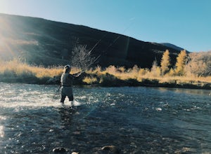
Fly Fish the Middle Provo River
The Middle Provo River runs from Jordanelle Reservoir to Deer Creek Reservoir through the Heber Valley. To get there from Salt Lake City, head southeast on I-80. Take exit 146 and merge onto US-189/US-40 toward Heber. Travel 17.1 miles; turning right onto W 100 South/River Road. 0.3 miles down Ri...Read more -
Salt Lake City, Utah
Trail Run or Hike Lambs Canyon
4.04 mi / 1531 ft gainTake I-80 East through Parley's Canyon and get off at the Lambs Canyon Exit. Stay right off the exit and start heading up the canyon. You will follow the road 1.5 miles. You will see the trail head on the right side of the road with a small area to park on the left next to the bathrooms.The trail...Read more -
Salt Lake City, Utah
Hike or Run Mount Wire
3.74.5 mi / 2082 ft gainThis 4.5 out-and-back trail starts just south of the Natural History Museum at the University of Utah. Park in the museum parking lot and walk up the stairs to the Bonneville Shoreline Trail. Then head south along the BST for a few minutes until you reach a big yellow sign with 174 on it. Turn le...Read more

