Pleasant Grove, Utah
Looking for the best hiking in Pleasant Grove? We've got you covered with the top trails, trips, hiking, backpacking, camping and more around Pleasant Grove. The detailed guides, photos, and reviews are all submitted by the Outbound community.
Top Hiking Spots in and near Pleasant Grove
-
Provo, Utah
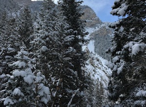
Snowshoe the Rock Canyon Trail
3 mi / 1630 ft gainThe Rock Canyon trail is a heavily trafficked path that brings people of all ages. In the winter the mountains are covered in snow and the path is well packed down due to the volume of people that are hiking. After about a mile of hiking, you will enter the more dense part of the canyon with lo...Read more -
Provo, Utah
Hike to Summit of Buffalo Peak
1 mi / 500 ft gainDrive up Provo Canyon and turn right on Squaw Peak Road. Follow the road til you reach the T in the road and head left on Road 027. Follow it 2.9 miles to the unmarked trail head. It is located next to a wooden fence on the right of the road and next to a sign about fire and wildlife safety. ...Read more -
Provo, Utah
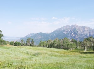
Buffalo Peak Trail
0.97 mi / 213 ft gainBuffalo Peak Trail is an out-and-back trail where you may see wildflowers located near Provo, Utah.Read more -
Sandy, Utah
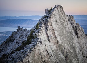
Climbing in the Lone Peak Cirque
4.0Lone Peak reaches 11,253 feet at its summit. It's alpine feel is unique as it stands above the busy city below. While this gem is one of the highlights in the Wasatch range, it must be earned. A long steep approach, best done at night in the summer months, deposits you in the high meadow surround...Read more -
Provo, Utah
The Y Trail
3.52.29 mi / 1063 ft gainHiking the Y is a classic hike in Provo, Utah—but don't expect it to be easy! There's no shade and not much greenery, so it's a hot, dusty trek to the top. Once you reach the Y, though, the view of the Provo and Utah Lake is amazing. There are also benches at the top. When you reach the Y, you w...Read more -
Provo, Utah
Backpack to Silver Lake
4.44.1 mi / 1500 ft gainThe trail is 4.1 miles roundtrip gaining almost 1,500 feet for the duration of the adventure. Some parts are exposed, so you can get a fair amount of sun.When you're on the trail, you'll get amazing views as you’re hiking to the lake of Mount Timpanogos and American Fork Canyon. This is followed ...Read more -
Provo, Utah
Camp at Silver Lake
4.54.4 mi / 1500 ft gainSilver Lake is a wonderful place to go if you're in need of a quick adventure in the woods. Located in the the Uinta National Forest, Silver Lake is relatively easy to get to via American Fork Canyon in Utah, however I do recommend driving a car with 4WD and can handle steep dirt roads with shar...Read more -
Wallsburg, Utah
Walk the Deer Creek Dam Trail
4.08.03 mi / 400 ft gainWhile driving East, the turnoff to the trailhead is just left of the dam. There is a size-able parking lot and rest rooms available. The hike itself is a dirt path and easy to follow. Access to the water's edge is restricted until you are 1500 feet past the dam. Though the trail is designed for b...Read more -
Provo, Utah
Hike to the Summit of Buckley Mountain
4.018 mi / 5000 ft gainThere are a few ways to get to the top of Buckley, but the funnest (and most strenuous) way to get up to Buckley is taking the trail up Slate Canyon. Slate Canyon has a parking lot and bathroom located at the base of the trail, and the trailhead is about ten minutes from the Provo Center Street e...Read more -
Provo, Utah
Hike Big Springs Hollow Loop
4.05 mi / 600 ft gainArriving to Big Springs Hollow is relatively easy. Drive up Provo Canyon and turn right onto South Fork Rd at Vivian Park. As you pass Vivian Park, you'll continue for 3 miles on South Fork Rd until you reach Big Springs Park. Continue up to the Upper level parking and the trailhead will be in...Read more -
Draper, Utah
Lone Peak via Jacobs Ladder
4.714.2 mi / 6713 ft gainThe main trail to Lone Peak is via Jacobs Ladder. To get to the start of the trailhead you need to drive on a dirt road for a little bit until you get to a little parking area (start of the road indicated on the map). The trail starts just south of where you park on the dirt road. The Jacobs Lad...Read more -
Draper, Utah
Lone Peak via the Cherry Creek Logging Trail
14.8 mi / 6378 ft gainYou start this trail at the Orson Smith Park in Draper. It joins with the Bonneville Shoreline Trail briefly before turning off onto the cherry creek logging trail. It switchbacks for a long ways exposed on towards the valley. It is fairly steep in places, but doable. I had tennis shoes with ...Read more -
Sandy, Utah
Upper Bell Canyon Reservoir via Bell Canyon Trail
4.39.12 mi / 4285 ft gainThis is one of my favorite spots in the state of Utah! It is completely secluded high up on the Wasatch front. You can hike here for a nice relaxing day, an overnight camping trip, or do a little fly fishing and hook some fun little brooke and cutthroat trout. The Bell Canyon trail is one of the...Read more -
Sandy, Utah
South Thunder Mountain via Bell Canyon
11.78 mi / 5968 ft gainStarting at the Bell's Canyon trailhead, the trail follows a river for most of the way, passing two reservoirs and two waterfalls. This trail is intermediate, depending on your destination. The first and most commonly visited section of the trail is the first reservoir. An easy hike of less than ...Read more -
Sandy, Utah
Explore Little Cottonwood Canyon's Lisa Falls
3.8Lisa Falls sits approximately 0.22 miles from Little Cottonwood Canyon Road. While the trail is not long or particularly steep, there are some large step ups that could be difficult for either the very old or very young. Nonetheless, this is a great option for a family outing.Once you arrive at t...Read more -
Sandy, Utah
Summit the Pfeifferhorn
5.09 mi / 3700 ft gainStarting at the White Pine Trailhead in Little Cottonwood Canyon, UT, hike southwest until reaching the junction to Red Pine Canyon. Take the trail that crosses the stream and continues west around the ridge. The trail will quickly turn south and begin to gain elevation. Continue west as you pass...Read more

