Heber City, Utah
Top Spots in and near Heber City
-
Hanna, Utah
Hike the Lofty Lake Loop Trail
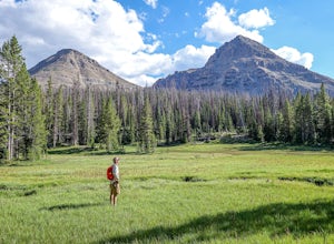
4.54.2 mi / 935 ft gainLofty Lake Loop Trail is located in the High Uintas near Kamas, Utah. The trail can be found right off the Mirror Lake Scenic Byway about 32 miles east of Kamas and starts at the Pass Lake Trailhead. This is a fairly mellow trail with some areas of good elevation gain, enough to get your heart w...Read more -
Salt Lake City, Utah
Cycle Big Mountain
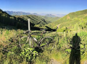
The views from the top of Big Mountain are breathtaking. From the Salt Lake - Morgan County border at about 7,400 ft, you will look down East Canyon, and over the top of Parley's Canyon into the Salt Lake Valley. Big Mountain can be ridden alone or as an extension to the Emigration Canyon Ride.Fr...Read more -
Salt Lake City, Utah
Bike Emigration Canyon
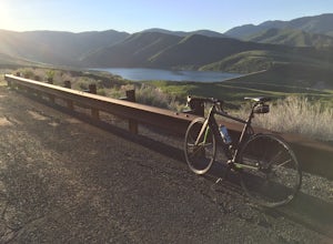
4.714.4 mi / 1300 ft gainIf you're looking for a fun climb on your road bike that won't kill you, or you are trying to find a place to train for some bigger climbing, Emigration is the perfect place to ride. The elevation gain is gradual, allowing you to grind it out for a great training ride, or spin steadily to the top...Read more -
Salt Lake City, Utah
Hike or Run Mount Wire
3.74.5 mi / 2082 ft gainThis 4.5 out-and-back trail starts just south of the Natural History Museum at the University of Utah. Park in the museum parking lot and walk up the stairs to the Bonneville Shoreline Trail. Then head south along the BST for a few minutes until you reach a big yellow sign with 174 on it. Turn le...Read more -
Salt Lake City, Utah
Hike the Living Room
4.42.5 mi / 1000 ft gainBecause if its proximity to downtown Salt Lake, this is a great quick hike to do after work. Although it's short, it is fairly steep, climbing nearly 1000 feet in 1.25 miles. However, most people can do it without too much difficulty. This is a good family hike and allows dogs on leashes. Due to ...Read more -
Saratoga Springs, Utah
Photograph the Sunrise at Utah Lake
4.0Turn off Highway 68 onto a dirt road towards Utah Lake. You'll see a large sign on your left and a small hill with ATV trails in the distance on your right. Follow the dirt road straight down past the hill. After veering right you can park down fairly close to the water's edge. The dirt road is f...Read more -
18899-19003 U.S. Highway 89, Utah
Visit the Flooded Thistle Ghost Town
3.0Thistle, Utah was a small community located in Spanish Fork Canyon, founded in 1883. It flourished for a time as a ranching community and eventually became a major stop on the rail line that ran through it. This all changed in 1983 when a massive landslide dammed the Spanish Fork River and floode...Read more -
Salt Lake City, Utah
Hike or Trail Run Mount Van Cott
4.03 mi / 1400 ft gainThere are many different trailheads that will take you to the top of Mount Van Cott, but the main trailhead is up Red Butte Canyon. Drive up the canyon until you reach the parking lot where the canyon gate is blocking the road. After parking your car here, head up the dirt road on foot until you ...Read more -
Evanston, Utah
Backpack Naturalist Basin and Summit Mount Agassiz
4.015 mi / 3700 ft gainNaturist Basin is a beautiful area in the High Uintas Wilderness with an abundance of mountains, lakes, meadows, and wildlife. It is best hiked July-September. To get to the trailhead, drive up the Mirror Lake Scenic Byway until you reach the Highline Trailhead Campground, about 3 miles past Mi...Read more -
Evanston, Utah
Hike to Hayden Peak in the High Uintas
3.63 mi / 2053 ft gainHayden Peak is by all means the monarch mountain of the Mirror Lake Highway. By that, I mean that Hayden Peak is easily the most rugged and impressive peak that can be viewed from the road. Driving over Bald Mountain Pass towards Evanston, WY, this peak looks amazing. There are few mountains out ...Read more -
Oakley, Utah
Backpack to Cutthroat Lake
4 mi / 280 ft gainThere isn't a trail to Cutthroat Lake so for a portion of the hike will be cross-country. I highly recommend bringing a GPS but with intermediate route-finding skills you should be able to find your way. We used the Gaia GPS app and this made the hike much easier. The distance depends on the r...Read more -
Oakley, Utah
Scale the Cliffs at Ruth Lake
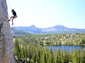
4.8Getting There From Evanston, take the Mirror Lake Highway 150 about 42 miles to the Ruth Lake trailhead and follow the easy hike up from the highway; just look for the signs directing you to Ruth Lake. The Trail/The Climbs Once on the trail, keep an eye out to your left and soon you'll see the cl...Read more -
Oakley, Utah
Hike to Ruth Lake in the High Uintas Wilderness
5.02 mi / 300 ft gainThe Uintas are a high elevation, pristine mountain wilderness located in Utah. This range receives over 400 inches of precipitation annually, and you can find water everywhere. There are 400+ miles of streams, waterfalls, and more than 2,000 lakes! One of the prettiest and most accessible of th...Read more -
Salt Lake City, Utah
Cycle City Creek Canyon
5.0City Creek Canyon is a hidden gem, just minutes away from downtown Salt Lake City. Secluded winding roads will take you deep into the canyon, away from the bustling city. The sounds of the creek, canyon views, and the thick forest that lines the road provide for the perfect, quick escape.Starting...Read more -
Coalville, Utah
Camp at Echo Reservoir
5.0This scenic reservoir provides you with the opportunity to spend the day on the water. To get here, drive around 45 minutes from Park City toward Coalville. Get off for the exit and take a left once in town; drive along this road until you see the campground entrance on your left.Overnight passes...Read more -
Salt Lake City, Utah
Ensign Peak
4.20.97 mi / 354 ft gainThis hike is a piece of cake with a sizable reward. It starts just up the hill behind the Capitol Building and ascends 350 feet over about 0.5 miles to the top on a very well marked trail. It's great for a family with young ones or maybe a quick post-dinner evening date. Parking is all along a re...Read more

