Cedar City, Utah
Looking for the best photography in Cedar City? We've got you covered with the top trails, trips, hiking, backpacking, camping and more around Cedar City. The detailed guides, photos, and reviews are all submitted by the Outbound community.
Top Photography Spots in and near Cedar City
-
Rockville, Utah
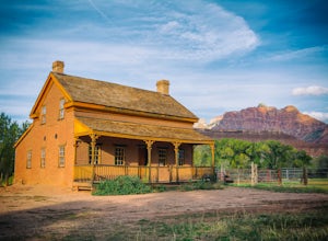
Grafton Ghost Town
4.8Grafton Ghost Town is an abandoned small town 7 miles outside Zion National Park and the modern towns of Rockville and Springdale, Utah. To get there from Highway 9, get off on Bridge Lane residential road and cross the Virgin River on a historic single track iron bridge- then head west. At th...Read more -
Rockville, Utah
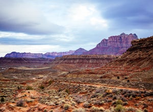
Camp off the Smithsonian Butte Backcountry Byway
5.09.5 mi / 800 ft gainSmithsonian Butte Backcountry Byway is gorgeous 9.5 mile road that runs between Rockville near the entrance to Zion National Park and Apple Valley UT, and affords excellent places to camp & boondock *as long* as it is 0.5 miles from the road itself (and there are numerous turn offs). To get ...Read more -
Hurricane, Utah
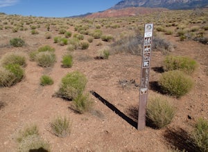
Hike the Historic Babylon - Little Purgatory Loop
6 mi / 1000 ft gainThe trailhead has space for about three or four cars. Watch for an obvious gap in the cliffs very close to the trailhead, this is where you should park. Just before exiting the gap, look to the left for some interesting petroglyphs. The trail follows a dry wash through some heavy vegetation for a...Read more -
Hurricane, Utah
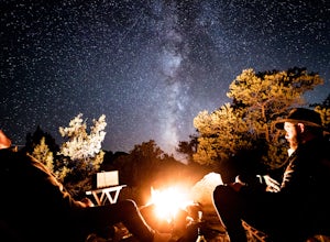
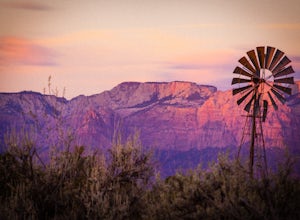
Camp on Wire Mesa
5.0Wire Mesa off the Smithsonian Butte Backcountry Byway is a fantastic place to camp in southeastern Utah even if you do not plan on visiting Zion, just a few miles to the north. There several backcountry campsites on the Mesa, with the northwestern-most site giving the best views overlooking the V...Read more -
Hurricane, Utah
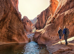
Red Cliffs Recreation Nature Trail
4.51.39 mi / 266 ft gainHike along streams that run through red sandstone - the blue water makes a fun contrast against the red rocks and sand. To get to the trailhead, drive to the Red Cliffs Campground about 20 minutes north of St. George. There is a small fee to park or camp at the campground. This trail starts in ...Read more -
Orderville, Utah
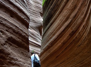
Hike Red Hollow Slot Canyon
5.03.2 mi / 200 ft gainThe trailhead is about 18 miles from the eastern entrance of Zion National Park, located in the small town of Orderville. In Orderville, the streets aren't marked too well, so follow the road that goes past the cemetery and the school, 100 East. When the road Ts, turn left. The road ends in a san...Read more -
Hurricane, Utah
Running Windmill Trail
8 miWindmill trail and trailhead sits just down the road from Gooseberry Mesa Trailhead in Apple Valley, Utah. Head out on this figure-8 loop for as long as you want. If you're smart, you'll bring your MTB, and you can ride the singletrack once you're done getting your run in.This is also a great spo...Read more -
Orderville, Utah
Hike through the Red Caves (Sand Wash)
5.0They don't require any technical gear unless you would like to do two short rappels near the beginning of Lower Red Cave and one short rappel into the Upper Red Cave. We didn't take a rope and were fine although the canyons are usually filled with water and have some difficult obstacles to overco...Read more -
Panguitch, Utah
Drive the Scenic Byway 12 in Utah
5.0The Scenic HWY 12 is a great stretch en route to Bryce Canyon. Stop at the overlooks and take in the beautiful surrounding scenery. The red rocks are spectacular!Read more -
Washington, Utah
Camping at Yant Flat
5.02.6 mi / 500 ft gainThough only a few miles from civilization as a bird flies, this trailhead is only accessible via a dirt road (that can be quite bumpy - high clearance vehicles recommended though I did it in a car). Given the condition of the road, drive time can be 45 minutes from St George, Utah. The road is ...Read more -
Dammeron Valley, Utah
Snow Canyon Overlook via Red Mountain Trail
4.74.65 mi / 525 ft gainWhile the trail to the top is mediocre, the views once you get there are absolutely stunning, making for an amazing hike. The hike begins at the Red Mountain Trailhead, north of Snow Canyon State Park. This trail is very rock and sandy, without much variety in landscape along the way. During the...Read more -
Hurricane, Utah
Camp at Little Creek Mesa
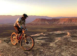
5.0Experience solitude and beauty at Little Creek Mesa Utah. When you get there, grab a campsite, and go for an evening mountain bike ride along the rim of the mesa and see breathtaking views of the valley below as the sun sets. Little Creek Mesa is located 22 miles from Hurricane, Utah and only 8 ...Read more -
St. George, Utah
Hike the Whiterocks Trail
1.75 mi / 400 ft gainThis trail starts from a parking area just off Route 18. Follow the obvious trail with the whiterocks to the right and views of Snow Canyon. The trail descend steep, deep sand path until you reach some petrified sand dunes. Great photo opportunities here. This section is short lived as you co...Read more -
Hurricane, Utah
Water Canyon Trail in the Canaan Mountain Wilderness
5.03.09 mi / 1302 ft gainWater Canyon is a narrow canyon on the southern side of Canaan Mountain in the Canaan Mountain Wilderness south of Zion. It makes for a great hike away from the crowds, though do not expect to have the trail to yourself as it is a great starting point for backpacking and canyoneering trips into t...Read more -
St. George, Utah
Hike the Lava Flow Trail
5.01.5 mi / 400 ft gainFrom the parking area, the trail travel west directly into the lava field. This is evident by the sharp black rocks the trail travels through. Watch for the first lava tube on the left. All lava tubes have a steep short descent down in to explore a bit but the tubes are not deep and could be d...Read more -
Orderville, Utah
Kanab's Peek-a-Boo Canyon
4.87.71 mi / 587 ft gainThe trailhead is Red Canyon (aka Peek-a-boo) trailhead located just off of Highway 89 between Kanab and Mt. Carmel Junction. The GPX track shows the entirety of the trail, but if you have 4WD and a high-clearance vehicle, you're able to reach the closer parking area for a less than 1-mile roundtr...Read more

