Bountiful, Utah
Looking for the best running in Bountiful? We've got you covered with the top trails, trips, hiking, backpacking, camping and more around Bountiful. The detailed guides, photos, and reviews are all submitted by the Outbound community.
Top Running Spots in and near Bountiful
-
Salt Lake City, Utah
Trail Run or Hike Lambs Canyon
4.04 mi / 1531 ft gainTake I-80 East through Parley's Canyon and get off at the Lambs Canyon Exit. Stay right off the exit and start heading up the canyon. You will follow the road 1.5 miles. You will see the trail head on the right side of the road with a small area to park on the left next to the bathrooms.The trail...Read more -
Holladay, Utah
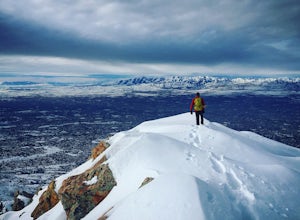
Winter Hike to Mt. Olympus
5.07 mi / 4200 ft gainApproach: You can access the well traveled Mount Olympus Trail the same as you would any other season. Park in the trailhead lot or along Wasatch Blvd. The trail starts on the south side of the parking lot.Route Description: Even in the winter the Mount Olympus trail should be pretty straightforw...Read more -
Summit County, Utah
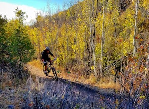
Mountain Bike the Genwild/Jeremy Ranch Trails
6 mi / 700 ft gainThere are several places to access the trail system and several good places to park on both the Jeremy Ranch side and the Glenwild side. One of my favorite options is to park at the end of Jeremy Road and then take the 24-7 trail into the action. This is also a good way to access the Flying Dog t...Read more -
Holladay, Utah
Hike Heughs Canyon (Olympus Waterfall)
4.52 mi / 1000 ft gainHeughs Canyon starts right on the edge of Salt Lake City, but within minutes, you’re in a shady forest next to a gurgling stream. This is the prefect after-work hike that can be enjoyed year-round. Two miles round-trip and just over 1,000 feet, the path takes you to a beautiful waterfall that flo...Read more -
Salt Lake City, Utah
Mountain Bike Dog Lake, Millcreek Canyon
4.4 mi / 1260 ft gainIf it’s an even day and you’re in Salt Lake and you’re in possession of a mountain bike, put down your phone and spend the next 2 hours in pure bliss. Mountain bikers are only allowed to use the trails of upper Millcreek Canyon on even days, which makes for a busy route, but well worth it. This i...Read more -
Salt Lake City, Utah
Trail Run Upper Big Water Trail to Dog Lake
4.06.2 mi / 1267 ft gainDrive all the way to the top of Millcreek Canyon until you can't drive any further. (They close the road further down the canyon in the winter so this trail is not accessible to cars in the winter.) There is a small parking lot at the end of the road, park here. The trail head is going to be on t...Read more -
Salt Lake City, Utah
Hike the Mineral Fork Trail
4.09.3 mi / 3500 ft gainThe trailhead begins along Big Cottonwood Canyon Road, with a relatively small parking lot at the trailhead. Starting early in the day is advised, as on nice summer days it will fill up quickly. The trail has a steady ascent for the first 2 miles starting around 6700' through aspen forests and cr...Read more -
Brighton, Utah
Hike or Trail Run Butler Fork
5.07.2 mi / 1964 ft gainTo get to the trailhead, drive up Big Cottonwood Canyon 8 miles. The parking lot is on the left side of the road. The first half mile is the steepest of the whole trail so don't get too intimidated by it, it mellows out a lot after. You will come to fork in the trail about a mile in, you can eith...Read more -
Salt Lake City, Utah
Hike from Mill D to Desolation Peak
10 mi / 2500 ft gainLargely runnable trail up through pines and aspens with a few steep climbs. Incredible wildflowers. You can stop at Desolation Lake then continue up towards the ridge and up to Desolation Peak. You have to listen and watch for descending bikers coming fast around corners.Read more -
Park City, Utah
Ride the RTS Trail
2.6 mi / 366 ft gainThe RTS trail at Utah's Olympic Park (ski jumping, bobsled, skeleton, and luge), is a fantastic beginner-to-intermediate trail. Since it's a short loop at only 2.6 miles and 366 feet of elevation gain, it's perfect for kids and beginners. Most of the sections are smooth dirt that winds through as...Read more -
Salt Lake City, Utah
Hike Cardiff Fork
8 mi / 2880 ft gainCardiff Fork and Donut Falls share the same parking lot, so depending on what time of week you go exploring here, it may be the most packed parking in all of the Wasatch. Head up on a weekday for less crowds. The Cardiff Fork trailhead is follows the rocky jeep road around the parking lot to the...Read more -
Salt Lake City, Utah
Kessler Peak in Utah's Big Cottonwood Canyon
4.74.66 mi / 2733 ft gainKessler Peak is a 10,403-foot peak located in Big Cottonwood Canyon. From the top, you can see all the way to the Uintas to the East, The tram at Snowbird to the south, and the Salt Lake Valley to the west. To the north is Mount Raymond and Gobblers Knob. Kessler Peak is the terminus and highes...Read more -
Park City, Utah
Hike, Run, Bike Rob's Trail in Park City
4.02.8 mi / 705 ft gainRob's Trail is a perennial favorite among Park City locals for year-round hiking, trail running, or mountain biking. The trail is primarily an out-and-back, but it if you go a bit further it can be combined with other trails to create a loop. The trail meanders through aspen and pine trees on the...Read more -
Salt Lake City, Utah
Hike Days Fork
5.07.5 mi / 2494 ft gainTo get to the trailhead drive up Big Cottonwood Canyon to Spruces Campground. Once in the parking lot, walk to the southwest corner of the parking lot and go up the road past the bathrooms. The trailhead will be next to the overgrown baseball field. The trail is awesome single track the whole wa...Read more -
Huntsville, Utah
Green Pond Loop
4.52.44 mi / 436 ft gainAbout a mile before Snowbasin, is a parking lot with a map and trail marker. The first incline is steep and follows a single track trail that leads to the ponds. This trail is great year-round, but in the winter, you may have some stray backcountry snowboarders in the area. It's pretty quiet over...Read more -
Sandy, Utah
Dimple Dell Trail West
3.88 mi / 236 ft gainDimple Dell Trail West is an out-and-back trail where you may see beautiful wildflowers located near Sandy, Utah.Read more

