Bountiful, Utah
Looking for the best fitness in Bountiful? We've got you covered with the top trails, trips, hiking, backpacking, camping and more around Bountiful. The detailed guides, photos, and reviews are all submitted by the Outbound community.
Top Fitness Spots in and near Bountiful
-
Bountiful, Utah
Trail Run to Elephant Rock
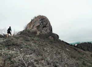
4.47 mi / 1025 ft gainMueller Park is a beautiful, quaint canyon, with some sweeping up canyon views throughout the ascent. The trail is a fun, family friendly single track from the bridge all the way to the rock. You will pass a bald strip (pipeline) that runs North to South which marks about halfway to the rock. At ...Read more -
Salt Lake City, Utah
Hike or Trail Run Mount Van Cott
4.03 mi / 1400 ft gainThere are many different trailheads that will take you to the top of Mount Van Cott, but the main trailhead is up Red Butte Canyon. Drive up the canyon until you reach the parking lot where the canyon gate is blocking the road. After parking your car here, head up the dirt road on foot until you ...Read more -
Salt Lake City, Utah
Hike or Run Mount Wire
3.74.5 mi / 2082 ft gainThis 4.5 out-and-back trail starts just south of the Natural History Museum at the University of Utah. Park in the museum parking lot and walk up the stairs to the Bonneville Shoreline Trail. Then head south along the BST for a few minutes until you reach a big yellow sign with 174 on it. Turn le...Read more -
Salt Lake City, Utah
Little Mountain in Emigration Canyon
4.34 mi / 440 ft gainJust off of Highway 80, head up Emigration Canyon Road to the trailhead. There is a large parking area on the opposite side of the road from the trailhead. The parking area comes equipped with a bathroom if you need one. To get started, cross the road and start heading uphill. Keep in mind that...Read more -
Salt Lake City, Utah
Hike Jacks Mountain
4.02.4 mi / 1300 ft gainNamed for a toddler who died of Lukemia in 1995, Jacks Mountain is a beautiful place to sit above the valley and contemplate mortality. On the peak, you’ll find a couple mailboxes containing heartfelt notes from hundreds of hikers throughout the years. It’s the kind of place that restores your fa...Read more -
Salt Lake City, Utah
Grandeur Peak West Face
2.23 mi / 3307 ft gainAre you planning a big adventure and need a boost getting ready for it? You came to the right place. This is my go-to when I’m preparing to climb a big mountain. It’s hard to find a steeper trail in the area (that’s not a game trail), and the West Face is usually free of snow early in the season....Read more -
Salt Lake City, Utah
Salt Lake Overlook via Desolation Trail
4.14.76 mi / 1729 ft gainThis popular trail follows a portion of the Desolation Trail leaving from Mill Creek Canyon. The trail to the overlook is 4.75 miles round trip with a 1700 ft elevation gain. You begin at the Desolation Trailhead and then turn around once you have a view of the Salt Lake Valley. It is a perfect h...Read more -
Salt Lake County, Utah
Hike Thayne Canyon
6 mi / 2800 ft gainIf you want to avoid the crowds heading to the Salt Lake Overlook and are looking for a bigger challenge with better views, Thayne Canyon is the ticket. The trail is 6 miles roundtrip with 2,800 feet of elevation gain. It’s a great evening hike and the peak is a nice place to watch the sunset. Th...Read more -
Salt Lake City, Utah
Hike Porter Fork, Millcreek Canyon
5.06.8 mi / 3250 ft gainPorter Fork starts at the aptly named Porter Fork Trailhead about 4 miles up Millcreek Canyon. It’s actually Porter Fork Road for the first 1.5 miles of the trail. This section is a pleasant, paved path winding up through a dozen or so cabins. You’ll gain about 1,000 feet. If you make it past the...Read more -
Salt Lake City, Utah
Trail Run Burch Hollow Trail
5.3 mi / 2412 ft gainThe Burch Hollow trailhead is about a quarter mile up the Pipeline trail in Millcreek Canyon. After hiking along the switchbacks of the Pipeline trail, you'll see a sharp turn in the trail that leads you up the side of the mountain. This turn can easily be missed so keep a good look out for it. C...Read more -
Salt Lake City, Utah
Hike Bowman Fork to Baker Pass
5.08.3 mi / 3375 ft gainTo get to the trailhead, drive up Millcreek Canyon about 4.5 miles until you reach the Terraces Picnic area. Turn here and drive up the small road until you reach the parking lot by the bathrooms. You'll see the Bowman Fork trailhead marker next to the parking lot. The trail climbs steadily and i...Read more -
Salt Lake City, Utah
Trail Run or Hike Lambs Canyon
4.04 mi / 1531 ft gainTake I-80 East through Parley's Canyon and get off at the Lambs Canyon Exit. Stay right off the exit and start heading up the canyon. You will follow the road 1.5 miles. You will see the trail head on the right side of the road with a small area to park on the left next to the bathrooms.The trail...Read more -
Holladay, Utah
Mt. Olympus Trail
4.76.46 mi / 4124 ft gainThe trail begins right on Wasatch Blvd. and after the first 0.5 miles you're into the Superior Wilderness. This is a very strenuous hike and you will be gaining elevation the whole way from the parking lot (4830 ft) to the summit (9026 ft). About .2 mile from the summit you will reach a saddle....Read more -
Summit County, Utah
Mountain Bike the Genwild/Jeremy Ranch Trails
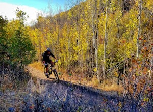
6 mi / 700 ft gainThere are several places to access the trail system and several good places to park on both the Jeremy Ranch side and the Glenwild side. One of my favorite options is to park at the end of Jeremy Road and then take the 24-7 trail into the action. This is also a good way to access the Flying Dog t...Read more -
Holladay, Utah
Hike Heughs Canyon (Olympus Waterfall)
4.52 mi / 1000 ft gainHeughs Canyon starts right on the edge of Salt Lake City, but within minutes, you’re in a shady forest next to a gurgling stream. This is the prefect after-work hike that can be enjoyed year-round. Two miles round-trip and just over 1,000 feet, the path takes you to a beautiful waterfall that flo...Read more -
Davis County, Utah
Hike the Frary Peak Trail
4.57 mi / 2050 ft gainThis is a fairly easy hike starting at the parking lot near the trailhead. You will encounter little or no obstacles on your hike, just a nice incline leading you to the highest point of the island.You will be able to see lots of buffalo roaming around most of the island on your way up. Be sure t...Read more

