Beaver, Utah
Top Spots in and near Beaver
-
Sevier, Utah
Hike Joe Lott Trail #051
6.5 mi / 3600 ft gainThe Joe Lott Trailhead starts at Castle Rock Campground and follows the Joe Lott Creek which has tall old growth trees to provide shade in the summer. Joe Lott Trail #051 is an out-and-back, so you can go as far as you like and turn around. We went 1.5 miles and had to cross the river 3-times. At...Read more -
Sevier, Utah
Explore Castle Rock's Slot Canyons
0.25 mi / 200 ft gainSurrounding the Castle Rock Campground on the East and West sides are slot formations that have formed over centuries by wind and rain as it erodes softer earth from the harder rock. There are no designated trails, but footpaths are visible, follow them up and start exploring. This area is part o...Read more -
Sevier, Utah
Camp at Castle Rock Campground
Castle Rock Campground is located within Utah's Fremont Indian State Park just off Interstate 70, which according to the camp host, is a favorite place to camp for people traveling between California and Colorado. At 6,200 feet in elevation, the temps are manageable in the summer, and the large ...Read more -
Sevier, Utah
Photograph Big Rock Candy Mountain
As you head south on Hwy 89 south of I-70 in central Utah, you wind through a picturesque canyon along the Sevier River. As the canyon opens up, Big Rock Candy Mountain's caramel colored hillside comes into full view. The caramel color is a stark contrast to the other mountains covered in pinion ...Read more -
Sevier, Utah
Cave of 100 Hands Trail
0.5 mi / 50 ft gainThe Cave of 100 Hands is a fascinating archeological/historical site that is easy all-ages and strollers. Over a thousand years ago, the valleys along what is now Interstate 70 near Sevier, Utah were home to the largest community of Fremont Indians ever discovered, and the Cave of 100 Hands has s...Read more -
Brian Head, Utah
Canyoneering Benson Creek
2 mi / 200 ft gainDisclaimer: Canyoneering is a dangerous and technical activity. Don’t enter any canyon without the skills to match it, or the knowledge to navigate it. Benson Creek is a pleasant little spot for families to hike a waterfall (Hidden Haven Falls), or a fantastic spot for canyoneers to rappel some w...Read more -
Monroe, Utah
Soak at Mystic Hot Springs in Monroe
4.5The Mystic Hot Springs are truly a hidden gem in Utah. I convinced my boyfriend, after spending the weekend camping in Bryce National Park and mountain biking Thunder Mountain, that we needed to stop and soak on our way home to Park City. It really wasn’t that hard to convince him. I had already ...Read more -
Panguitch, Utah
Drive the Scenic Byway 12 in Utah
5.0The Scenic HWY 12 is a great stretch en route to Bryce Canyon. Stop at the overlooks and take in the beautiful surrounding scenery. The red rocks are spectacular!Read more -
Millard County, Utah
Take a Dip in the Meadow Hot Springs
3.8These hot springs are located on private property but the owner allows anyone to come and take a dip. You can camp overnight and also have fires in the several pits near the pools. He just asks all the visitors to keep it cleaner than they found it and Leave No Trace of course. There are 3 differ...Read more -
Cedar City, Utah
Hike the Hoodoo Loop Trail in Dixie National Forest
5.00.3 miHoodoo's are unique rock formations formed over many years by erosion. In this region, the hoodoos are formed through a process called frost wedging. This is the process of repeated freeze thaw cycles. As snow melts the water seeps between the cracks in the rocks then freezes at night when the...Read more -
Brian Head, Utah
Hike the Brian Head Loop Trail
0.2 miDrive to the peak on county road 47 to the parking area. Hike around the peak and admire the beautiful views of the mountains and the resort below. Be sure to take pictures of the abundant wildflowers around the peak. The drive to the peak is very scenic.Read more -
Hatch, Utah
Bike Thunder Mountain Trail
4.08 mi / 1123 ft gainThunder Mountain Trail is one that should be on every mountain bikers bucket list. It's located just outside of Bryce Canyon National Park and passes through hoodoos, classic Bryce Canyon topography and epic views to the west. For the first 2.5 miles, the trail meanders back and forth with littl...Read more -
Fillmore, Utah
Camp and Explore at Meadow Lava Tubes
4.41 miEXPLORE THE AREAThe entrance to the Lava Tubes is located in a rock pit near the NW base of Tabernacle Hill. The trail is not marked very well, so you'll have to use your best exploring skills to find your way. Once you have entered the first cave follow it underground for about 100 ft until it l...Read more -
Brian Head, Utah
Alpine Pond North Loop
1.22 mi / 79 ft gainAlpine Pond North Loop is a loop trail that takes you by a lake located near Cedar City, Utah.Read more -
Brian Head, Utah
Hike the Sunset Trail
4.01 mi / 200 ft gainCedar Breaks National Monument is a gorgeous multi-colored limestone amphitheater that many consider to be more beautiful than Bryce Canyon National Park given its greater depth over a shorter distance and higher elevation. It is far less traveled than its neighbors of Zion and Bryce. The Sunset ...Read more -
Brian Head, Utah
Hike Ramparts Trail via Spectra Point
5.04 miTo call this place "breathtaking" would not do it justice. The rusty red, orange, purple colors of million-year-old rock erosion are otherworldly, something you'd imagine on Mars. The Indians named Cedar Breaks the "Circle of Painted Cliffs," and when you see this brilliantly colored coliseum you...Read more
Top Activities
Camping and Lodging in Beaver
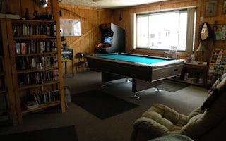
Beaver, Utah
Beaver KOA Journey
Set in the high desert at 6,000 feet, this KOA is an oasis of mature shade trees, flowers and plants. Midway between Salt Lake City and L...
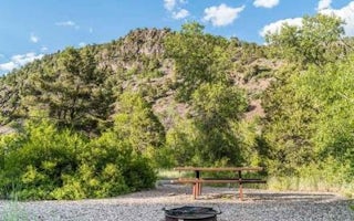
Beaver, Utah
Little Cottonwood Campground
Overview
The Little Cottonwood Campground is conveniently located off Utah's I-15, adjacent to the Beaver River just outside of the commu...
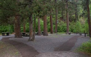
Beaver, Utah
Ponderosa Picnic Area
Overview
Ponderosa Picnic Area is located along the Beaver Canyon Scenic Byway. It is next to the Beaver River, at an elevation of 7,000 ...
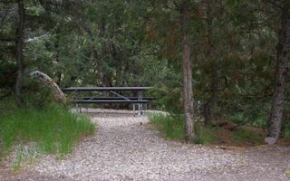
Beaver, Utah
Mahogany Cove Campground
Overview
Mahogany Cove Campground is located in a grassy meadow along the Beaver Canyon Scenic Byway just 12 miles from Beaver, Utah, at ...
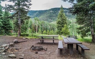
Beaver, Utah
Kents Lake Campground
Overview
Kents Lake Campground has 28 single family campsites and two multiple family campsites. It is situated in a beautiful forested s...
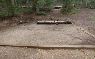
Beaver, Utah
Anderson Meadow Campground
Overview
Anderson Meadow Campground is nestled above Anderson Meadow Reservoir in the Fishlake National Forest. The area boasts spectacul...


