Spicewood, Texas
Top Spots in and near Spicewood
-
Johnson City, Texas
Hike Wolf Mountain, Juniper Ridge And South Loop Equestrian Trail
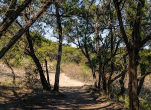
6.6 mi / 374 ft gainThe Wolf Mountain, Juniper Ridge and South Loop Equestrian Trail is a 6.6 mile loop hike within Pedernales Falls State Park, right outside of Johnson City, Texas. The trail is pretty wide and great for all sorts of exercising and social distancing. The trail is relatively moderate, with few incl...Read more -
Marble Falls, Texas
Camp at Shaffer Bend Recreation Area
6 mi / 80 ft gainAfter turning off Highway 1431 you'll drive through a little quiet and narrow one road neighborhood to arrive at the entrance to Shaffer Bend Recreation Area. From there you will drive down a dirt road which will take you almost all the way through Shaffer Bend's 523 acre lot, and lead you direct...Read more -
Austin, Texas
Swim and Relax at Common's Ford Ranch
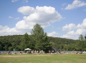
3.0Commons Ford is a lakefront park offering a boathouse that can be reserved, fishing, volleyball net and picnicking. Many people go to the park with the expectation of lounging on the large grassy area for many hours so be sure to pack food, blankets, sunscreen, and tubes if you plan to float in ...Read more -
Austin, United States
Riverplace Nature Trail
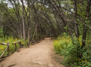
4.45.41 mi / 768 ft gainThis is a great trail to get some exercise close to downtown Austin, Texas. The trail at Natural Preserve at River Place is well maintained and has stairs and plenty of elevation gain to make your legs a little wobbly by the time you get back to your car. The trail is a 5.5-mile out-and-back hike...Read more -
Austin, Texas
Hike the Little Fern Trail
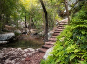
0.5 mi / 140 ft gainThe Little Fern Trail is a 1.9 mile out-and-back hike that is a part of the River Place Nature Trail. It is perfect for hiking, walking, running, and biking. The trail is open for use year-round and is easy to follow, with lots of small, side waterfalls and lush greenery scattered along. The tree...Read more -
Austin, Texas
Turkey Creek Trail
2.72 mi / 259 ft gainTurkey Creek trail is a 2.7 mile out-and-back hike located within Emma Long Metropolitan Park in Northwest Austin, Texas. This trail is perfect for cycling, running, walking, and general exercise. The trail is made of dirt with few inclines. Please note, however, at the beginning of the trail the...Read more -
Austin, Texas
Wild Basin Wilderness Preserve Loop
4.01.8 mi / 262 ft gainWild Basin Wilderness Preserve is managed as part of the Balcones Canyonlands Preserve and consists of 227 acres of beautiful Hill Country woodlands owned jointly by Travis County (164.4 acres) and St. Edwards University (62.6 acres). Wild Basin is open to visitors who can hike the 2.5 miles of t...Read more -
Austin, Texas
Watch the Sunrise at Highway Scenic Overlook
This spot is located right off of the North Capital of Texas Highway (Loop 360) on the west side of Austin. It faces east and is perfect for catching the sunrise over the city or just overall chillin'. It provides easy and accessible parking. It's a popular spot for sunset and sunrise. There are ...Read more -
Austin, Texas
Sculpture Falls
4.12.23 mi / 577 ft gainSculpture Falls is a hidden gem that is part of the 7.9 mile long Barton Creek Greenbelt in Austin. It's considered an urban oasis and is part of the Edwards Aquifer making the water temperatures in the summer about 70 degrees, and is a perfect way to cool off in the Texas heat! To find the trai...Read more -
Austin, Texas
Hike Hill of Life Hiking Trail
4.53.1 mi / 328 ft gainThe Hill of Life hiking trail is an out-and-back hiking trail around 3 miles long total. Parking is parallel parking on the street and can be found in the neighborhood where the trailhead is located. The trail begins with a half mile descent down a very rocky and gravel-ridden trail. The descent ...Read more -
Austin, Texas
Hike the 360/Pennybacker Bridge Overlook Trail
1.8 mi / 167 ft gainThis is a pretty challenging hike but the view is most definitely worth the effort. There are two sides you can hike up on: the east and west. The west side is more popular as it gives a view of the Austin skyline as well the Pennybacker Bridge. However, the east side is good for sunset viewing. ...Read more -
Austin, Texas
Photograph Pennybacker Bridge (Austin 360 Bridge)
4.30.5 mi / 75 ft gainIf you're looking for excellent views of hill country, the skyline, or just an awesome place to watch the sunset this is the place to be. If you're heading southbound from 183 on 360 just before you reach the bridge there will be a dirt parking lot on your right. There are trailheads on the easts...Read more -
Austin, Texas
St. Edwards Park Greenbelt Loop
0.75 mi / 43 ft gainParked in parking lot and walked yellow trail until it met up with the river then followed the river to the blue, purple, green trails back to parking lot. With many stops for photographs this little loop took less than an hour. North red is a little trail is longer. Where the yellow/orange/red ...Read more -
Austin, Texas
St. Edwards Park Yellow & Blue Trails
4.71.24 miSt. Edwards Park offers 2 main trails taking you along a creek, up hill trails with gorgeous views from atop a bluff, through exposed meadows filled with prairie grasses and cacti, and to a small swimming hole with a rope swing. The Creek Trail is a much easier, family friendly hike compared to ...Read more -
Austin, Texas
St. Edwards Green and Red Loop
2.8 mi / 328 ft gainSt. Edwards Green and Red Loop is a 2.7 mile loop hike located in northwest, Austin, Texas. The trail is heavily trafficked, but has a great nature scene, including a multitude of bird species and wildflowers. Bull creek flows through the trail, creating a waterfall at one point which makes for a...Read more -
Austin, Texas
Hike the Bull Creek Loop
4 mi / 100 ft gainPart park, part preserve, St. Edwards Park is not too well known, even among long time Austin residents. It's hidden away on old Spicewood Springs Road, beyond the Loop 360 boundary beyond which most people do not venture. The park consists of two parts, one park and one preserve. The portion of ...Read more

