Smithville, Texas
Looking for the best running in Smithville? We've got you covered with the top trails, trips, hiking, backpacking, camping and more around Smithville. The detailed guides, photos, and reviews are all submitted by the Outbound community.
Top Running Spots in and near Smithville
-
Cedar Creek, Texas
Pine Ridge Overlook
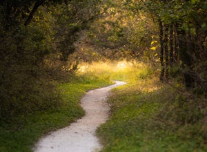
4.52.95 miPine Ridge Overlook is one of the longest hikes at McKinney Roughs Nature Area offering 2.7 miles through piney woods that overlook valleys and offer glimpses of the Colorado River. McKinney Roughs is considered a nature and learning park and requires a $5 entrance fee per-person at the Visitor ...Read more -
Garfield, Texas
Hike the Southeast Metropolitan Park Primitive Trail
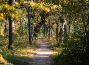
4.02.17 mi / 223 ft gainThe Southeast Metropolitan Park Primitive Trail is a quick 2.3 mile hike, perfect for families, hikers, and trail runners. This trail is dog friendly, and is open for use year round. This hike is lightly trafficked, so this is a great place to go if you are looking for some solitude.Read more -
Austin, Texas
Hike Mueller Park Trail
4.02.6 mi / 78 ft gainThe Mueller Park Trails total a distance of 5 miles with a 2.6 mile loop hike that takes you by some waterfalls located in Austin, TX. You can wander around Mueller Lake or the pond in Southwest Greenway, where man-made waterfalls can be viewed, or both! In addition to the waterfalls, the Southwe...Read more -
Gonzales, Texas
Hike the Ottine Swamp Trail
4.01.2 mi / 13 ft gainThe trail offers a number of activity options and is accessible year-round. Dogs are also able to use this trail but must be kept on leash.Wide gravel partly shaded trail that is well maintained. $3 / person over 12 (or free with a Texas State Park Pass) to enter the park.Read more -
Austin, Texas
University of Texas Walk
2.99 mi / 197 ft gainThe University of Texas Walk is about a 3-mile loop trail around the University of Texas at Austin. Beginning at the LBJ Presidential Library, the trail loops around all of UT's most prominent landmarks, including the LBJ fountain, the Blanton Museum of Art and of course the renowned school tower...Read more -
Austin, Texas
Hike along Lady Bird Hike & Bike Trail
10 miThe Hike and Bike Trail around Lady Bird Lake provides great views of the city skyline from several different perspectives. It's perfect for exercising or just taking a stroll on. It's about a 10 mile looping trail however there are several points in which you can cross the river and make the loo...Read more -
Austin, Texas
Hike Mary Moore Searight Park Trail
2.1 mi / 65 ft gainThe outer loop trail at Mary Moore Searight park is 2.1 miles and is interconnected by several smaller trails, which can be used to shorten the length of the hike. The trail is relatively easy with very few inclines and declines. The trail is mostly very thin crushed gravel and great for an easy ...Read more -
Austin, Texas
Hike the Shoal Creek Trail
5.05.47 mi / 173 ft gainThe Shoal Creek trail is located along the Shoal Creek Greenbelt which stretches the length of central/downtown Austin. It is a 5.4 mile out-and-back trail following along Shoal Creek. Much of the trail runs through residential area. And though it runs parallel to a creek, itis a city trail and n...Read more -
Barton Creek Greenbelt: Trail 11, Texas
Barton Creek Greenbelt Trail via Spyglass Trailhead
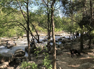
5.03.03 mi / 128 ft gainOutside of the fantastic job market, one of the most magical things about Austin is how quickly you can go from city life to being immersed in nature. Nearly every day, I take a quick jaunt down to the Barton Creek Greenbelt with my trusty companion, Sage the Chocolate Lab. We live within walking...Read more -
Austin, Texas
Hike or Bike the Walnut Creek Trail
3.74.4 mi / 190 ft gainWalnut Creek Park has a TON of little side trails that make this a must do if you are in or near the area. This particular trail (1 of 2 major ones) is a 15 mile loop but can be done as a shorter out and back. Once you park in the parking lot head southwest to find the trailhead and you're good t...Read more -
Austin, Texas
Hike Walnut Creek Metro Loop
4.08.8 mi / 534 ft gainWalnut Creek Metro Loop is an 8.8 mile loop hike located within Walnut Creek Metro Park in north Austin, Texas. The trail is moderately hiked and relatively easy. It's great for walking/running/cycling. There are many smaller trails that connect portions of the main loop and it's easy to get conf...Read more -
Austin, Texas
Hike the Violet Crown Trail: 360 to 290 Trailhead
1.8 mi / 239 ft gainThe Violet Crown Trail: 360 Trailhead to 290 trail is a 1.8 mile point-to-point hike that stretches from Loop 360 to Highway 290. Only a portion of the trail follows alongside Barton Creek before heading south towards HWY 290 while the creek veers off to the west. Dogs are more than welcome as lo...Read more -
Austin, Texas
Hike Barton Greenbelt Trail Via Barton Creek Plaza
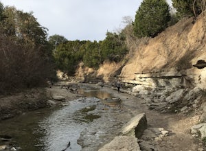
6.6 mi / 380 ft gainThe Barton Greenbelt Trail via Barton Creek Plaza is a 6.6 mile out-and-back hike located within the Barton Creek Greenbelt. This trail follows along the creek and features a couple prominent waterfalls that also serve as popular swimming holes in the summer months. Depending on the rainfall for ...Read more -
Austin, Texas
Three Falls Hike
7.35 mi / 600 ft gainThe Three Falls Hike is a 7.35 mile out and back hike located in the Barton Creek Greenbelt in Austin, Texas. The hike is heavily trafficked. The trail takes you past three waterfalls, which during the summer time serve as extremely popular swimming holes. Please note that the flow of the waterf...Read more -
Austin, Texas
Stephenson Preserve Loop
2.17 mi / 243 ft gainThe Stevenson Preserve Trail is a 1.5 mile loop hike located in South Austin. The outer trail makes a large loop around the entire park, however there are several interconnecting trails within the loop. This trail system is part of the Stephenson Preserve, which is also connected to the Longview ...Read more -
Travis County, Texas
Hike Violet Crown Trail: Zilker to 360 Trailhead
3.03.7 mi / 282 ft gainThe Violet Crown Trail: Zilker to 360 is 3.7 mile out-and-back stretch through the Barton Creek Greenbelt. The trail begins in Zilker Park and follows Barton Creek all the way south to Loop 360. Parking can be found at Zilker Park. Though on weekends and during the summer time, the park is usuall...Read more

