Horseshoe Bay, Texas
Looking for the best hiking in Horseshoe Bay? We've got you covered with the top trails, trips, hiking, backpacking, camping and more around Horseshoe Bay. The detailed guides, photos, and reviews are all submitted by the Outbound community.
Top Hiking Spots in and near Horseshoe Bay
-
Georgetown, Texas
Good Water Loop
5.025.58 mi / 2241 ft gainThe Good Water Loop is a loop trail around the San Gabriel River through Russel Park and Sawyer Park. Just outside of Georgetown, Texas, this trail is perfect for a lengthy trail run or for an overnight backpacking trip. This trail is open year-round, and dogs are allowed to use this trail if kep...Read more -
Georgetown, Texas
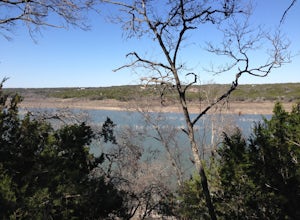
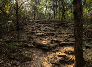
Hike Good Water Trail Loop From Cedar Breaks
10.1 mi / 688 ft gainThe Good Water Trail Loop from Cedar Breaks is a 10.1 mile loop hike that begins within Cedar Breaks Park, just northeast of Georgetown, Texas. The trail is heavily trafficked and even more so on weekends. There are several inclines and declines, but nothing too significant. The trail has rough t...Read more -
Georgetown, Texas
Hike the San Gabriel River Trail
7.6 mi / 498 ft gainThe San Gabriel River trailhead is found within Cedar Breaks Park, just northeast of Georgetown, Texas. The trail is a 7.6 mile moderate out-and-back trail. The trail is heavily trafficked and even more so on weekends. There are several inclines and declines, but nothing too significant. The trai...Read more -
Georgetown, Texas
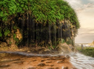
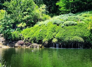
Crockett Gardens and Falls
4.57.68 mi / 1030 ft gainThis is a 7.6 mile out-and-back trail snaking along the banks of Lake Georgetown. The trailhead is located in Cedar Breaks Park. There is no fee to hike the trail however there are fees for camping, boating, or picnicking so be sure to tell the attendants you are just there to hike. Once through ...Read more -
Austin, Texas
Mount Bonnell Loop
3.60.46 mi / 59 ft gainThe trail up is a combination of manmade and natural stairs that take you up to the top. At the summit, you will find beautiful views of the area, and a pavilion where you can have a picnic lunch. To head back down by a different route, continue on the northern trail, which will take you past mo...Read more -
Austin, Texas
Hike Laguna Gloria Trail
0.4 mi / 9 ft gainThe Laguna Gloria Trail is a 0.4 mile out-and-back hike beginning in Mayfield Park, a popular park located in west Austin. The trail is very short and relatively easy. The trail is made of dirt and is completely shaded. It's a very calming walk and beautiful walk, full of lush greens and dependin...Read more -
Austin, Texas
Hike the Mayfield Park Lake Trail
3.01 mi / 0 ft gainMayfield Nature Preserve is a 21-acre park located just west of downtown Austin, Texas. This nature preserve is unique from all other parks in Austin in that it that features free-roaming peacocks. It's a beautiful park full of beautiful nature and the trail leads down near the lake. The trail is...Read more -
Austin, Texas
Hike Main Trail to Meadow Loop to Taylor Creek Loop
0.6 mi / 55 ft gainThe Main Trail to Meadow Loop to Taylor Creek Loop is a 0.6 loop hike found within Mayfield Park just west of downtown Austin. The trail is completely shaded and is a relatively easy hike. The trail does descend down stairs in some spots, but nothing too significant. This is a great family trail ...Read more -
Travis County, Texas
Hike Violet Crown Trail: Zilker to 360 Trailhead
3.03.7 mi / 282 ft gainThe Violet Crown Trail: Zilker to 360 is 3.7 mile out-and-back stretch through the Barton Creek Greenbelt. The trail begins in Zilker Park and follows Barton Creek all the way south to Loop 360. Parking can be found at Zilker Park. Though on weekends and during the summer time, the park is usuall...Read more -
Austin, Texas
Twin Falls and Sculpture Falls via Barton Creek Greenbelt Trail
3.03.23 mi / 141 ft gainThis hike is about 3.2 miles in total and is an out-and-back trail found within the Barton Creek Greenbelt stretch. The trail follows along the Barton Creek and is popularly known for the two major waterfalls it entails: Twin Falls and Sculpture Falls, which are very popular swimming destinations...Read more -
Austin, Texas
Three Falls Hike
7.35 mi / 600 ft gainThe Three Falls Hike is a 7.35 mile out and back hike located in the Barton Creek Greenbelt in Austin, Texas. The hike is heavily trafficked. The trail takes you past three waterfalls, which during the summer time serve as extremely popular swimming holes. Please note that the flow of the waterf...Read more -
Austin, Texas
Hike Barton Greenbelt Trail Via Barton Creek Plaza
6.6 mi / 380 ft gainThe Barton Greenbelt Trail via Barton Creek Plaza is a 6.6 mile out-and-back hike located within the Barton Creek Greenbelt. This trail follows along the creek and features a couple prominent waterfalls that also serve as popular swimming holes in the summer months. Depending on the rainfall for ...Read more -
Austin, Texas
Rock Climb at Gus Fruh
0.5 mi / 50 ft gainNOTICE:For this activity it is necessary to have someone with lead climbing and belaying expertise. There is a wide range of difficulties on the routes. A guide that has climbed at this wall before is recommended. GETTING THERE:You can enter Gus Fruh from a couple of different points starting in ...Read more -
Austin, Texas
Hike the Violet Crown Trail: 360 to 290 Trailhead
1.8 mi / 239 ft gainThe Violet Crown Trail: 360 Trailhead to 290 trail is a 1.8 mile point-to-point hike that stretches from Loop 360 to Highway 290. Only a portion of the trail follows alongside Barton Creek before heading south towards HWY 290 while the creek veers off to the west. Dogs are more than welcome as lo...Read more -
Wimberley, Texas
Old Baldy Trail
0.17 mi / 92 ft gainOld Baldy Trail is a 0.2 mile out-and-back trail located between FM 2325 and FM 12 in Wimberley, Texas. The trail leads to the summit of a large hill with an overlook of the town and its surrounding area. It's a great location for a picnic or to just hang out and definitely worth the effort. Fa...Read more -
Austin, Texas
Swim at Gus Fruh
4.00.26 mi / 79 ft gainThe trailheads are located in neighborhoods and parking isn't really too much of an issue. The shortest entrance is located off Barton Hills Dr. A quick google search and you will find it and the labeled trail. You walk down into the Barton Creek Green Belt and your spirits are uplifted. That cra...Read more

