Texas
Looking for the best hiking in Texas? We've got you covered with the top trails, trips, hiking, backpacking, camping and more around Texas. The detailed guides, photos, and reviews are all submitted by the Outbound community.
Top Hiking Spots in and near Texas
-
Culberson County, Texas
Pratt Lodge Via McKittrick Canyon Trail
4.8 mi / 341 ft gainPratt Lodge via McKittrick Canyon Trail is a 4.8 mile out and back hike that takes you by a river located near Salt Flat, TX.Read more -
Austin, Texas
Hike Main Trail to Meadow Loop to Taylor Creek Loop
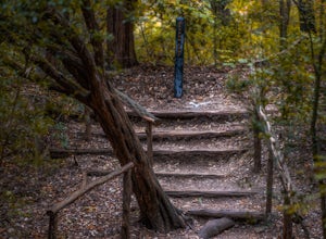
0.6 mi / 55 ft gainThe Main Trail to Meadow Loop to Taylor Creek Loop is a 0.6 loop hike found within Mayfield Park just west of downtown Austin. The trail is completely shaded and is a relatively easy hike. The trail does descend down stairs in some spots, but nothing too significant. This is a great family trail ...Read more -
Eustace, Texas
Wolfpen Hike and Bike Green and Blue Trail Loop
5.03.28 mi / 171 ft gainWolfpen Hike and Bike Green and Blue Trail is a loop trail starting at Purtis Creek Trailhead located near Eustace, TX. The adventure begins next to the lake offering a scenic starting point in Purtis Creek State Park. The trail is mostly flat and a little wider, making this not too strenuous of ...Read more -
San Marcos, Texas
Hike Limbo, Dante, and Ripheus Loop
2 mi / 98 ft gainThe Limbo, Dante, and Ripheus Loop is a 2-mile loop hike in San Marcos, Texas found within the Purgatory Creek Green space. The trail is a filled with nature and is perfect for escaping the business of town. The trail is beautiful during the spring, with an abundance of wildflowers. It is mostly ...Read more -
San Antonio, Texas
Main Loop to Restoration Way Trail
5.63 mi / 958 ft gainMain Loop to Restoration Way Trail is a ~5.6 mile loop hike located in Northwest San Antonio within Friedrich Park. Portions of the trail are paved, however this particular loop is not recommended for those that have mobility limitations because of the more strenuous inclines. This trail is prim...Read more -
El Paso, Texas
Hike to West Cottonwood Springs Trail
1.6 mi / 781 ft gainStart your hike from the west cottonwood trail parking lot and ascend through some nice desert vegetation. The trail is rather rocky and has lots of loose rocks so step carefully. You'll pass by the old copper mine and then proceeded up the steep arroyo to the spring and cottonwood trees for very...Read more -
El Paso, Texas
Hike the Hueco Tanks Nature Trail
1.5 miThe nature trail is an easy trail to walk and gives you very good views of the rock formations. To see the pictographs you will have to hike up the North Mountains to get the best views. The West and East Mountains are only accessible by guided tours. During the summer and fall when there is wate...Read more -
Austin, Texas
Hike the Bull Creek Loop
4 mi / 100 ft gainPart park, part preserve, St. Edwards Park is not too well known, even among long time Austin residents. It's hidden away on old Spicewood Springs Road, beyond the Loop 360 boundary beyond which most people do not venture. The park consists of two parts, one park and one preserve. The portion of ...Read more -
Big Bend National Park, Texas
Upper Burro Mesa Pouroff
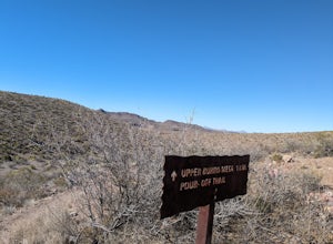
3.63 mi / 413 ft gainWhile you may question what scenery the Upper Burro Mesa Pouroff Trail could offer given the initial view, enjoy the stroll through the Chihuahuan desert as you gradually find your way into a narrowing gravelly wash. You'll have to pass down a few dry falls of varying height, the final passable f...Read more -
El Paso, Texas
Mundy's Gap Trail
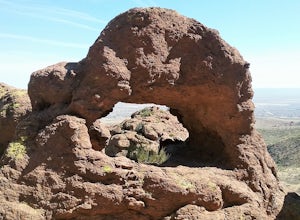
3.36 mi / 1161 ft gainYou can start hiking the trail either from the West side or East side. I started on the West side at the Agave Trail. The climb up the mountain is not too hard and offers good views of the mountains. There are some very interesting rock formations on the east side. You can continue the trail to t...Read more -
Sugar Land, Texas
Oyster Creek Loop
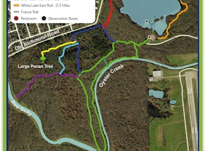
1.67 mi / 82 ft gainOyster Creek Loop is a loop trail that runs along Oyster Creek and has views of White Lake on your return. This trail is located in Cullinan Park near Sugar Land, TX. The trail is dog-friendly and is frequently used by people trail running or simply out for a stroll.Read more -
Austin, Texas
Hike Valburn South Loop
1.02.3 mi / 334 ft gainThe Valburn South Loop is a 2.3 mile loop trail within the Bull Creek Greenbelt in Northwest Austin, Texas. The trail is known for its grand views of the surrounding Hill Country. The trail is shaded for the most part and is pretty rocky, good shoes are highly recommended. The trail is made up of...Read more -
Spring, Texas
Hike Spring Creek Nature Trail
13.3 mi / 219 ft gainSpring Creek Nature Trail is a 13.3 mile point-to-point hike that takes you by a river located near Spring, TX.Read more -
Austin, Texas
Valburn to Bull Creek Loop
1.6 mi / 170 ft gainThe Valburn to Bull Creek Loop is a 1.6 mile loop hike through the Bull Creek Greenbelt located in Northwest Austin, Texas. The trail follows alongside the creek and is pretty rocky and steep with many changes in elevation. The trail is very scenic and has many wildlife watching opportunities, a...Read more -
San Antonio, Texas
Hike Mc Allister Park Blue Loop Trail
4.06.7 mi / 236 ft gainMcAllister Park Blue Loop Trail is a 6.7 mile loop hike where you may see beautiful wild flowers located near San Antonio, TX.Read more -
Plano, Texas
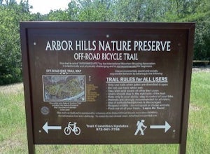
Arbor Hills Mountain Bike Loop
2.31 mi / 121 ft gainArbor Hills Mountain Bike Loop is a 2.1 mile loop hike where you may see local wildlife located near Plano, TX.Read more

