Harker Heights, Texas
Looking for the best running in Harker Heights? We've got you covered with the top trails, trips, hiking, backpacking, camping and more around Harker Heights. The detailed guides, photos, and reviews are all submitted by the Outbound community.
Top Running Spots in and near Harker Heights
-
Harker Heights, Texas
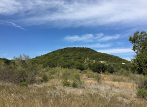
Dana Peak Park Loop
3.08 mi / 705 ft gainThis trail is shared by hikers, mountain bikers, horseback riders, and trail runners. The trail is open year-round, but is best travelled from October through April. Dogs are allowed on this trail but should be kept on leash. The peak offers scenic views of central Texas. You can park inside or o...Read more -
Salado, Texas
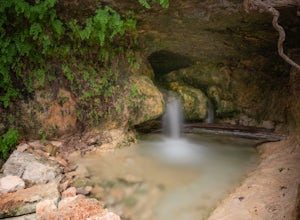
Hike the Chalk Ridge Falls Trail
3.02.5 mi / 131 ft gainThe Chalk Ridge Falls Trail can be found within Chalk Ridge Falls Park just outside of Belton, Texas. The trail features one main waterfall as well as a neat suspension bridge. The hike to the waterfall and the bridge are not but about half a mile from the parking lot. Overall the trail is about ...Read more -
Georgetown, Texas
Good Water Loop
5.025.58 mi / 2241 ft gainThe Good Water Loop is a loop trail around the San Gabriel River through Russel Park and Sawyer Park. Just outside of Georgetown, Texas, this trail is perfect for a lengthy trail run or for an overnight backpacking trip. This trail is open year-round, and dogs are allowed to use this trail if kep...Read more -
Georgetown, Texas
Hike the San Gabriel River Trail
7.6 mi / 498 ft gainThe San Gabriel River trailhead is found within Cedar Breaks Park, just northeast of Georgetown, Texas. The trail is a 7.6 mile moderate out-and-back trail. The trail is heavily trafficked and even more so on weekends. There are several inclines and declines, but nothing too significant. The trai...Read more -
Taylor, Texas
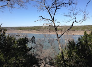
Granger Lake Trail
7.54 mi / 400 ft gainGranger Lake Trail is an out-and-back trail that starts off in Taylor Park in Granger Texas. At the end of the trail are primitive campsites, accessible by hike or by boat. This trail is used by hikers and bikers and dog-friendly on leash. Backcountry campground reservations for Fox Bottom Camp A...Read more -
Cedar Park, Texas
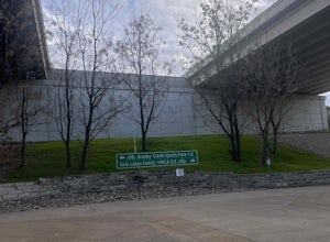
Hike the Brushy Creek Regional Trail
4.56.5 mi / 85 ft gainPark in the big lot off E Little Elm Trail Road (see map) to access the trailhead. Trail is accessible year round and is dog-friendly.Read more -
Waco, Texas
Hike Cameron Park
4.57.2 mi / 639 ft gainCameron Park is shared by hikers, trail runners, mountain bikers, horseback riders, and dog walkers. You can also fish and canoe in the park. The trail system offers scenic views of the surrounding landscape and is a great place to see wildflowers and wildlife. There are restrooms, water fountai...Read more -
Austin, Texas
Hike Walnut Creek Metro Loop
4.08.8 mi / 534 ft gainWalnut Creek Metro Loop is an 8.8 mile loop hike located within Walnut Creek Metro Park in north Austin, Texas. The trail is moderately hiked and relatively easy. It's great for walking/running/cycling. There are many smaller trails that connect portions of the main loop and it's easy to get conf...Read more -
Austin, Texas
Hike or Bike the Walnut Creek Trail
3.74.4 mi / 190 ft gainWalnut Creek Park has a TON of little side trails that make this a must do if you are in or near the area. This particular trail (1 of 2 major ones) is a 15 mile loop but can be done as a shorter out and back. Once you park in the parking lot head southwest to find the trailhead and you're good t...Read more -
Austin, Texas
St. Edwards Park Yellow & Blue Trails
4.71.24 miSt. Edwards Park offers 2 main trails taking you along a creek, up hill trails with gorgeous views from atop a bluff, through exposed meadows filled with prairie grasses and cacti, and to a small swimming hole with a rope swing. The Creek Trail is a much easier, family friendly hike compared to ...Read more -
Austin, Texas
Hike the Bull Creek Loop
4 mi / 100 ft gainPart park, part preserve, St. Edwards Park is not too well known, even among long time Austin residents. It's hidden away on old Spicewood Springs Road, beyond the Loop 360 boundary beyond which most people do not venture. The park consists of two parts, one park and one preserve. The portion of ...Read more -
Burnet, Texas
Hike the Inks Lake State Park Trail
4.04.7 mi / 347 ft gainThe Inks Lake State Park Trail is a 4.7 mile loop trail located within Inks Lake State Park, just outside of Burnet, Texas. Only a small portion of the trail follows the lake, then it veers off through the rocky and hilly terrain of the Texas Hill Country. The trail is only partially shaded at ti...Read more -
Austin, Texas
Hike Lost Trail
1.5 mi / 52 ft gainLost Trail is a 1.3 mile loop hike through the Upper Bull Creek Greenbelt in northwest Austin, Texas. The trail features a beautiful waterfall, an abundance of wildlife and wildflowers, several benches, and many beautiful scenes. During the wet season, the creek fills up and flows very nicely. T...Read more -
Austin, Texas
Hike Valburn South Loop
1.02.3 mi / 334 ft gainThe Valburn South Loop is a 2.3 mile loop trail within the Bull Creek Greenbelt in Northwest Austin, Texas. The trail is known for its grand views of the surrounding Hill Country. The trail is shaded for the most part and is pretty rocky, good shoes are highly recommended. The trail is made up of...Read more

