Dale, Texas
Top Spots in and near Dale
-
San Marcos, Texas
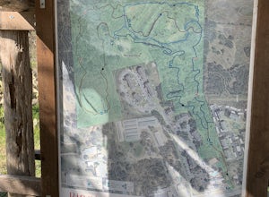
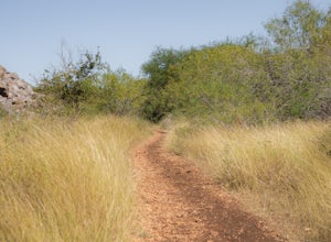
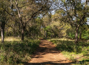
Hike the Ringtail Ridge Trail
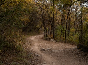
4.01.93 mi / 91 ft gainThis trail is shared by hikers, trail runners, mountain bikers, and dog walkers. The trail is open for use year round, featuring beautiful wildflowers in the spring. The trail can be slightly hard to spot - a good place to park is next to a church off Old Hwy 80, and a spur trail will take you t...Read more -
San Marcos, Texas
Dante's, Lower Purgatory Creek and Blue Trail Loop
2.74 mi / 249 ft gainDante's, Lower Purgatory Creek and Blue Trail Loop is a 2.7 mile loop hike located in San Marcos, Texas. Located outside of downtown, it serves as a great nature trail for hiking, biking, and general exercise. It's primarily shaded and is a very moderate trail. It is not heavily trafficked, espec...Read more -
San Marcos, Texas
Purgatory Creek Natural Area Loop
4.07.77 mi / 568 ft gainPark in the dirt lot off of Hunter Road (see map) to access the trail. Trail is open year round and is dog-friendly.Read more -
San Marcos, Texas
Hike Lower Purgatory Creek Greenspace To Dante's Trail Loop
3.5 mi / 173 ft gainThe Lower Purgatory Creek Greenspace to Dante's Trail Loop is a 3.5 mile loop hike located in San Marcos, Texas. The trail is great for hiking, biking and general exercise. It's shaded for the most part. The trail is very rocky and uneven at certain points, but flat and smooth at others. It's a f...Read more -
Austin, Texas
Stephenson Preserve Loop
2.17 mi / 243 ft gainThe Stevenson Preserve Trail is a 1.5 mile loop hike located in South Austin. The outer trail makes a large loop around the entire park, however there are several interconnecting trails within the loop. This trail system is part of the Stephenson Preserve, which is also connected to the Longview ...Read more -
San Marcos, Texas
Hike Dante's Trail And Backend Loop
2.5 mi / 213 ft gainThe Dante's Trail and Backend Loop is a 2.5 mile loop hike located within the Purgatory Creek Greenspace area just south of San Marcos, Texas. This particular section of the Greenspace is made of flattened crushed gravel and is mostly shaded. The trail is very well maintained and several benches ...Read more -
San Marcos, Texas
Hike Purgatory Creek Overlook Via Dante's Trail
2.8 mi / 209 ft gainThe Purgatory Creek Overlook via Dante's Trail is a 2.8 mile out-and-back hike located within the Purgatory Creek Greenspace area just south of San Marcos, Texas. This particular section of the Greenspace is made of flattened crushed gravel and is mostly shaded. The trail is very well maintained ...Read more -
Austin, Texas
Bike through Iconic Graffiti Landmarks in Austin
5.0You don't have to rent a bike but it's the "Austin" thing to do. With plenty of pick up and drop off locations all throughout the city you can start the trip and end it whenever you feel like it! It's recommended to start the trip on South Congress at the bike rental located near Doc's Motorworks...Read more -
Austin, Texas
Watch the Mexican-Free-Tailed Bats Emerge from Congress Street Bridge
Every evening, just as the sun sets, you can watch the 1.5 million bats take flight into the evening sky. This is great family fun and a must if you visit/are new to Austin. Parking is easy and nearby, however it is paid. There is a separate lot located in the Austin American Stateman parking lot...Read more -
Austin, Texas
Hike along Lady Bird Hike & Bike Trail
10 miThe Hike and Bike Trail around Lady Bird Lake provides great views of the city skyline from several different perspectives. It's perfect for exercising or just taking a stroll on. It's about a 10 mile looping trail however there are several points in which you can cross the river and make the loo...Read more -
Austin, Texas
Hike the Violet Crown Trail: 360 to 290 Trailhead
1.8 mi / 239 ft gainThe Violet Crown Trail: 360 Trailhead to 290 trail is a 1.8 mile point-to-point hike that stretches from Loop 360 to Highway 290. Only a portion of the trail follows alongside Barton Creek before heading south towards HWY 290 while the creek veers off to the west. Dogs are more than welcome as lo...Read more -
Austin, Texas
Hike Barton Greenbelt Trail Via Barton Creek Plaza
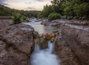
6.6 mi / 380 ft gainThe Barton Greenbelt Trail via Barton Creek Plaza is a 6.6 mile out-and-back hike located within the Barton Creek Greenbelt. This trail follows along the creek and features a couple prominent waterfalls that also serve as popular swimming holes in the summer months. Depending on the rainfall for ...Read more -
Travis County, Texas
Hike Violet Crown Trail: Zilker to 360 Trailhead
3.03.7 mi / 282 ft gainThe Violet Crown Trail: Zilker to 360 is 3.7 mile out-and-back stretch through the Barton Creek Greenbelt. The trail begins in Zilker Park and follows Barton Creek all the way south to Loop 360. Parking can be found at Zilker Park. Though on weekends and during the summer time, the park is usuall...Read more -
Austin, Texas
Walk Through Austin State Capitol
4.03.4 mi / 101 ft gainThe loop is primarily used for hiking and walking and is accessible year-round. Dogs are also able to use this trail but must be kept on leash. This walking tour provides the visitor with many views of Texas History: the beautiful state capitol building, the capitol grounds filled with historic m...Read more -
Austin, Texas
Swim at Gus Fruh
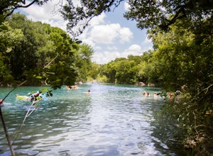
4.00.26 mi / 79 ft gainThe trailheads are located in neighborhoods and parking isn't really too much of an issue. The shortest entrance is located off Barton Hills Dr. A quick google search and you will find it and the labeled trail. You walk down into the Barton Creek Green Belt and your spirits are uplifted. That cra...Read more -
Austin, Texas
Rock Climb at Gus Fruh
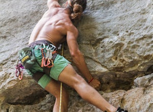
0.5 mi / 50 ft gainNOTICE:For this activity it is necessary to have someone with lead climbing and belaying expertise. There is a wide range of difficulties on the routes. A guide that has climbed at this wall before is recommended. GETTING THERE:You can enter Gus Fruh from a couple of different points starting in ...Read more

