Austin, Texas
Top Spots in and near Austin
-
Austin, Texas
Hike the Mayfield Park Lake Trail
3.01 mi / 0 ft gainMayfield Nature Preserve is a 21-acre park located just west of downtown Austin, Texas. This nature preserve is unique from all other parks in Austin in that it that features free-roaming peacocks. It's a beautiful park full of beautiful nature and the trail leads down near the lake. The trail is...Read more -
Austin, Texas
Visit the Cathedral of Junk
4.7The Cathedral of Junk is a hidden gem within the Austin City Limits, actually located in the Artists backyard. Construction was started back in 1988 by Vince Hahnemann and he still continues to add to it to this day! Climb to the top of the tower to rock out on the drum set or maybe even catch a ...Read more -
Austin, Texas
Hike Barton Greenbelt Trail Via Barton Creek Plaza
6.6 mi / 380 ft gainThe Barton Greenbelt Trail via Barton Creek Plaza is a 6.6 mile out-and-back hike located within the Barton Creek Greenbelt. This trail follows along the creek and features a couple prominent waterfalls that also serve as popular swimming holes in the summer months. Depending on the rainfall for ...Read more -
Austin, Texas
Hike the Violet Crown Trail: 360 to 290 Trailhead
1.8 mi / 239 ft gainThe Violet Crown Trail: 360 Trailhead to 290 trail is a 1.8 mile point-to-point hike that stretches from Loop 360 to Highway 290. Only a portion of the trail follows alongside Barton Creek before heading south towards HWY 290 while the creek veers off to the west. Dogs are more than welcome as lo...Read more -
Austin, Texas
Mount Bonnell Loop
3.60.46 mi / 59 ft gainThe trail up is a combination of manmade and natural stairs that take you up to the top. At the summit, you will find beautiful views of the area, and a pavilion where you can have a picnic lunch. To head back down by a different route, continue on the northern trail, which will take you past mo...Read more -
Austin, Texas
Twin Falls and Sculpture Falls via Barton Creek Greenbelt Trail
3.03.23 mi / 141 ft gainThis hike is about 3.2 miles in total and is an out-and-back trail found within the Barton Creek Greenbelt stretch. The trail follows along the Barton Creek and is popularly known for the two major waterfalls it entails: Twin Falls and Sculpture Falls, which are very popular swimming destinations...Read more -
Austin, Texas
Three Falls Hike
7.35 mi / 600 ft gainThe Three Falls Hike is a 7.35 mile out and back hike located in the Barton Creek Greenbelt in Austin, Texas. The hike is heavily trafficked. The trail takes you past three waterfalls, which during the summer time serve as extremely popular swimming holes. Please note that the flow of the waterf...Read more -
Austin, Texas
Sculpture Falls
4.12.23 mi / 577 ft gainSculpture Falls is a hidden gem that is part of the 7.9 mile long Barton Creek Greenbelt in Austin. It's considered an urban oasis and is part of the Edwards Aquifer making the water temperatures in the summer about 70 degrees, and is a perfect way to cool off in the Texas heat! To find the trai...Read more -
Austin, Texas
Hike Hill of Life Hiking Trail
4.53.1 mi / 328 ft gainThe Hill of Life hiking trail is an out-and-back hiking trail around 3 miles long total. Parking is parallel parking on the street and can be found in the neighborhood where the trailhead is located. The trail begins with a half mile descent down a very rocky and gravel-ridden trail. The descent ...Read more -
Travis County, Texas
Hike Violet Crown Trail: Zilker to 360 Trailhead
3.03.7 mi / 282 ft gainThe Violet Crown Trail: Zilker to 360 is 3.7 mile out-and-back stretch through the Barton Creek Greenbelt. The trail begins in Zilker Park and follows Barton Creek all the way south to Loop 360. Parking can be found at Zilker Park. Though on weekends and during the summer time, the park is usuall...Read more -
Austin, Texas
Wild Basin Wilderness Preserve Loop
4.01.8 mi / 262 ft gainWild Basin Wilderness Preserve is managed as part of the Balcones Canyonlands Preserve and consists of 227 acres of beautiful Hill Country woodlands owned jointly by Travis County (164.4 acres) and St. Edwards University (62.6 acres). Wild Basin is open to visitors who can hike the 2.5 miles of t...Read more -
Austin, Texas
Hike Onion Creek And Homestead Trail Loop
5.06.5 mi / 387 ft gainThe Onion Creek and Homestead Trail Loop is a 6.5 mile loop hike within McKinney Falls State Park, just outside of Austin city limits. The trail is long however pretty beginner level as there are not many inclines. The trail features two waterfalls: the Upper and Lower falls which are popular swi...Read more -
Austin, Texas
Hike the Homestead Trail
4.03.1 mi / 157 ft gainThe Homestead Loop hike is a 3.1 mile loop featuring the Lower Falls of McKinney Falls State Park. The hike is pretty intermediate and is mostly shaded. There are not many inclines. It is both dog- and kid-friendly. The trail does cross small streams, so be weary to bring water shoes/sandals. Th...Read more -
Austin, Texas
Relax at McKinney Falls
4.0McKinney Falls is separated into the Upper and Lower Falls along Onion Creek just 15 miles outside of Austin. The pin I dropped on the map gets you to the parking lot at the Upper Falls. From there it is a very short walk past the Smith Visitor Center to the falls. The upper falls offers some sha...Read more -
Austin, Texas
Watch the Sunrise at Highway Scenic Overlook
This spot is located right off of the North Capital of Texas Highway (Loop 360) on the west side of Austin. It faces east and is perfect for catching the sunrise over the city or just overall chillin'. It provides easy and accessible parking. It's a popular spot for sunset and sunrise. There are ...Read more -
Austin, Texas
Hike the 360/Pennybacker Bridge Overlook Trail
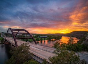
1.8 mi / 167 ft gainThis is a pretty challenging hike but the view is most definitely worth the effort. There are two sides you can hike up on: the east and west. The west side is more popular as it gives a view of the Austin skyline as well the Pennybacker Bridge. However, the east side is good for sunset viewing. ...Read more

