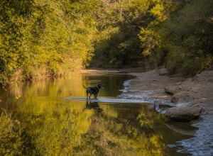
Austin, Texas
Looking for the best chillin in Austin? We've got you covered with the top trails, trips, hiking, backpacking, camping and more around Austin. The detailed guides, photos, and reviews are all submitted by the Outbound community.
Top Chillin Spots in and near Austin
-
Austin, Texas
Three Falls Hike
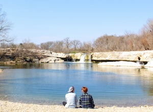
7.35 mi / 600 ft gainThe Three Falls Hike is a 7.35 mile out and back hike located in the Barton Creek Greenbelt in Austin, Texas. The hike is heavily trafficked. The trail takes you past three waterfalls, which during the summer time serve as extremely popular swimming holes. Please note that the flow of the waterf...Read more -
Austin, Texas
Hike Hill of Life Hiking Trail
4.53.1 mi / 328 ft gainThe Hill of Life hiking trail is an out-and-back hiking trail around 3 miles long total. Parking is parallel parking on the street and can be found in the neighborhood where the trailhead is located. The trail begins with a half mile descent down a very rocky and gravel-ridden trail. The descent ...Read more -
Travis County, Texas
Hike Violet Crown Trail: Zilker to 360 Trailhead
3.03.7 mi / 282 ft gainThe Violet Crown Trail: Zilker to 360 is 3.7 mile out-and-back stretch through the Barton Creek Greenbelt. The trail begins in Zilker Park and follows Barton Creek all the way south to Loop 360. Parking can be found at Zilker Park. Though on weekends and during the summer time, the park is usuall...Read more -
Austin, Texas
Hike the Homestead Trail
4.03.1 mi / 157 ft gainThe Homestead Loop hike is a 3.1 mile loop featuring the Lower Falls of McKinney Falls State Park. The hike is pretty intermediate and is mostly shaded. There are not many inclines. It is both dog- and kid-friendly. The trail does cross small streams, so be weary to bring water shoes/sandals. Th...Read more -
Austin, Texas
Relax at McKinney Falls
4.0McKinney Falls is separated into the Upper and Lower Falls along Onion Creek just 15 miles outside of Austin. The pin I dropped on the map gets you to the parking lot at the Upper Falls. From there it is a very short walk past the Smith Visitor Center to the falls. The upper falls offers some sha...Read more -
Austin, Texas
Watch the Sunrise at Highway Scenic Overlook
This spot is located right off of the North Capital of Texas Highway (Loop 360) on the west side of Austin. It faces east and is perfect for catching the sunrise over the city or just overall chillin'. It provides easy and accessible parking. It's a popular spot for sunset and sunrise. There are ...Read more -
Austin, Texas
Photograph Pennybacker Bridge (Austin 360 Bridge)
4.30.5 mi / 75 ft gainIf you're looking for excellent views of hill country, the skyline, or just an awesome place to watch the sunset this is the place to be. If you're heading southbound from 183 on 360 just before you reach the bridge there will be a dirt parking lot on your right. There are trailheads on the easts...Read more -
Austin, Texas
Stephenson Preserve Loop
2.17 mi / 243 ft gainThe Stevenson Preserve Trail is a 1.5 mile loop hike located in South Austin. The outer trail makes a large loop around the entire park, however there are several interconnecting trails within the loop. This trail system is part of the Stephenson Preserve, which is also connected to the Longview ...Read more -
Austin, Texas
Turkey Creek Trail
2.72 mi / 259 ft gainTurkey Creek trail is a 2.7 mile out-and-back hike located within Emma Long Metropolitan Park in Northwest Austin, Texas. This trail is perfect for cycling, running, walking, and general exercise. The trail is made of dirt with few inclines. Please note, however, at the beginning of the trail the...Read more -
Austin, Texas
Hike Valburn South Loop
1.02.3 mi / 334 ft gainThe Valburn South Loop is a 2.3 mile loop trail within the Bull Creek Greenbelt in Northwest Austin, Texas. The trail is known for its grand views of the surrounding Hill Country. The trail is shaded for the most part and is pretty rocky, good shoes are highly recommended. The trail is made up of...Read more -
Austin, Texas
Take a Stroll on the Dick Nichols Park Trail
1.09 mi / 16 ft gainThe Dick Nichols Park Trail is a 1 mile loop neighborhood park trail located in Southwest Austin. The trail is completely flat and is entirely paved. It circles the park and is equally shaded and exposed. It's very kid-friendly and perfect for walking the dog, biking, trail running, hiking, and e...Read more -
Austin, Texas
Hike Lost Trail
1.5 mi / 52 ft gainLost Trail is a 1.3 mile loop hike through the Upper Bull Creek Greenbelt in northwest Austin, Texas. The trail features a beautiful waterfall, an abundance of wildlife and wildflowers, several benches, and many beautiful scenes. During the wet season, the creek fills up and flows very nicely. T...Read more -
Austin, Texas
Hike Mary Moore Searight Park Trail
2.1 mi / 65 ft gainThe outer loop trail at Mary Moore Searight park is 2.1 miles and is interconnected by several smaller trails, which can be used to shorten the length of the hike. The trail is relatively easy with very few inclines and declines. The trail is mostly very thin crushed gravel and great for an easy ...Read more -
Austin, Texas
Hike the Great Hills Park Trail
2.31 mi / 127 ft gainThe Great Hills Park trail is a 2.3 mile point-to-point nature trail found within the Great Hills neighborhood of Northwest Austin. The trail is perfect for cycling, hiking, or just for taking a regular walk. The hike features a multitude of wildlife and is primarily shaded. There are several bat...Read more -
Austin, Texas
Hike the Little Fern Trail
0.5 mi / 140 ft gainThe Little Fern Trail is a 1.9 mile out-and-back hike that is a part of the River Place Nature Trail. It is perfect for hiking, walking, running, and biking. The trail is open for use year-round and is easy to follow, with lots of small, side waterfalls and lush greenery scattered along. The tree...Read more -
Austin, Texas
Hike Walnut Creek Metro Loop
4.08.8 mi / 534 ft gainWalnut Creek Metro Loop is an 8.8 mile loop hike located within Walnut Creek Metro Park in north Austin, Texas. The trail is moderately hiked and relatively easy. It's great for walking/running/cycling. There are many smaller trails that connect portions of the main loop and it's easy to get conf...Read more

