Chattanooga, Tennessee
Looking for the best running in Chattanooga? We've got you covered with the top trails, trips, hiking, backpacking, camping and more around Chattanooga. The detailed guides, photos, and reviews are all submitted by the Outbound community.
Top Running Spots in and near Chattanooga
-
Chattanooga, Tennessee
Stroll Chattanooga's Walnut Street Bridge
5.0Chattanooga's Walnut Street Bridge was once almost demolished, but instead it was revitalized to be one of the longest pedestrian bridges in the world. Connecting the Downtown Arts District to Northshore's Frazier Avenue, this bridge hosts visitors and locals year round. Whether you walk, bike, o...Read more -
Chattanooga, Tennessee
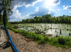
Bike or Run the Tennessee Riverwalk
4.013 miThe Tennessee Riverwalk is a part of the Tennessee Riverpark System that features the Coolidge Park, Renaissance Park, Ross's Landing, and the Walnut Street Bridge, all jewels of downtown Chattanooga. It is a networks of boardwalks, bridges, and paved pathways that runs alongside the Tennessee Ri...Read more -
Rising Fawn, Georgia
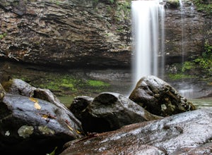
Hike the West Rim Trail to Cherokee Falls
4.54.77 mi / 814 ft gainGood luck finding something you dislike about Cloudland Canyon State Park - one of Georgia's largest and most scenic parks. Sitting on the western edge of Lookout Mountain, it is home to a plethora of luscious trails, easily-accessible campgrounds or yurts, and flowing waterfalls. The West Rim L...Read more -
Rising Fawn, Georgia
Cloudland Rim Loop via East Rim Campground
4.66 mi / 873 ft gainCloudland Rim Loop via East Rim Campground is a loop trail in Cloudland Canyon State park, which offers up stunning vistas and several waterfalls. This trail is located near Rising Fawn, Georgia.Read more -
Rising Fawn, Georgia
Camp at Cloudland Canyon State Park
4.8If you're looking to camp somewhere with exceptional hiking and beautiful waterfalls, Southeastern Tennessee locals know not to look further than Lookout Mountain. Located on the western edge, Cloudland Canyon State Park straddles Sitton Gulch Creek and is perfect for a weekend exploration.If sta...Read more -
Tracy City, Tennessee
Firey Gizzard, Dog Hole and Ravens Point
5.08.42 mi / 1302 ft gainFirey Gizzard, Dog Hole and Ravens Point is an out-and-back trail that takes you by a waterfall located near Tracy City, Tennessee.Read more -
Reliance, Tennessee
Hike the Scenic Spur Trail
5.03.9 mi / 426 ft gainVery little elevation gain leads to an easy hike along a river right outside of the Ocoee river region. First .7 miles is very flat, then leads to some slight elevation gain but nothing too serious. This trail traverses through the lush forest for a short distance when you come across a small cre...Read more -
Sewanee, Tennessee
Hike to Bridal Veil Falls in Sewanee, TN
4.01.5 mi / 387 ft gainGreat short hike. Hard to find trail head, it is not marked at the parking area or where you leave the road. Put in your gps the coordinate spot tagged above off Clara Point Rd. To get to the trailhead, you have to cross the road from small parking area and go back 20 - 30 yards, where you will ...Read more -
Cowan, Tennessee
Sewanee Perimeter Trail
18.4 mi / 1483 ft gainAn absolutely beautiful day-long hike around the perimeter of Monteagle Mountain, in the heart of Middle Tennessee. This perimeter trail completely circles the quaint community of Sewanee, Tennessee; as well as, the beautiful University of the South campus. While not easy, it presents a perfect...Read more -
Sherwood, Tennessee
Walls of Jericho via Tennessee Trailhead
5.07.74 mi / 1667 ft gainWalls of Jericho via Tennessee Trailhead is an out-and-back trail that takes you by a waterfall located near Belvidere, Tennessee.Read more -
Ellijay, Georgia
Hike the Tumbling Waters Trail
5.01.3 mi / 160 ft gainJust North of Carters Lake lies one of its tributaries, Tails Creek. The Tumbling Waters Trail follows along a scenic stretch of this creek as it cascades its way towards the lake. This trail is moderately trafficked and considered a local favorite. The Tumbling Waters trailhead also contains a...Read more


