Blount County, Tennessee
Top Spots in and near Blount County
-
Bryson City, North Carolina
Andrews Bald
5.03.55 mi / 1200 ft gainThe trail begins at the Clingmans Dome parking lot, just to the left of the paved walkway up to Clingmans Dome. You will start the hike at an elevation of 6130 feet which is only 334 feet less than Clingmans Dome which is the highest point in The Great Smoky Mountain National Park, and the second...Read more -
Bryson City, North Carolina
Clingmans Dome Loop
25.75 mi / 4000 ft gainThe first day of the hike is either 12.3 miles or 10.5 miles (depending on the campsite) almost all downhill, and the second half of the loop is 13.3 miles or 11.5 miles, again depending on the campsite, almost exclusively uphill. Just as a reference the first day took us about 6 and a half hours...Read more -
35.556724,-83.495827
Forney Creek Loop
4.519.04 mi / 3500 ft gainThis is an overnight loop hike that is built around one night in the back country. It can be done as an ambitious day hike. Be advised that permits are required by the NPS for all overnight stays in Great Smoky Mountain National Park. The hike begins at the Clingman's Dome parking lot at the For...Read more -
Gatlinburg, Tennessee
Hike the Chimney Tops
4.94.03 mi / 1487 ft gainThe Chimney Tops Trail is one of the most visited trails in the Smokies, which is why I recommend going up just before sunset to beat the crowd! During the summer and fall months, it's common to see a hundred people taking in the views on the same trail, but if you scramble on out after hours, y...Read more -
Kodak, Tennessee
Bobwhite Trail
2 mi / 100 ft gainThis is a great and easy hike through the Seven Islands Birding State Park. This park is located in east Knoxville and is one only 20 minutes from downtown Knoxville. The trail starts at the Seven Islands Birding Park parking lot that has a beautiful garden with lots of wildflowers. The trail is ...Read more -
Kodak, Tennessee
Kelly Lane Greenway
2.5 mi / 50 ft gainThis trail is located in the Seven Islands Birding State Park. This park is east of Knoxville only about 20 minutes from downtown Knoxville. The park is small but there is plenty of beauty and lots of hiking trails in the area. At the beginning of the trail there is a gorgeous flower garden and a...Read more -
Gatlinburg, Tennessee
Grotto Falls Trail
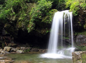
5.01.83 mi / 585 ft gainThis is an intermediate hike along Trillium Gap Trail. There are four stream crossings on your way to the falls as you hike through an idyll, often wildflower-sprinkled landscape. Late spring is best for catching blooms. Once at the waterfall, you can walk behind the cascade of water. This is a ...Read more -
Joyce Kilmer-Slickrock Wilderness, North Carolina
Backpack Slickrock Creek Trail #42
30 mi / 3700 ft gain8:30 a.m. and we’re winding our way down Highway 129 near Robbinsville, NC. The fog is still thick over the Little Tennessee River as we slow down crossing the bridge into Graham County. “I think we missed it,” I say as we continue onward. Within minutes the Tapoco Lodge comes into view. My pre-h...Read more -
Robbinsville, North Carolina
Hike Joyce Kilmer Memorial Forest Loop
5.02 miThe beauty of this trail starts at the parking lot. Before you start the trail, you will find a picnic table near the parking lot and go down to the edge of the rolling stream. Its a great spot to hear the stream and take some pictures. If you are feeling adventurous you can try to hop from rock ...Read more -
Gatlinburg, Tennessee
Hike to Mt. LeConte via Alum Cave Bluff
5.010.68 mi / 3982 ft gainThe Alum Cave trailhead is on Newfound Gap Road, 8 miles from the Sugarlands Visitor Center. Mt. LeConte is the third highest peak in the Smokies, and this is an extremely popular hike, so arrive early to get a parking spot and beat the crowds. Starting from the parking lot the trail gently wind...Read more -
35.629385,-83.450994
Camp out at Mt. LeConte Lodge via Alum Cave
5.09.96 miAt the summit of Mt. LeConte in the Great Smoky Mountains National Park, the lodge sits at a elevation of 6400 feet. It is the only "accommodations" inside the park boundaries. It is the highest lodge in the eastern United States. Accessible only by hiking one of the five trails to the summit,...Read more -
Vonore, Tennessee
Camp at Citico Creek
5.0There are a few options for getting to Citico Creek, you can either go up the windy gravel road from US 411 or get off of the Cherohala Skyway and go down the mountain past the Indian Boundary campground. The Citico Creek campground has about 5 or 6 spots but is rarely full because it is very sec...Read more -
Gatlinburg, Tennessee
Appalachian Trail: Charlie's Bunion and Kephart Loop
5.016.84 mi / 4429 ft gainAppalachian Trail: Charlie's Bunion and Kephart Loop is a loop trail that takes you by a waterfall located near Cherokee, North Carolina.Read more -
Knoxville, Tennessee
Victor Ashe Park
2.5 miThis park is located just 10 minutes from downtown Knoxville. The parking here is massive and has near 100 parking spots spread out over the park. The park offers many activities and amazing views. The main attraction of the park is the greenway and the disc golf course. The greenway runs all the...Read more -
Bryson City, North Carolina
Southern Smokies: Fontana Lake to Clingman's Dome
4.520.39 mi / 5750 ft gainThis is a strenuous (though not technical) hike that really showcases the forests, creeks, and (eventually) the highest point of Great Smoky Mountains National Park. As this is a point-to-point route, you will want to have two vehicles - one that you can leave at Clingman's Dome and one that you ...Read more -
35.610235,-83.426410
Myrtle Point via Alum Cave
5.015.43 mi / 3100 ft gainThis hike can be started at the Alum Cave trailhead or the Boulevard Trailhead. For this particular adventure, the starting point is Alum Cave. If you're lucky enough to stay the night at the backcountry shelter on top of Mt. LeConte, (add 0.2 miles if coming from the Lodge), head east on the Bou...Read more

