Hermosa, South Dakota
Looking for the best photography in Hermosa? We've got you covered with the top trails, trips, hiking, backpacking, camping and more around Hermosa. The detailed guides, photos, and reviews are all submitted by the Outbound community.
Top Photography Spots in and near Hermosa
-
Custer, South Dakota
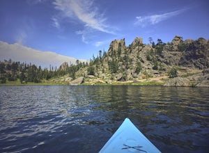
Kayak Sylvan Lake
4.02 miThere are a few reservoirs within the hot and dry Black Hills of South Dakota. The water here comes from the harsh winter month's snowpack or frequent afternoon thunderstorms. Sylvan Lake in the town of Custer offers many activities thanks to it's unique and rugged terrain. Hiking, biking, rock c...Read more -
Rapid City, South Dakota
Dakota Point at Sheridan Lake via the North Trail
2.2 mi / 200 ft gainThere are 2 ways to get to Dakota Point, one from the north that is more common which I will talk about (or one from the south). The trail that starts on the north side of the lake is a nice easy trail to follow, it is wide and well-worn mostly in forested areas. Keep your eyes out for wildlife...Read more -
Custer, South Dakota
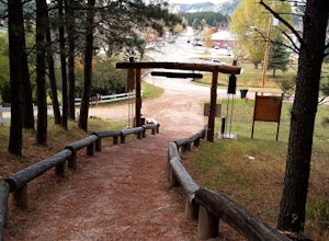
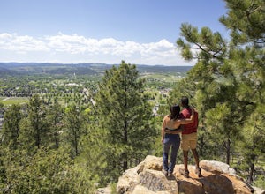
Hike the Custer Skywalk to Big Rock Observation Point
0.6 mi / 370 ft gainPark on the South end of 6th Street at Harbach Park in Custer, just 2 blocks off Main Street. The entrance to the trail is marked by an archway and a "Custer Skywalk" sign. The path is a dirt/small gravel trail that has stairs built into the hillside. To get to the first observation point it is a...Read more -
Rapid City, South Dakota
Explore the Skyline Wilderness Area
3 mi / 0 ft gainDividing Rapid City's East and West sides, the Skyline Wilderness Area is a 150-acre park that features numerous walking, biking and hiking trails. This area can also be enjoyed as a beautiful drive that offers one of the best views of Rapid City. The road stretches about two miles long and giv...Read more -
Hot Springs, South Dakota
Camp at Elk Mountain Campground in Wind Cave National Park
4.0Elk Mountain Campground is in a secluded area of the park, providing plenty of peace and quiet. Sites operate on a first come, first serve basis, although the campground was less than half full when we stayed in the middle of busy summer months. There are about 64 sites available in the campgroun...Read more -
Rapid City, South Dakota
Hike to Falling Rock Overlook
0.5 mi / 50 ft gainThe beautiful hike is a tremendous spot to get out of town and enjoy the scenery and a great view of Rapid Creek down in the canyon below. Parking is right off Falling Rock Rd. then the trail is a very well marked path through the trees, easy to follow, and leads you right to the edge of limesto...Read more -
Hot Springs, South Dakota
Tour Wind Cave
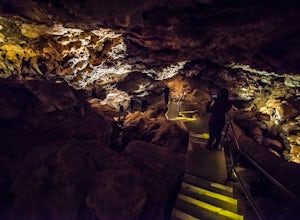
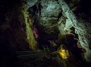
4.80.67 mi / 6 ft gainEstablished in 1903, Wind Cave National Park is home to over 140 miles of mapped cave passages. The cave features 95% of the world's known boxwork calcite formations and got its name from the sound of rushing wind created at its few small openings.A guided tour is the only way to see the cave sys...Read more -
Hot Springs, South Dakota
Photograph Sunset at Wind Cave NP
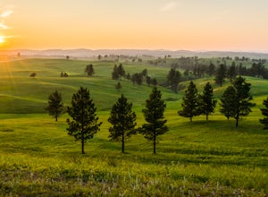
5.0Above the famous Wind Cave, miles of natural mixed-grass natural prairie cover the Black Hills. In summer, the lush grasses attract the park's free-roaming bison herd as well as elk, pronghorn antelope, prairie dogs, and black-footed ferrets.One of the best spots for capturing sunset over the pra...Read more -
Rapid City, South Dakota
Fly Fish from the Rapid Creek Trailhead
2 miTo get the the trailhead for Rapid Creek you must turn to the east onto Pactola Basin Road or FS road 164 when on Highway 385 crossing the Pactola Reservoir. The road down to the trailhead is steep and can be rough depending on the time of the year. Once at the trailhead there is a parking area, ...Read more -
Rapid City, South Dakota
Hike the Deerfield Lake Trail to Slate Creek Convergence
5 mi / 60 ft gainThe Deerfield Lake trail is overall 23 miles long, but this post is just about the section of the trail that starts at Silver City where Rapid Creek flows into Pactola Reservoir, and follows the creek upstream to where Slate Creek converges, about 2.5 miles from the trailhead. You could follow th...Read more -
Custer, South Dakota
Tour Jewel Cave
4.00.5 mi / 20 ft gainEstablished in 1908, Jewel Cave National Monument is home to over 179 miles of mapped cave passages. The cave features larger chambers and more interesting formations then nearby Wind Cave NP, and much of it is covered in spar crystals.A guided tour is the only way to see the cave system unless y...Read more -
Custer, South Dakota
Hike through Hell Canyon
5.3 miThe Trailhead lies down in the canyon bottom, just one mile west of Jewel Cave National Monument and 13 miles west of Custer. Upon arrival, you are greeted by the parking lot, which is right off the highway and boasts a spacious gravel lot to park in. Since the trail is a loop, you can go either ...Read more -
Hill City, South Dakota
Camp at Castle Creek Campground
5.00.25 mi / 0 ft gainCastle Creek is a challenging place to get to, the road in the off seasons can be even more difficult. In the spring/early summer when the road is wet it can become rutted. There is one road to get to the campground from the East from Mystic it is about 8 rough narrow miles, but you could arrive ...Read more -
Scenic, South Dakota
Explore Sheep Mountain Table
4 mi / 200 ft gainSheep Mountain Table is located in the Stronghold Unit that is in the Pine Ridge Indian Reservation of Badlands National Park. The area is prime for exploring. Once you get off Highway 27 for Sheep Mountain Table, you will travel about 4 miles on a well maintained gravel road, to an Overlook and ...Read more -
Northeast Fall River, South Dakota
Swim at Cascade Falls
2.0Cascade Falls is 10 miles south of Hot Springs on highway 71, it is easy to access, and is a great spot for a picnic or to cool off in the cool waters on hot days! There are several picnic tables, vault toilets and a large parking area, and just a short walk down to the falls. The pool at the bas...Read more -
Hill City, South Dakota
Camp at Black Fox Campground
Black Fox is 9 miles west of Rochford has nine campsites along the Rhoads Fork Creek where it meets up with the South Fork of Rapid Creek. Campsites are nicely arranged for the most part with a fire pit and picnic table at each site. From the campground there are many things to do, many people en...Read more
Go Great Places in South Dakota
In the Mount Rushmore state, travels to South Dakota are full of one-of-a-kind adventure with wide-open spaces as endless as the horizons. Between legendary landscapes and scenic drives, you can always find space that shifts life into park. When you’re ready, go great places.
Learn More

