New Shoreham, Rhode Island
Top Spots in and near New Shoreham
-
East Lyme, Connecticut
Rocky Neck State Park Trail is a 2.5 mile loop hike where you may see beautiful wild flowers located near East Lyme, Connecticut.
Read more
-
Dartmouth, Massachusetts
Frank Knowles-Little River Reserve contains nearly 9 miles of hiking trails to explore. Start off by parking in the white sea shell parking lot. From there you will find the trail marked by a DNRT sign .
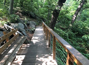
My group and I walked along the red/boardwalk trail which features a number of boardwalks lea...
Read more
-
Shelter Island, New York
Just a short ferry ride from the Hamptons, South Ferry Road is exactly where it sounds; very close to the South Ferry of Shelter Island. The parking lot of Mashomack Preserve is marked by a large sign. When you walk in, you'll see a large nature center. Sign in at a clipboard at the table out fro...
Read more
-
-
Franklin, Connecticut
It's steep and rocky in the beginning but it levels out after a while! When standing in the parking lot, the trailhead is hidden! Look to the right. The trail ends on Ayer's Road so you have to walk back a little ways on the road.
Read more
-
Chilmark, Massachusetts
5.0
2.98 mi
/ 344 ft gain
GPS service in densely wooded areas on the Vineyard is hard to come by, so plugging in Menemsha Hills Reservation before getting on the road is advised. Traveling down N Road, you'll find an unmarked gravel road located between Turtle Cove and Trustees Lane. A short 400 meter drive will take you ...
Read more
-
Providence, Rhode Island
5.0
1.49 mi
/ 171 ft gain
To enter the park, you first have to go through a field and past a baseball park. Next, you will see a high slope, you can either enter the trails through here or the stairs at the side. Some of the trails are overgrown and may have ticks or poison ivy so be careful. This place is good for kids a...
Read more
-
East Haddam, Connecticut
If you map to Chapman Falls in East Haddam, CT, you will be brought to a parking lot opposite from the waterfall in Devil's Hopyard, a beautiful Connecticut state park. Once there, it's only a few minute walk down a very clear trail to the base of the 60 foot falls. There's plenty of room to set ...
Read more
-
Southampton, New York
While there are many ways to access the Peconic Bay, I have found the best direction to explore is north west after launching and during the sunset. If you head to the public beach on Towd Point Rd. you can launch from there and make your way out toward Robins Island. Like most places the water i...
Read more
-
West Tisbury, Massachusetts
While there are a number of beaches on Martha's Vineyard, many of the more well known and popular ones can easily get over crowded. The less widely known Lambert's Cove, however, is a gem that will not disappoint.
To access Lambert's Cove in the summer season, you'll need to get or borrow a pas...
Read more

