Wellsboro, Pennsylvania
Looking for the best photography in Wellsboro? We've got you covered with the top trails, trips, hiking, backpacking, camping and more around Wellsboro. The detailed guides, photos, and reviews are all submitted by the Outbound community.
Top Photography Spots in and near Wellsboro
-
Wellsboro, Pennsylvania
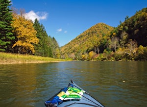
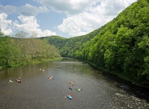
Kayak Camp the Pennsylvania Grand Canyon
5.0Start at the Big Meadows parking area in Ansonia. The water access is at Marsh Creek but almost immediately meets up with Pine Creek. Arrange a shuttle service with Pine Creek Outfitters to either pick you up or shuttle your vehicle to the take out at Blackwell and also pick up one of their wate...Read more -
Wellsboro, Pennsylvania
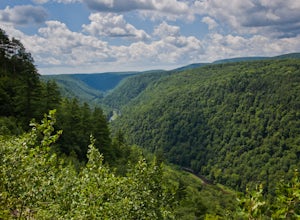
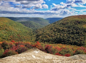
West Rim Trail
4.027.97 mi / 4065 ft gainHiking north to south, the trailhead is just off of Colton Road at a gravel parking lot with bathrooms. The trail is marked with orange blazes and has the largest elevation gain at the beginning and then has relatively moderate elevation change throughout the remainder of the hike. At 2.6 mile...Read more -
Wellsboro, Pennsylvania
Barbour Rock Loop
2.64 mi / 331 ft gainThe parking can be found along Colton Road heading toward Colton Point State Park. There is a large sign opposite the parking and the trail is a wide gravel path through the woods. It is 0.7 miles walk on the path to the vista suitable for anyone. You then have the option to head back or create ...Read more -
Wellsboro, Pennsylvania
Turkey Path
4.31.72 mi / 748 ft gainThis is a fairly steep trail with many switchbacks, which makes it an easy hike down and a tough one back. But don't worry there are bridges and stairs to help you out. It is also family friendly, but make sure you plan on taking on the added weight if you have young children with you. We went wi...Read more -
Wellsboro, Pennsylvania
Hike Leonard Harrison SP's Overlook Trail to Otter View
4.30.6 miThis is a simple .6 mile trail that starts around the bathrooms and loops past Otter View.The trail itself is an easy hike. Otter View is a great spot for a family hike. By the bathrooms are different spots to get amazing views. The upper level is handicap accessible and there are steps down to a...Read more -
Morris, Pennsylvania
Hike to Pine Island Vista
5.05.1 miThe access to this trail is from a mountain road, Clay Mine Road. From Stony Fork, follow Dibble Hill Road to Clay Mine Road, once on Clay Mine Road, follow into the forest and park at the first gravel parking area on the right. You will see the unmarked trail at the rear of the parking startin...Read more -
Wellsboro, Pennsylvania
Explore the Waterfalls at Campbells Run
1.5 miIn order to access Campbells Run, park at the Tiadaghton Pine Creek Rail Trail parking. There are restrooms at this parking lot. The road in does not have winter maintenance and is steep in places. From the parking walk back the rail trail to Campbells Run which comes out between two cabins, a sm...Read more -
Morris, Pennsylvania
Hike to Bohen Run Falls
4 miParking for this trail is at the Blackwell access area off of route 414. Then walk across the the bridge over Pine Creek and immediately hop over the guardrail to your right for the Bohen Trailhead.The beginning of the trail becomes narrow and steep for a short climb. The trail then levels off p...Read more -
Morris, Pennsylvania
Kayak or Canoe Pine Creek: Blackwell to Black Walnut Bottom
The start of this trip is at the Blackwell boat launch. Get some friends together and organize a trip, leave a car at Black Walnut Bottom for the take out. Pine Creek can be very low in summer, check this water gauge, I recommend a minimum level of 1.8 feet. Optimal would be 2.5-3.5 feet. If ...Read more -
Morris, Pennsylvania
Hike the Gillespie Point Loop
5.3 mi / 1166 ft gainFrom the Blackwell parking access at the route 414 bridge that crosses Pine Creek, walk on 414 east towards Babb's Creek. Shortly after crossing the single lane bridge over Babb's Creek, you will turn right onto Big Run Road.Follow Big Run Road for about 2 miles and when the road makes a sharp t...Read more -
Slate Run, Pennsylvania
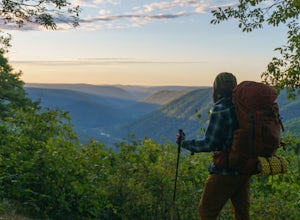
Backpack the Black Forest Trail
5.042 mi / 8550 ft gainThe Black Forest Trail is an orange blazed horseshoe loop with many options for a starting point which over the years due to reroutes may make the trail a little longer than 42 miles . I started at the traditional trailhead on Slate Run Road and hiked counter clockwise. Many consider this trail t...Read more -
Trout Run, Pennsylvania
Hike the Frozen Run Gorge
5.05 miOne of the most remote hikes in the beautiful Loyalsock State Forest, this loop through the Frozen Run Gorge is a fantastic hike for an experienced hiker looking to see a place that few other hikers do.There are no official trails through the gorge and this hike is a bushwhack. There are a couple...Read more -
Brown Township, Pennsylvania
Hike the Hemlock Mountain Loop
5.06.48 mi / 1200 ft gainThe trail starts where Naval Run Road ends. Follow the the blue blazes into Naval Run. After crossing Naval Run continue right up an old logging skid trail along the run. The trail will intersect with the Black Forest Trail at Naval Run Falls.The trail will follow the orange blazes of Black Fo...Read more -
Brown Township, Pennsylvania
Hike the Gas Line Ridge Loop
3.8 mi / 900 ft gainPark at the end of Naval Run Road, at the end of the road to the right, follow the sign for Lance Raisch Trail marked with yellow blazes. This is the first of three trails that this loop will use. The Lance Raisch Trail climbs in elevation along Naval Run and after about a quarter mile will ins...Read more -
Lock Haven, Pennsylvania
Hike the Ruth Will Trail
3 miTheir is a large gravel parking area about 12 miles north of Haneyville on route 44. Parking is on the east side of route 44.The trailhead is on the opposite side of the road, follow the trails blue blazes right to hike the loop counter clockwise. The trail initially parallels route 44.The trai...Read more -
Cammal, Pennsylvania
Bob Webber Trail
4.03.63 mi / 1424 ft gainTo get to the Bob Webber Trail, start by heading up one of the most beautiful valleys in Pennsylvania: Pine Creek. Shortly after Waterville jump onto 414 and enjoy the drive past Cammal. About one mile after Cammal you will come to the Ross Run parking area on the left and you are there. The Bob ...Read more

