Lewisberry, Pennsylvania
Looking for the best photography in Lewisberry? We've got you covered with the top trails, trips, hiking, backpacking, camping and more around Lewisberry. The detailed guides, photos, and reviews are all submitted by the Outbound community.
Top Photography Spots in and near Lewisberry
-
Marietta, Pennsylvania
Climb At Chickies Rock
From parking at the fairly new lot on Furnace Road, head down river on the walking trail about a half mile to an obvious large face next to the train tracks. From here you choose from a variety of routes including some two pitch routes like Witches’ Brew 5.4 to Main Street 5.5 over to some of the...Read more -
Newville, Pennsylvania
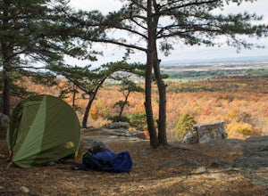
Camp at Tom's Run Shelter
3 mi / 85 ft gainStarting from the small parking area on Bunkerhill Rd, head north (turn right) onto Michaux Rd. After about 1/3 of a mile you will reach the Appalachian Trail where you will want to head west (turn left).This will lead you on a leisurely hike through the woods (follow the white blazes). It won't ...Read more -
Freeland, Maryland
Hike Hemlock Gorge
5.03.5 mi / 300 ft gainThis is one of Baltimore's little known gems. The area contains an ecosystem which is essentially non-existent outside of the Appalachian mountain regions. It has also been seemingly under-appreciated and abused by locals. I am trusting that the Outbound Collective community will do its part to e...Read more -
Airville, Pennsylvania
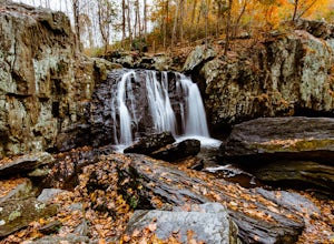
Explore Mill Creek Falls
It's not too hard to find the Mill Creek Falls; you can see it from the parking lot. This is an ideal spot if you just need a quick fix of something beautiful. From the road, follow the blue blazes of the Mason-Dixon Trail up the hill. After you admire and photograph the falls, consider hiking t...Read more -
Parkton, Maryland
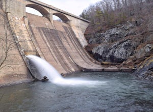
Photograph Prettyboy Dam
4.0Make sure you park in the designated spots located above the Dam. Walk across the Dam road bridge and about mid way stop and take a look over the edge. You will be greeted with the a beautiful view of the valley. To explore more keep walking over the dam bridge and walk down the stairs to view ...Read more -
Airville, Pennsylvania
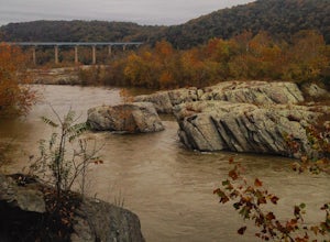
Hike the Mason-Dixon Trail to Peavine Island
2 miThe Mason-Dixon Trail is a 200-mile trail that begins and ends in Pennsylvania, passing through Maryland and Delaware along the way. The trail connects the AT to the Brandywine Trail and spends considerable time adjacent to the wide and wondrous Susquehanna River. One of the Mason-Dixon trail's m...Read more -
Chambersburg, Pennsylvania
Rock Climb at White Rocks
White Rocks, a segment of the slightly larger Pond Bank area, is a single pitch top rope or traditional climbing area. To get there, follow 30 until you are a few miles west of Caledonia State park and reach an intersection of 997. You can then head south on 997 until you reach White Rock Road. ...Read more -
Pylesville, Maryland
Hike to Kilgore Falls
3.81.2 miThis 1.2 mile roundtrip hike leads to the second tallest waterfall in the state of Maryland. It is a short hike that's great for families and bringing the dog. In the warmer months, you can swim in the pool at the base of the waterfall. People have cliff jumped here, but exercise caution and do s...Read more -
Thurmont, Maryland
Hike Catoctin Mountain
4.58.4 mi / 1370 ft gainPark at Catoctin Mountain Visitor Center. The hike starts at the end of the gravel parking lot across from the visitor center. This is definitely a popular hiking location, so come early on the weekends to guarantee a parking spot and to avoid the crowds. To start, take the right trail towards th...Read more -
Thurmont, Maryland
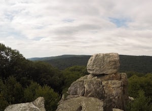
Hike Chimney Rock at Catoctin Mountain Park
4.25 mi / 600 ft gainChimney Rock is the quintessential breathtaking view that makes a hike worthwhile. By parking at the most northeast parking lot on the trail map you are able to include the sweeping views of Thurmont Vista, and Wolf Rock on your way to Chimney Rock. Highly recommend visiting in the fall, and on w...Read more -
Smithsburg, Maryland
Hike to Cunningham Falls
4.22.8 miThis 78-foot waterfall, among the largest in the state, is easily accessible by two short trails. Lower Trail (0.5 miles) leads directly to the falls, whereas Cliff Trail (0.75 miles) has slightly more difficult terrain and takes you to a viewing platform. To lengthen the adventure, Hunting Creek...Read more -
Bel Air, Maryland
Hike the Deer Creek Trail
5.02 miBecause Palmer State Park is still under development (with no timeline given for its completion), there are only a few trails that meander through this 555-acre reserve. Palmer's official website offers a not-so-helpful topographical map, but the easiest way into the park that I could find was ne...Read more

