Fairfield, Pennsylvania
Top Spots in and near Fairfield
-
Lewisberry, Pennsylvania
Hike Quaker Race's Lakeside Trail
4.03 miThis trail is best accessed from the Quaker Race Day Use Area or from the Cabin Colony for cabin occupants. This trail has a dirt or rocky surface, uneven terrain and one steep but short hill. This trail connects to Lakeside Trail at its end to form a 3-mile loop that passes through diverse habit...Read more -
Eldersburg, Maryland
Mineral Hill Trail
4.02.04 mi / 282 ft gainMineral Hill Trail is an out-and-back trail that takes you by a lake located near Finksburg, Maryland.Read more -
Knoxville, Maryland
Hike the AT to Weverton Cliffs
4.93 mi / 1500 ft gainThe trailhead is located right off Weverton Cliff's Road in Knoxville, Maryland. Park at a Park and Ride on the right side of the road, then walk right out of the parking lot down Weverton Cliff's Road until you see the white blazes of the Appalachian Trail. Follow that trail for 1.5 miles along ...Read more -
Dickerson, Maryland
Hike the Sugarloaf Mountain Trail
4.76.05 mi / 1509 ft gainPark on Sugarloaf Mountain Drive (as indicated on the map below) to access the trail. It is open from March-November and is dog friendly.Read more -
Knoxville, Maryland
Explore Point of Rocks/ Potomac River Overlook
4.00.2 mi / 95 ft gainPark at the Chesapeake and Ohio Canal parking lot. Walk to the US 15 and cross the road. Trail is not marked, though its faint traces can be detected as you continue on. GPS is recommended. Enjoy the overlook and when you're ready to go back, retrace your steps.Read more -
Purcellville, Virginia
Explore Potomac Wayside Park
4.00.25 mi / 75 ft gainThis is a small park along route 340 in Purcellville, Virginia near Harper's Ferry. After you have parked, look for the park sign which will be a few feet behind you. There is a trail that will take you down to the bottom of the waterfall and eventually to the Potomac River. There is also a trail...Read more -
Knoxville, Maryland
Hike to Maryland Heights
4.82.8 mi / 900 ft gainMaryland Heights is at the convergence of Maryland, West Virginia and Virginia, as well as the Potomac and Shenandoah Rivers. The Appalachian Trail and C&O Canal Towpath are also easily accessible from the trailhead parking lot. The parking lot holds about 16 cars and is between Locks 33 and ...Read more -
Knoxville, Maryland
Hike Maryland Heights Trail Loop
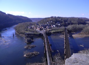
5.3 mi / 1600 ft gainLearn Civil War history as you hike through forts and read signs about the war. Enjoy beautiful lookouts, including one with a great view of Harpers Ferry. The 5.3 mile hike is relatively easy and offers an interesting opportunity to learn history in one of the most important historical areas i...Read more -
Parkton, Maryland
Photograph Prettyboy Dam
4.0Make sure you park in the designated spots located above the Dam. Walk across the Dam road bridge and about mid way stop and take a look over the edge. You will be greeted with the a beautiful view of the valley. To explore more keep walking over the dam bridge and walk down the stairs to view ...Read more -
Harpers Ferry, West Virginia
Hike Weverton Cliffs Overlook from Harpers Ferry
5.08.2 mi / 925 ft gainParking and trail head: Park at the Harpers Ferry Visitors Center for $10 (171 Shoreline Dr, Bolivar, WV 25425) and take the shuttle a mile and a half to lower town (free). Walk straight from the shuttle to the large bridge. Cross the bridge to hop on the C&O canal trail. This is the point w...Read more -
Harpers Ferry, West Virginia
Hike Maryland Heights via Harpers Ferry
4.54.2 mi / 800 ft gainParking and trail head: Park at the Harpers Ferry Visitors Center for $10 (171 Shoreline Dr, Bolivar, WV 25425) and take the shuttle a mile and a half to lower town (free). Walk straight from the shuttle to the large bridge. Cross the bridge and take a left on the C&O Canal trail. You will s...Read more -
Carlisle, Pennsylvania
Hike to the Cumberland Valley Overlook
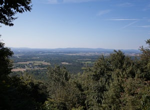
4.06 miThis hike is steep at points but the climb up the mountain has lots of switchbacks so it isn't just straight up. The hike is beautiful and during the summer there are lots of blackberry and raspberry bushes along the trail that we stopped to snack on. The Overlook is just before you crest the top...Read more -
Owings Mills, Maryland
Soldiers Delight Loop
4.75.33 mi / 466 ft gainFrom Deer Park Road, parking is available at the nature center or the scenic overlook (about 100 yards up the road). I typically park at the overlook as this affords the ability to hike trails on either side of the road, and always finish the hike back at the car. From the parking area you are ju...Read more -
Owings Mills, Maryland
Serpentine Trail
4.52.39 mi / 226 ft gainPark in the area off of Deer Park road to access the trail. Dogs are welcome on leash. Trail can get muddy in the spring, and there are some stream crossings.Read more -
Parkton, Maryland
Hike the Gunpowder Falls North and South Loop Trail
5.013.3 mi / 1180 ft gainPark in the lot on Bunker Hill Road and then continue a short ways to the trailhead (see map). There are no bridges for crossing the water so be prepared to pick your way across.Read more -
Boyds, Maryland
Black Hill Regional Park Loop
5.02.78 mi / 312 ft gainThe Black Hill Regional Park has 1300 acres of oak forests that have views of the Little Seneca Lake. This lake offers a place for visitors to canoe and stand up paddle board. This trail is open to hiking and mountain biking. In addition, dogs are welcome to use the trail but must be on leash a...Read more

