West Linn, Oregon
Looking for the best hiking in West Linn? We've got you covered with the top trails, trips, hiking, backpacking, camping and more around West Linn. The detailed guides, photos, and reviews are all submitted by the Outbound community.
Top Hiking Spots in and near West Linn
-
Amboy, Washington
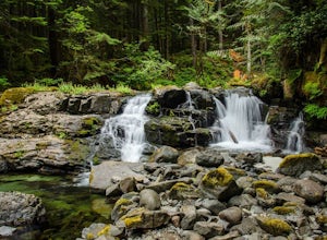
Siouxon Trail to 14 Mile Falls
5.013.03 mi / 2310 ft gainWhen you park at the top of the trail, all you see is layers and layers of emerald trees and ground clear of any underbrush. Once on the trail, you start on a rapid decline that brings you to the first of the many streams along this hike. Cross the bridge made out of logs and head towards the ma...Read more -
Detroit, Oregon
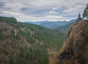
Battle Ax Mountain
5.05.09 mi / 1594 ft gainWith no officially marked trailhead, this hike begins slightly west of Elk Lake in Marion County. Take Highway 22 to Detroit, OR. East of the bridge over Breitenbush River, turn onto (FR) Forest Road 46, with signs pointing to Breitenbush River. After 4.5 miles turn left at a sign for Elk Lake, a...Read more -
Gates, Oregon
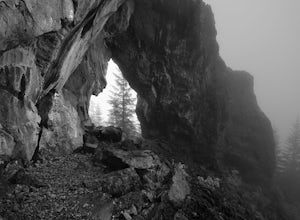
Natural Rock Arch
5.00.68 mi / 449 ft gainThe Santiam Forest is well known for its many beautiful spots, but this one is fairly uncommon. It's likely you will be the only person out here. Since it's such a short hike, just about a mile round trip, you could easily make it a pit stop on your way to or from someplace else and not have to w...Read more -
Clackamas County, Oregon
Little Crater Lake to Timothy Lake Campground
3.42 mi / 338 ft gainLittle Crater Lake to Timothy Lake Campground is an out-and-back trail that takes you by a lake located near Government Camp, Oregon.Read more -
Tillamook, Oregon
Wilson River Trail
3.018.58 mi / 4879 ft gainThis long trail provides hikers with great views of the corridor in the Coast Range. As the trail follows public land for the most part, there are a couple sections with steady elevation gains to avoid private land: near Lees Camp and Ryan Creek. Although the trail receives some of the most rain...Read more -
Timber, Oregon
Hike the Upper Salmonberry River Trail
4.112.5 mi / 1600 ft gainIf you are craving adventure and exploration in a unique hiking setting, then you have come to the right place! This is a hike where every time you turn a corner your eyes light up with excitement and your imagination runs wild. Be forewarned though…if you fear cold, dark, and creepy abandoned tr...Read more -
Marion County, Oregon
Gold Butte Fire Lookout
4.32.44 mi / 741 ft gainGold Butte Fire Lookout is a real gem in the Willamette National Forest. At 4618 feet elevation, the nearby Cascade Mountain views are nothing short of spectacular! At the summit, sits a L-4 Ground Structure Type Fire Lookout that was built in1934 to be used as a Fire Lookout. Additionally, durin...Read more -
White River West Sno-Park, Oregon
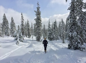
Snowshoe Pacific Crest Trail at White River West
3.4 mi / 800 ft gainPark at White River West Sno-Park. Walk to the north end of the parking lot. Start a very brief way up the White River Trail. After 100-200 feet, step off the main trail, to your left, and head into the woods for some solitude. To get to the Pacific Crest Trail, look for the blue diamond trail ma...Read more -
Tillamook, Oregon
King's Mountain
4.54.47 mi / 2461 ft gainKing's Mountain may be one of the most consistent hikes in the greater Portland area gaining 2,500 vertical-feet over 2.5 miles almost evenly the entire time. The trail starts out at a marked trailhead just west of the Elk Mountain campground (stop there for water and more restrooms in summer &a...Read more -
Mount Hood, Oregon
Snowshoe to Umbrella Falls
0.5 mi / 100 ft gainJust 66 miles east of Portland, and 35 miles south of Hood River the infamous Mt Hood breaks through the clouds for all to see. The highest peak of Oregon is the ultimate explorer's paradise offering something for every season... and in this case we mean snow shoeing and hiking!!Our trek begins ...Read more -
Detroit, Oregon
Dome Rock via the Upper Trailhead
2.36 mi / 479 ft gainFrom Highway 22 at the Breitenbush River Bridge, in Detroit, turn north on to French Creek Rd. Drive up French Creek about 7.7 miles to the Upper TH #3379/3381 to Dome Rock and Tumble Lake. The trail can be found on the left side of the road and is easily seen after you pass it. It's best to pass...Read more -
Cascade Locks, Oregon
Emerald Falls
2.00.65 mi / 308 ft gainStart at the Wyreth Campground day-use area. If it's closed, park on the side of the road and walk in from the roadway. You'll see an intersection with a wooden bridge crossing the river. Take a few pictures and continue straight on the trail. You'll go about 1/2 mile on the trail until you rea...Read more -
Cascade Locks, Oregon
North Lake via Wyeth Trail
1.012.36 mi / 4505 ft gainPark at the Wyeth Trailhead parking lot and start hiking south along the old road bed. At the junction with the Gorge-Wyeth Trail, bear left and follow the Wyeth Trail as it goes beneath several power lines. Follow the trail as it goes back into the woods and crosses Harphan Creek. Continue on an...Read more -
Cascade Locks, Oregon
Gorton Creek Falls
4.71.01 mi / 361 ft gainThe Gorton Creek Falls hike provides an excellent challenge for those who are searching for a bit of adventure. The trailhead starts at the Wyeth Campground day use area, and continues straight at the intersection. The first 2/3rds of the trail are relatively easy to traverse (depsite being rough...Read more -
Mount Hood, Oregon
Cooper Spur
5.06.87 mi / 3097 ft gainCooper Spur is located on the north east side of Mount Hood. This is the hike to do if you want to get up close and personal with the mountain. To get there you have to drive around 10 miles up a bumpy dirt road, once off the main road. Low-clearance vehicles can make it but high clearance vehic...Read more -
Hood River County, Oregon
Camp at Elk Meadows
4.54.5 mi / 1200 ft gainThis is a great trip for those who are new to backpacking. The hike to the quiet, peaceful Elk Meadows is relatively short, but the Newton Creek crossing presents enough difficulty to make this a fun and challenging adventure.Start at the Hood River Meadows Trailhead parking lot. Though there are...Read more

