Terrebonne, Oregon
Top Spots in and near Terrebonne
-
Idanha, Oregon
Hunt's Cove via Pamelia Lake Trail
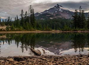
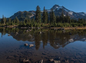
14.74 mi / 3150 ft gainThis loop through the Pamelia Lake Limited Entry Area is one of the premier backpacking trips in the Mount Jefferson Wilderness. The trail offers sustained up-close views of Mount Jefferson and several lookout points provide panoramic views of the western Oregon Cascades. The several large back...Read more -
Idanha, Oregon
Pamelia Lake Trail
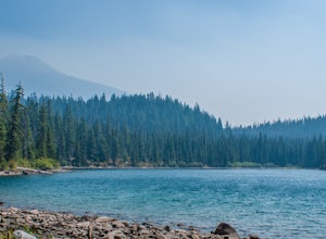
4.04.37 mi / 906 ft gainPamelia Lake Trail is an out-and-back trail that takes you by a lake located near Idanha, Oregon.Read more -
Marion County, Oregon
Explore Mt. Jefferson
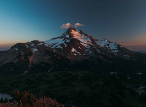
5.0I went for a quick overnighter. The end of August is great for weather, very little bugs, and perfect time to meet and chat with PCT through hikers.The weather was absolutely perfect for night photography and lounging around camp. It's also one of the best views in Oregon if you ask me.If you're ...Read more -
Marion County, Oregon
Hike Mt. Jefferson's Park Ridge
5.07.4 mi / 1500 ft gainFrom the Breightenbush Lake PCT trailhead (5,600ft Elevation) you hike through a thick forest until you reach an old burn area. This area was burned from a forest fire and has rebirthed lush green plants and bushes to help feed all the animals in the area. After a mile of climbing through the bur...Read more -
Detroit, Oregon
Russell Lake via Whitewater Creek Trailhead
4.811.4 mi / 1926 ft gainThis hike begins 7.5 miles down Whitewater Road at the Whitewater Trailhead, about 10 miles east of Detroit Lake. The road is bumpy, but can be navigated at slow speeds, even without four-wheel drive. Make sure to fill out a wilderness pass once you arrive at the trailhead. The trail is very wel...Read more -
Linn County, Oregon
Tamolitch Blue Pool
5.03.56 mi / 253 ft gainThe hike out to Tamolitch Pool, or "Blue Pool," is 2 miles each way and follows the McKenzie River to a lava flow pool. Off Highway 126 14 miles east of McKenzie Bridge, turning into the Trailbridge Campground, drive right 1/3 of a mile to the trailhead. The trail is relatively flat, which gives ...Read more -
Bend, Oregon
Hike to Lucky Lake
5.02.5 mi / 405 ft gainLocated just 4.36 miles past the popular Elk Lake Day Use turnoff, the trailhead is on the right side of the highway, marked by a small 'trailhead' sign. The hike begins at the Senoj Lake Trailhead and climbs up to the lake for 1.26 miles. Once you reach the lake, you can choose to go left or rig...Read more -
La Pine, Oregon
Camp and Fish on East Lake
East Lake is located in a very scenic part of Central Oregon about 30 miles East of the town of La Pine. At 6,400 feet in elevation, the lake is fed by snowmelt and underground springs. East Lake is know for it's trophy Brown Trout, Kokanee, Rainbow Trout and Atlantic Salmon. Because of the deep...Read more -
La Pine, Oregon
Hike to Paulina Lake Hot Springs
5.02.4 miStarting at Little Crater Campground, head north toward the hot springs (43.730, -121.247). If you're really looking to stretch your legs, you can extend the out-and-back hike to a full loop around the lake just shy of 8 miles. The water in the springs is around 95 degrees, and doesn't smell of s...Read more -
Lane County, Oregon
Bigelow Hot Springs
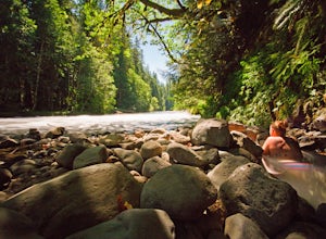
2.0Unlike many other springs you'll find, this pool has basically no barriers to entry – it is accessible via a short hike, has no fee, and is available year-round. While the temperature is less than 100 degrees, the scenic surroundings make up for the slightly less than hot water.Read more -
National Forest Development Road 4220, Oregon
Hike to Gifford Lake
3 mi / 500 ft gainSet out at the Lower Lake trailhead along trail #717. After only half a mile the trail opens up to Lower Lake, with views of Olallie Butte. The trail winds around the north east side of the lake and you come to a junctions with trail #706. From here take the left onto #706 and continue about .6 o...Read more -
National Forest Development Road 4220, Oregon
Olallie Lake North Basin Loop
12.05 mi / 2021 ft gainBegin at the Lower Lake Campground and take the Lower Lake trailhead. The best direction to hike is counter clockwise, however you can do either. Continue along Trail #717 and very shortly you come out to Lower Lake featuring Mt. Jefferson as the backdrop. From here keep hiking and you reach yo...Read more -
La Pine, Oregon
Hike up Paulina Peak
5.06 mi / 1800 ft gainDistance: 6 miles, out-and-back (Can also be done as a 12 mile loop via Crater Rim Trail). Starting at Paulina Lake, just past the Visitor Center lies a marked trailhead for Paulina Peak. The trail starts close to the road and winds through the forest around the back of some lake maintenance fac...Read more -
La Pine, Oregon
MTB the Crater Rim Trail
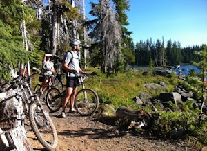
Paulina Peak with an elevation of 7,984 feet, and is about 4,000 feet higher than the terrain surrounding the volcano. There is a gravel fire road that winds to the top. This is a grueling climb with an 8000 foot elevation. Air please!The trail head starts about 1000 feet from the peak. It is a p...Read more -
Lane County, Oregon
Belknap Hot Springs
4.5This is a popular, family friendly spot, complete with two pools, indoor lodging, RV and tent camping, and hiking trails. The pools are kept at 185-195 degrees, with the smaller of the two being reserved for overnighters only. Day visitors are charged an hourly fee.Read more -
La Pine, Oregon
Paulina Falls Hike to Paulina Lake
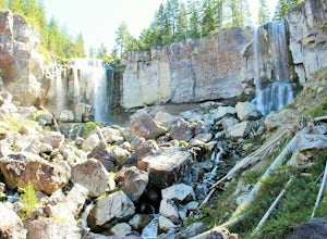
0.6 mi / 300 ft gainFirst take the short 1/4 mile hike down to the lower lookout. Get there early to beat the crowd and get unobstructed views. The Paulina Falls is an 80 ft. twin waterfall. It's gorgeous. After you see the falls from the lower lookout, you can walk back up to the upper lookout for a different view....Read more

