Stayton, Oregon
Looking for the best running in Stayton? We've got you covered with the top trails, trips, hiking, backpacking, camping and more around Stayton. The detailed guides, photos, and reviews are all submitted by the Outbound community.
Top Running Spots in and near Stayton
-
Silverton, Oregon
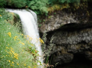
South Silver Falls
5.02.14 mi / 361 ft gainSouth Silver Falls is a loop trail that takes you by a river located near Silverton, Oregon.Read more -
Salem, Oregon
Minto-Brown Island Park
7.3 mi / 492 ft gainMinto-Brown Island Park Tail is a loop trail that takes you by a lake located near Salem, Oregon.Read more -
Salem, Oregon
Bridge and Orchard
3.26 mi / 220 ft gainBridge and Orchard is a loop trail that takes you by a lake located near Salem, Oregon.Read more -
Molalla, Oregon
Huckleberry, Mark's and Looney's Gate Loop
4.03.72 mi / 702 ft gainHuckleberry, Mark's and Looney's Gate Loop is a loop trail that takes you through a nice forest located near Molalla, Oregon.Read more -
Lebanon, Oregon
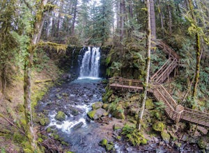
Hike McDowell Creek County Park
4.9GPS coordinates Lat: 44.46389 Long: -122.68278Exit off I-5 in Albany onto Highway 20 and proceed for approximately 20 miles to McDowell Creek Road and turn left, follow McDowell Creek Road - watching for signs for the park - for about 6 ½ miles, to the first of three parking areas within the park...Read more -
Corvallis, Oregon
Dimple Hill Via Patterson Road 600
4.86 mi / 715 ft gainDimple Hill Via Patterson Road 600 is a loop trail where you may see local wildlife located near Corvallis, Oregon.Read more -
Corvallis, Oregon
Vineyard Mountain Loop
3.36 mi / 505 ft gainVineyard Mountain Loop is a loop trail located near Corvallis, Oregon.Read more -
Corvallis, Oregon
Lewisburg Saddle Upper Horse Trail Loop
4.53.17 mi / 630 ft gainLewisburg Saddle Upper Horse Trail Loop is a loop trail in McDonald-Dunn Forest located near Adair Village, Oregon. The trail is dog, horse, and Mountain Bike friendly. If bringing your pup, please be sure to keep in on-leash with horses and other wildlife potentially on the trail. The loop sin...Read more -
Corvallis, Oregon
McCulloch Peak Loop
5.07.17 mi / 1719 ft gainMcCulloch Peak Loop is a loop trail where you may see local wildlife located near Corvallis, Oregon.Read more -
Oregon City, Oregon
Walk the Canemah Bluff Loop
4.51.6 mi / 200 ft gainYou'll never stumble upon Canemah Park unless you're really looking for it. Tucked away in the hills of Oregon City above the Locks, this residential park has a miniature-sized set of everything you'd expect in a children's park: Playground, picnic benches, bathrooms, and wide, forested trails. D...Read more -
McMinnville, Oregon
Hike the Red Trail in Miller Woods
4.04 mi / 400 ft gainLocated three miles west of McMinnville and available for public hiking and activities, Miller Woods is owned and operated by Yamhill SWCD. You may choose different trails to take.From the parking lot the trails are marked by colors to go on the 4.0 mile loop go to the meadow and follow the red m...Read more -
McMinnville, Oregon
Miller Woods
5.03.63 mi / 735 ft gainMiller Woods Trail is a loop trail where you may see beautiful wildflowers located near McMinnville, Oregon.Read more -
Gladstone, Oregon
Run the Clackamette Park Loop
1.2 mi / 10 ft gainClackamette Park is known for its prime destination right off of the freeway and across from Oregon City's most popular shopping area, but it's frequented for its public boat dock, RV facilities, and handicap-accessible picnic benches. While the rest of Portland's parks freeze over or flood, Clac...Read more -
West Linn, Oregon
Run Old River Road to George Rogers Park
5.04.8 mi / 100 ft gainPortland and its surrounding suburbs are filled with trails and hidden treasures, including this stretch along the Willamette River. This road is a super popular pedestrian path and can be accessed from West Linn, the Mary's Woods and Marylhurst Development, or from Lake Oswego off of Highway 43....Read more -
Foster, Oregon
Iron Mountain
4.71.79 mi / 610 ft gainGetting There There are a couple of different routes to the summit of Iron Mountain. This adventure article focuses on the shorter but more strenuous hike to the summit of Iron Mountain. To get there, drive to the upper trailhead (Trail # 3389) via Highway 20. Take Forest Service Road (FSR) 035 ...Read more -
Portland, Oregon
Tryon Creek Outer Loop
4.55.12 mi / 554 ft gainTryon Creek State Park has a fantastic, well-maintained trail system that’s a great alternative to Portland’s downtown Washington Park and Forest Park. It’s a super family-friendly area with a Nature Center that hosts kid’s events year-round. This entire area is relatively small and therefore eas...Read more

