Otter Rock, Oregon
Top Spots in and near Otter Rock
-
Beaver, Oregon
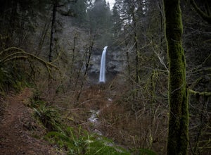
Hike to Pheasant Creek Falls
4.04 mi / 800 ft gainHike: The hike to Pheasant Creek Falls is just short continuation of nearby Niagara Falls. After reaching Niagara Falls, continue on the trail for about another 300 feet and you'll reach the more impressive, Pheasant Creek Falls.For more detailed information including a trail map and directions ...Read more -
Corvallis, Oregon
Hike Woodland Meadow Park Loop
0.5 mi / 59 ft gainThis trail is perfect for jogging or walking, with your pup! The loop is located near a popular dog park in Corvallis, and so can get crowded in the evenings after work. There is ample room for you dog and you to get out and enjoy nature.Read more -
Corvallis, Oregon
420, 300, and 400 Trails Loop
4.06.64 mi / 1043 ft gain420, 300, and 400 Trails Loop is a loop trail that takes you through a nice forest located near Corvallis, Oregon.Read more -
Beaver, Oregon
Hike to Niagara Falls, OR
4.04 mi / 800 ft gainGetting There Get onto Highway 101. Between Tillamook and Lincoln City at the town of Beaver, turn east near mile marker 80 onto a paved road toward upper Nestucca River. Follow this scenic road 6.7 miles to the town of Blaine. Stay to the right and drive another 4.8 miles; between mile markers 1...Read more -
Monroe, Oregon
Alsea Falls and Green Peak Falls
4.32.4 mi / 269 ft gainThis is a great and easy day hike that features two waterfalls - Alsea Falls and Green Peak Falls - amid beautiful Oregon Coast Range scenery. This hike is perfect for a family trip as the trail is dog-friendly, the Alsea River serves as a swimming hole on hot days, and there is a picnic area jus...Read more -
Cloverdale, Oregon
Cape Lookout
4.54.74 mi / 1135 ft gainCape Lookout is a two-mile long peninsula that juts into the Pacific Ocean from Oregon's rugged coastline. The park features more than 170 campsites, yurts, rustic cabins, and a day-use area, all located a short walk from the beach. There are roughly 10 miles of trails ranging from easy to mode...Read more -
Cloverdale, Oregon
North Trail
3.04.22 mi / 1053 ft gainThe North Trail at Cape Lookout State Park in Oregon is a challenging (hilly) route with beautiful views of the Pacific Ocean. Start at trailhead along Cape Lookout Road. There are 3 trails available, North, Cape Lookout, and South trails. Follow signs for the North trail. The trail drops stee...Read more -
Corvallis, Oregon
Mary's Peak
4.452 mi / 4020 ft gainThis ride takes you from the banks of the Willamette River at the Corvallis waterfront to the top of Mary's Peak, 26 miles and 4,000 vertical feet away. While it starts out with a warm-up through the flats of the Willamette Valley, it quickly starts climbing up around the west side of Mary's Pea...Read more -
Yachats, Oregon
Heceta Head Lighthouse to Hobbit Beach
5.03.76 mi / 1040 ft gainHeceta Head Lighthouse to Hobbit Beach is an out-and-back trail that provides a good opportunity to view wildlife located near Florence, Oregon.Read more -
Florence, Oregon
Explore Heceta Head Lighthouse State Scenic Viewpoint
5.01 mi / 150 ft gainAt the mouth of Cape Creek sits a beautiful cove with one of the best views in Oregon. Above the sandy beach and sea stacks, rises the Heceta Head Lighthouse, a 100-year-old+ structure that's been laboriously restored and kept in working condition. At night, this quiet piece of the Oregon coast g...Read more -
Corvallis, Oregon
Explore the Finley Wildlife Refuge
4.3Starting at the visitor center, the trail begins west heading into the forest where you’ll only gain around a couple hundred feet of elevation. While you are hiking on this trail you are surrounded by conifer trees, little open areas of sitting water, and look outs that are hidden within the trai...Read more -
Tillamook, Oregon
Short Hike to Munson Creek Falls
4.00.4 miLocated just outside of Tillamook, Oregon, Munson Creek Falls is a must do if you're in the area. Standing at almost 320 feet tall, Munson Creek Falls is one of few waterfalls in Oregon that is over 300ft tall.Because of heavy storms in the area there has been a build up of fallen trees around th...Read more -
Blachly, Oregon
Triangle Lake Rock Slides and Lake Creek Falls
4.7Stay cool on a hot summer day with a natural rock water slide, multiple swimming hole areas, and multiple waterfalls. This is perfect for relaxing in the sun! The sign for the parking area is upstream of the falls. There is a store across from the lake if you need any last minute food and drinks...Read more -
Oceanside, Oregon
Oceanside Beach Trail
4.00.86 mi / 144 ft gainOceanside Beach Trail is an out-and-back trail that provides a good opportunity to view wildlife located near Tillamook, Oregon.Read more -
Oceanside, Oregon
Tunnel Beach
5.00.47 mi / 75 ft gainThe main beach is located adjacent to Oceanside Beach State Park, which can be accessed via Cape Meares Loop/Netarts Oceanside Hwy. Once you arrive at the park, head down towards the beach and start walking North. You'll notice a little hole-in-the-wall past a small group of rocks which you'll h...Read more -
Tillamook, Oregon
Relax at Oceanside Beach
4.0Oceanside Beach is often passed over for Tunnel Beach just north. Both are great, but you're missing out if you don't head down to Oceanside and fly a kite. There's a parking lot right next to the marked location. Park there, then head down to the beach—don't forget your kite!Read more

