Marion Forks, Oregon
Looking for the best hiking in Marion Forks? We've got you covered with the top trails, trips, hiking, backpacking, camping and more around Marion Forks. The detailed guides, photos, and reviews are all submitted by the Outbound community.
Top Hiking Spots in and near Marion Forks
-
Deschutes County, Oregon
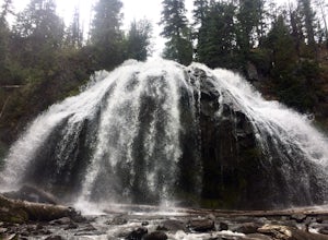
Chush Falls
3.35.75 mi / 823 ft gainJust outside of Sisters, Oregon, near Bend, is a beautiful hike to a picturesque waterfall. It is rarely crowded thanks (and no thanks) to the Pole Creek Fire, which ravaged the area several years ago. Because of the fire, the hike and landscape have been drastically altered. What used to be a 2-...Read more -
Scotts Mills, Oregon
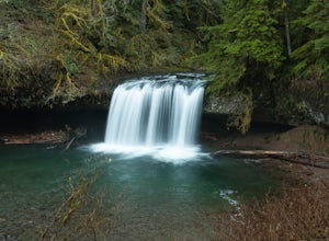
Upper Butte Creek Falls
4.00.73 mi / 308 ft gainFrom Scott Mills Follow Crooked Finger RD NE for 13.3 Miles to the Upper Butte Creek Trailhead. The last 2-3 miles or so is gravel road with some potholes but most cars shouldn't have a problem. The path down to the falls starts near the bathrooms. A short .3 mile walk on a few switchbacks and...Read more -
Terrebonne, Oregon
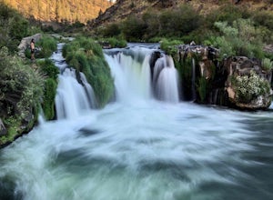
Steelhead Falls
1.98 mi / 148 ft gainSteelhead Falls is an out-and-back trail that takes you by a waterfall located near Terrebonne, Oregon.Read more -
Terrebonne, Oregon
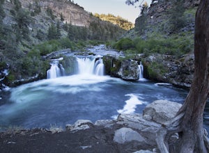
Hike to Steelhead Falls
4.81 mi / 120 ft gainFollowing along the Dechutes river for half a mile you will see where the river progressively gets more aggressive. On both sides of the trail you will see beautiful mountain inclines and jagged cliffs. If your lucky you might just see a bald eagle soaring high above! Along with Steel Head being ...Read more -
Clackamas County, Oregon
Bike the Timothy Lake Trail
4.515 miLocated about 2 hours outside of Portland, Timothy lake is a great home base to adventure from. It has many campgrounds, lots of lake access and great loop around the lake that is open to both hiking and Mt biking. While the hiking loop is 13 miles, the Mt. bike loop is 15 since you need to make ...Read more -
Stayton, Oregon
Shellburg Falls
3.23.7 mi / 520 ft gainThis hike is currently closed due to fire damage. Please check the Oregon.gov website or the call the Oregon Department of Forestry (503-859-4344) for updates. The hike, including the initial 1.25 mile gravel road to the trailhead, is easy to complete within 1-2 hours and only requires a modera...Read more -
Scotts Mills, Oregon
Abiqua Falls
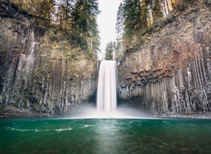
4.90.69 mi / 115 ft gainThis trail is unmarked and a little rough and rugged. The land is privately owned by Mount Angel Abbey, but they don't appear to have problems with courteous hikers. Walking out of the parking area back up the road in the direction you came from, you’ll pass one dirt trail right at the ending of ...Read more -
Lebanon, Oregon
Hike McDowell Creek County Park
4.9GPS coordinates Lat: 44.46389 Long: -122.68278Exit off I-5 in Albany onto Highway 20 and proceed for approximately 20 miles to McDowell Creek Road and turn left, follow McDowell Creek Road - watching for signs for the park - for about 6 ½ miles, to the first of three parking areas within the park...Read more -
Clackamas County, Oregon
Little Crater Lake to Timothy Lake Campground
3.42 mi / 338 ft gainLittle Crater Lake to Timothy Lake Campground is an out-and-back trail that takes you by a lake located near Government Camp, Oregon.Read more -
Silverton, Oregon
South Silver Falls
5.02.14 mi / 361 ft gainSouth Silver Falls is a loop trail that takes you by a river located near Silverton, Oregon.Read more -
Bend, Oregon
Tam McArthur Rim, Green Lakes, Park Meadow Tie Loop
3.322.58 mi / 3675 ft gainThis loop trip around Broken Top is one of the premier backpacking loops in Oregon. The trail winds past numerous alpine lakes, including the popular Green Lakes area, and offers near-constant views of Broken Top, the Three Sisters, and Mount Bachelor. To top it all off, the clear skies typical o...Read more -
Bend, Oregon
Hike Tam McArthur Rim Trail
5.05.2 mi / 1500 ft gainThe Tam McArthur Rim Trail is a day hike in the Three Sisters Wilderness that will have you gaining about 1,500' of elevation for beautiful views of Three Creek Lake and the surrounding Three Sisters Mountains. On a clear day you can also catch a peak of Mt. Bachelor Ski Area. The trail is less ...Read more -
Silverton, Oregon
Camp in Silver Falls State Park
4.68.7 mi / 1300 ft gainIf you're thinking of hiking the Trail of Ten Falls Loop and staying overnight, there are 42 tent campsites (available from April – Oct) as well as 14 rustic cabins. With multiple beds, heat, electricity, a covered porch, and a small fridge, they provide the perfect respite after a long day of ex...Read more -
Drake Crossing, Oregon
Trail of Ten Falls Loop
4.77.16 mi / 1178 ft gainThe unique feature of South Falls, Lower South Falls, and Middle North Falls are the paths that pass behind the falls providing an amazing visual and auditory experience; however, be sure to have a good bag for your equipment to avoid water damage and a decent jacket (preferably water-resistant)....Read more -
Lane County, Oregon
Terwilliger (Cougar) Hot Springs
4.20.9 mi / 249 ft gainSoaking in Terwilliger (otherwise known as "Cougar") hot springs is a great way to relax and wind back while exploring the Cascades. A spring flows from a small cave and cascades into multiple pools leading down a small gully, creating pools which have varying temperatures from hot (closer to the...Read more -
Molalla, Oregon
Huckleberry, Mark's and Looney's Gate Loop
4.03.72 mi / 702 ft gainHuckleberry, Mark's and Looney's Gate Loop is a loop trail that takes you through a nice forest located near Molalla, Oregon.Read more

