Linn County, Oregon
Looking for the best running in Linn County? We've got you covered with the top trails, trips, hiking, backpacking, camping and more around Linn County. The detailed guides, photos, and reviews are all submitted by the Outbound community.
Top Running Spots in and near Linn County
-
Lebanon, Oregon
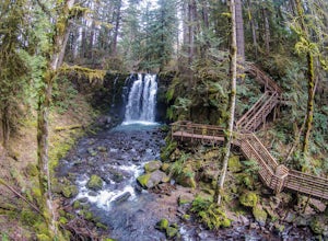
Hike McDowell Creek County Park
4.9GPS coordinates Lat: 44.46389 Long: -122.68278Exit off I-5 in Albany onto Highway 20 and proceed for approximately 20 miles to McDowell Creek Road and turn left, follow McDowell Creek Road - watching for signs for the park - for about 6 ½ miles, to the first of three parking areas within the park...Read more -
Foster, Oregon
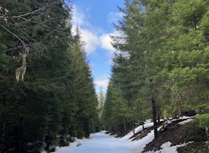
Iron Mountain
4.71.79 mi / 610 ft gainGetting There There are a couple of different routes to the summit of Iron Mountain. This adventure article focuses on the shorter but more strenuous hike to the summit of Iron Mountain. To get there, drive to the upper trailhead (Trail # 3389) via Highway 20. Take Forest Service Road (FSR) 035 ...Read more -
Sisters, Oregon
Duffy Lake Trail
6.92 mi / 869 ft gainDuffy Lake Trail is an out-and-back trail that takes you by a lake located near Idanha, Oregon.Read more -
Silverton, Oregon
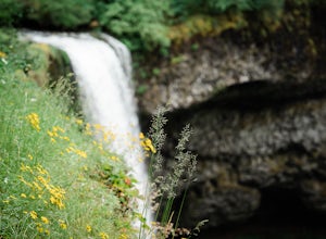
South Silver Falls
5.02.14 mi / 361 ft gainSouth Silver Falls is a loop trail that takes you by a river located near Silverton, Oregon.Read more -
Idanha, Oregon
Pamelia Lake Trail
4.04.37 mi / 906 ft gainPamelia Lake Trail is an out-and-back trail that takes you by a lake located near Idanha, Oregon.Read more -
Sisters, Oregon
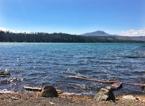
Suttle Lake Loop
5.03.66 mi / 128 ft gainBeginning at the Suttle Lake Lodge just off Highway 20, the Suttle Lake Loop follows a wide dirt path that circumnavigates the entire lake. Hug the lake whenever the trail opens up to camping areas or pavement - it's nearly impossible to become lost on this track. Pass campsites, kayakers, and r...Read more -
Corvallis, Oregon
Dimple Hill Via Patterson Road 600
4.86 mi / 715 ft gainDimple Hill Via Patterson Road 600 is a loop trail where you may see local wildlife located near Corvallis, Oregon.Read more -
Corvallis, Oregon
Vineyard Mountain Loop
3.36 mi / 505 ft gainVineyard Mountain Loop is a loop trail located near Corvallis, Oregon.Read more -
Corvallis, Oregon
Lewisburg Saddle Upper Horse Trail Loop
4.53.17 mi / 630 ft gainLewisburg Saddle Upper Horse Trail Loop is a loop trail in McDonald-Dunn Forest located near Adair Village, Oregon. The trail is dog, horse, and Mountain Bike friendly. If bringing your pup, please be sure to keep in on-leash with horses and other wildlife potentially on the trail. The loop sin...Read more -
Eugene, Oregon
Wild Iris Ridge Loop from Summit Sky Boulevard
5.01.58 mi / 220 ft gainWild Iris Ridge Loop from Summit Sky Boulevard is a loop trail where you may see beautiful wildflowers located near Eugene, Oregon.Read more -
Corvallis, Oregon
McCulloch Peak Loop
5.07.17 mi / 1719 ft gainMcCulloch Peak Loop is a loop trail where you may see local wildlife located near Corvallis, Oregon.Read more -
Molalla, Oregon
Huckleberry, Mark's and Looney's Gate Loop
4.03.72 mi / 702 ft gainHuckleberry, Mark's and Looney's Gate Loop is a loop trail that takes you through a nice forest located near Molalla, Oregon.Read more -
Lowell, Oregon
Mount June Trail
5.02.21 mi / 833 ft gainMount June Trail in Lowell, Oregon, is a moderate difficulty hiking trail that stretches for 2.21 miles. The trail is known for its steep inclines and rocky terrain, making it a challenging yet rewarding hike. The trailhead is located off of Lost Creek Road, with a small parking area available fo...Read more -
Salem, Oregon
Minto-Brown Island Park
7.3 mi / 492 ft gainMinto-Brown Island Park Tail is a loop trail that takes you by a lake located near Salem, Oregon.Read more -
Salem, Oregon
Bridge and Orchard
3.26 mi / 220 ft gainBridge and Orchard is a loop trail that takes you by a lake located near Salem, Oregon.Read more

