Lake Oswego, Oregon
Looking for the best photography in Lake Oswego? We've got you covered with the top trails, trips, hiking, backpacking, camping and more around Lake Oswego. The detailed guides, photos, and reviews are all submitted by the Outbound community.
Top Photography Spots in and near Lake Oswego
-
Rhododendron, Oregon
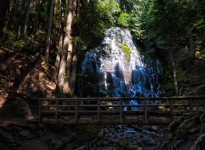
Ramona Falls Loop
4.77.17 mi / 1148 ft gainI'd been wanting to do this hike for quite a while, and when I found work taking me to Portland, I made my return trip through the Mt. Hood wilderness area. I started this Hike from the Ramona Falls trailhead, which is the most popular starting point. The easiest way to find the trailhead, is t...Read more -
Timber, Oregon
Hike the Upper Salmonberry River Trail
4.112.5 mi / 1600 ft gainIf you are craving adventure and exploration in a unique hiking setting, then you have come to the right place! This is a hike where every time you turn a corner your eyes light up with excitement and your imagination runs wild. Be forewarned though…if you fear cold, dark, and creepy abandoned tr...Read more -
Rhododendron, Oregon
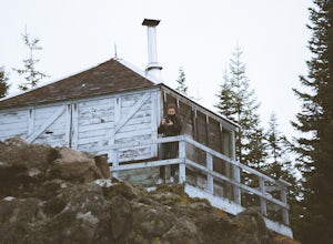
Devil's Peak Lookout
3.02.62 mi / 600 ft gainThe Trail: This hike is one of the 2 routes that lead to the lookout, and the shorter of the two. It requires more driving to get to the trailhead than the other, but less walking, so if that sounds appealing to you, you have come to the right place! First, you'll be greeted by a dense forest w...Read more -
Cascade Locks, Oregon
Dry Creek Falls via PCT
4.34.44 mi / 1191 ft gainThis is a 4.4 mile out and back hike with only 710 feet in elevation gain. From the parking area at the Bridge of The Gods Trailhead, make your way across the road to the Pacific Crest Trail, which runs parallel with I-84. Shortly you'll run into a street that goes under I-84. Make your way up...Read more -
Rhododendron, Oregon
Burnt Lake and Zigzag Mountain
5.012.27 mi / 3225 ft gainAfter getting your back country permit from a park ranger, you can park your car and head up Zigzag Mountain. There's a tiny 'parking lot' (lot of dirt) where you park that's right by the trailhead. The hike up to the campsites is roughly 4 miles, and it is all uphill. Not only are you surrounde...Read more -
Cascade Locks, Oregon
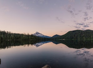
Camp at Lost Lake
4.7When the temperature starts to creep up in the summer, Lost Lake is the perfect escape. The campground provides you with everything you could want – miles of scenic hiking, a multitude of water activities, and even a general store for anything you might have forgotten at home.The lakeside tent ca...Read more -
Amboy, Washington
Siouxon Trail to 14 Mile Falls
5.013.03 mi / 2310 ft gainWhen you park at the top of the trail, all you see is layers and layers of emerald trees and ground clear of any underbrush. Once on the trail, you start on a rapid decline that brings you to the first of the many streams along this hike. Cross the bridge made out of logs and head towards the ma...Read more -
Tillamook, Oregon
King's Mountain
4.54.47 mi / 2461 ft gainKing's Mountain may be one of the most consistent hikes in the greater Portland area gaining 2,500 vertical-feet over 2.5 miles almost evenly the entire time. The trail starts out at a marked trailhead just west of the Elk Mountain campground (stop there for water and more restrooms in summer &a...Read more -
Stayton, Oregon
Shellburg Falls
3.23.7 mi / 520 ft gainThis hike is currently closed due to fire damage. Please check the Oregon.gov website or the call the Oregon Department of Forestry (503-859-4344) for updates. The hike, including the initial 1.25 mile gravel road to the trailhead, is easy to complete within 1-2 hours and only requires a modera...Read more -
Mount Hood, Oregon
McNeil Point via Top Spur Trailhead
4.97.17 mi / 2428 ft gainThe hike to McNeil Point begins at Top Spur Trailhead, in the Mt. Hood National Wilderness. Follow signs for McNeil Point along the Pacific Crest and Timberline Trails heading north. Though there are numerous camping opportunities along the way (most of the route follows the PCT), an old stone s...Read more -
Mount Hood, Oregon
Hike to Sandy Glacier Caves
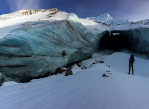
4.512.5 mi / 2800 ft gainThe hike to the caves begins at Top Spur Trailhead. The hike to McNeil Point is 5.4 miles one way, and 2200 feet of elevation gain. The trail starts in the forest, but will eventually open up to views of Mt Hood, as well as St. Helens, Adams and Rainier on a clear day.There is a shortcut up to Mc...Read more -
Rhododendron, Oregon
Little Zig Zag Falls
5.00.66 mi / 131 ft gainThe hike along Little Zig Zag River is definitely one of Oregon's hidden gems. Although the waterfall isn't as highly rated in comparison to other impressive falls like Multnomah Falls, Abiqua Falls, or Bridal Viel Falls, it is still quite the sight to see, and most definitely worth the visit. T...Read more -
Lyons, Oregon
Henline Falls Trail
5.01.71 mi / 312 ft gainThe trail is a washed out, old mining road making its way through a lush forest with a mix of ferns, moss covered trees, and towering Douglas Firs with trees blown over from wind storms lining both sides of the trail. I call those Big Foot traps. The trail comes to a fork, stay to the left you ar...Read more -
Lyons, Oregon
Swim at Three Pools
5.0To get there from Salem, Follow Hwy. 22 east to Mehama. Turn on Little North Santiam Road (FS 2209) and proceed for 12 miles to Three Pools Day Use Area. Three Pools is by far one of the most popular swimming holes in the Northwest. With multiple swimming holes within just feet from one another i...Read more -
Cascade Locks, Oregon
Chinidere Mountain
4.83.18 mi / 1150 ft gainThe easy version of the Chinidere Mountain hike starts Wahtum Lake Trailhead. The road to the parking lot for Wahtum Lake is paved and thus very easy to access in summer and before snowfall in autumn! The mountain sits across the lake from the parking lot and there are several trails that will ta...Read more -
Cascade Locks, Oregon
Indian Point via Herman Creek Trailhead
5.08.08 mi / 3658 ft gainPark at the Herman Creek Trailhead in Cascade Locks 2 miles from the exit. Remember to bring your Northwest Forest pass or a $5 payment to park. Start ascending on the Herman Creek trail a little over a mile until you hit a three-way junction for Gorton Creek Trail #408, Trail #400, and Herman ...Read more

