Galice, Oregon
Looking for the best photography in Galice? We've got you covered with the top trails, trips, hiking, backpacking, camping and more around Galice. The detailed guides, photos, and reviews are all submitted by the Outbound community.
Top Photography Spots in and near Galice
-
Josephine County, Oregon
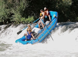
Raft or Kayak the Wild & Scenic Rogue River
4.8The Wild and Scenic Section of the Rogue River is a hidden secret in the Pacific Northwest. This virtually untouched 34-mile section boasts some of the most pristine and secluded scenery in Oregon. Bald eagles, osprey, and black bears are frequently (if not always) spotted along the way. This bea...Read more -
Agness, Oregon
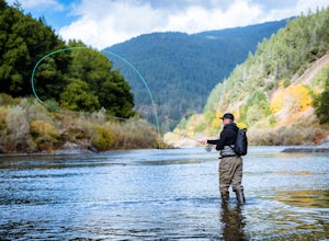
Fly Fish the Rogue River at the Mermaid Riffle
The Steelhead run on the Rogue River is famous the world over and for good reason. Like anywhere, local guides are the gatekeepers to the right spot and should be contacted accordingly. Steelhead run December through March and Chinook April through Fall, with Coho making an appearance in the lat...Read more -
Agness, Oregon
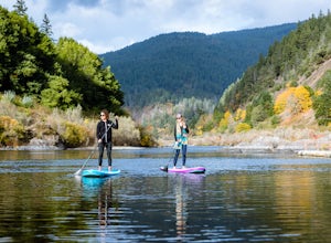
Stand Up Paddleboard the Mermaid Riffle on the Rogue River
The Rogue River is famous the world over for rafting and for its Steelhead runs, possessing a dramatic undeveloped canyon untouched by road and man, and being one of the Original 7 Wild & Scenic Rivers designed by Congress. And not only is it fantastic for rafting but entire sections are perf...Read more -
Port Orford, Oregon
Humbug Mountain Loop
5.32 mi / 2064 ft gainStarting out at the pullout on the highway across from the Humbug Mountain State Campground, follow the winding trail up through the forrest to the top of the mountain. There is a nice bench at the top for a snack (or a beer). The hike is fairly long and demanding, but isn't too steep due to th...Read more -
Del Norte County, California
Backpack to Raspberry Lake
1.012 mi / 1800 ft gainIf you wish to experience the beauty of the Siskiyou Wilderness and avoid the crowds associated with The Devil’s Punchbowl, then consider a visit to Raspberry Lake. Beginning at the Young’s Valley Trailhead (Coordinates: 41.889919, -123.654755), this hike is a great option for those seeking wide...Read more -
Brookings, Oregon
Explore Thunder Rock Cove at Samuel H Boardman State Scenic Corridor
1.5 mi / 400 ft gainOne of many magical nooks and crannies to explore all along the Samuel H. Boardman State Scenic Corridor, Thunder Rock Cove sits between the iconic (and more popular) Natural Bridges and Secret Beach. The hike to the cover overlook is an easy .75 mile hike down from the Thunder Rock pull-off tha...Read more -
Brookings, Oregon
Explore Natural Bridges at Samuel H. Boardman State Scenic Corridor
4.86 mi / 0 ft gainThe Samuel H. Boardman Scenic Corridor is 12 miles of rugged, steep coastline with many hidden & secluded beaches and coves, and the Natural Bridges section is one of the most iconic (and most photographed) along the entire Corridor.There are several hikes above and around the natural bridges...Read more -
Port Orford, Oregon
Hike the Port Orford Heads Trail
1.3 mi / 300 ft gainThe Port Orford Heads State Park comprises a drastically pronounced peninsula jutting out into the Pacific Ocean from the southern Oregon coast, providing breathtaking views both north to the Cape Blanco Lighthouse and south to Humbug Mountain and beyond. The Port Orford Heads Trail is the main l...Read more

