Estacada, Oregon
Looking for the best hiking in Estacada? We've got you covered with the top trails, trips, hiking, backpacking, camping and more around Estacada. The detailed guides, photos, and reviews are all submitted by the Outbound community.
Top Hiking Spots in and near Estacada
-
Cascade Locks, Oregon
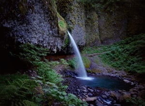
Ponytail Falls
4.60.85 mi / 463 ft gainPonytail Falls is an easy 0.8 mile hike located in the gorge that begins at Horsetail Falls. After hiking up mild switchbacks, continue to your right at the first trailhead intersection. The path levels out before coming around the mountain and opening up to the waterfall. This is the easiest wa...Read more -
Clackamas County, Oregon
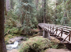
Bagby Hot Springs
4.32.91 mi / 397 ft gainBagby Hot Springs is actually a set of amazing bathhouses nestled in the forest outside of Estacada. They are one of Oregon’s most poplar hot springs, and for good reason. The hike into the hot springs is easy and quite scenic. You’ll cross a bridge over Nohorn Creek and follow the Hot Springs Fo...Read more -
Portland, Oregon
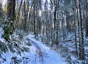
Lower Macleay Park to Pittock Mansion
3.04.7 mi / 965 ft gainLower Macleay Park is one of most easily accessible trailheads in the city, especially during one of Portland’s rare snow years where even driving up to 500 feet of elevation can challenge your car. You can park within the park entrance cul-de-sac, around the intersection of Upshur St. & NW 2...Read more -
Rhododendron, Oregon
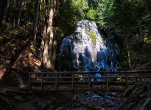
Ramona Falls Loop
4.77.17 mi / 1148 ft gainI'd been wanting to do this hike for quite a while, and when I found work taking me to Portland, I made my return trip through the Mt. Hood wilderness area. I started this Hike from the Ramona Falls trailhead, which is the most popular starting point. The easiest way to find the trailhead, is t...Read more -
Rhododendron, Oregon
Burnt Lake and Zigzag Mountain
5.012.27 mi / 3225 ft gainAfter getting your back country permit from a park ranger, you can park your car and head up Zigzag Mountain. There's a tiny 'parking lot' (lot of dirt) where you park that's right by the trailhead. The hike up to the campsites is roughly 4 miles, and it is all uphill. Not only are you surrounde...Read more -
Rhododendron, Oregon
Little Zig Zag Falls
5.00.66 mi / 131 ft gainThe hike along Little Zig Zag River is definitely one of Oregon's hidden gems. Although the waterfall isn't as highly rated in comparison to other impressive falls like Multnomah Falls, Abiqua Falls, or Bridal Viel Falls, it is still quite the sight to see, and most definitely worth the visit. T...Read more -
Government Camp, Oregon
Veda Lake Trail
4.02.5 mi / 748 ft gainThis hike starts at the Fir Tree Trailhead and is an out and back 2.8 mile round trip. It's short, but there's 660 feet of elevation gain. To start, you climb steeply then it's an easy hike to a beautiful viewpoint overlooking the lake. The trail descends via switchbacks down to the lake for the ...Read more -
Scotts Mills, Oregon
Upper Butte Creek Falls
4.00.73 mi / 308 ft gainFrom Scott Mills Follow Crooked Finger RD NE for 13.3 Miles to the Upper Butte Creek Trailhead. The last 2-3 miles or so is gravel road with some potholes but most cars shouldn't have a problem. The path down to the falls starts near the bathrooms. A short .3 mile walk on a few switchbacks and...Read more -
Government Camp, Oregon
Tom Dick and Harry Mountain
5.08.28 mi / 1726 ft gainLooking to score those iconic photos of Mt. Hood? Climb the well-graded trail to Tom Dick and Harry Mountain, one of the most accessible summit hikes to Portlanders, and see where they were all taken. Starting from the busy Mirror Lake Trailhead, climb roughly 900 feet and 1.5 miles to Mirror La...Read more -
Government Camp, Oregon
Mirror Lake Trail
4.54.09 mi / 810 ft gainI was out doing the Ramona Falls hike, and I decided that I needed to find a lake that provided me with a great view of Mt Hood. My first stop was Trillium Lake, but with that being a “drive up” lake, there were tons of people. Tons of people only means one thing…turbulent waters! As I was dr...Read more -
Scotts Mills, Oregon
Abiqua Falls
4.90.69 mi / 115 ft gainThis trail is unmarked and a little rough and rugged. The land is privately owned by Mount Angel Abbey, but they don't appear to have problems with courteous hikers. Walking out of the parking area back up the road in the direction you came from, you’ll pass one dirt trail right at the ending of ...Read more -
Saint Paul, Oregon
Hike the Champoeg SP Loop
5.03.4 mi / 120 ft gainChampoeg was the first town to be settled in the Willamette Valley and the site of the formation of the first government in the northwest. The park offers historical sites as well as plentiful camping and some short day hikes. I decided to do the Townsite loop with my family on black friday #opto...Read more -
Cascade Locks, Oregon
Elowah Falls
4.81.36 mi / 512 ft gainMultnomah Falls, which is about 5 miles from Elowah [along the Historic Columbia River Highway] takes a large portion of the crowd due to its visibility from the highway. With that said, you may get a much more deserted Elowah Falls if you decide to take the short but steep 15-minute hike to it...Read more -
Cascade Locks, Oregon
Upper McCord Creek Falls
4.71.98 mi / 617 ft gainStarting at the John B Yeon Trailhead parking lot, begin to walk into the forest. After a little more than a quarter mile, you will see a fork in the road, with one way leading to Elowah Falls, and the other way leading to Upper McCord Creek Falls. Take the trail leading to Upper McCord Creek. Th...Read more -
Mount Hood, Oregon
McNeil Point via Top Spur Trailhead
4.97.17 mi / 2428 ft gainThe hike to McNeil Point begins at Top Spur Trailhead, in the Mt. Hood National Wilderness. Follow signs for McNeil Point along the Pacific Crest and Timberline Trails heading north. Though there are numerous camping opportunities along the way (most of the route follows the PCT), an old stone s...Read more -
Mount Hood, Oregon
Hike to Sandy Glacier Caves
4.512.5 mi / 2800 ft gainThe hike to the caves begins at Top Spur Trailhead. The hike to McNeil Point is 5.4 miles one way, and 2200 feet of elevation gain. The trail starts in the forest, but will eventually open up to views of Mt Hood, as well as St. Helens, Adams and Rainier on a clear day.There is a shortcut up to Mc...Read more

