Estacada, Oregon
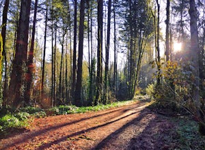
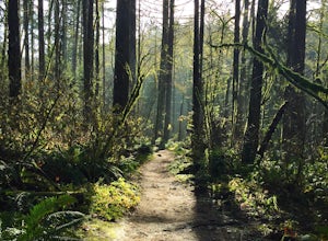
Looking for the best hiking in Estacada? We've got you covered with the top trails, trips, hiking, backpacking, camping and more around Estacada. The detailed guides, photos, and reviews are all submitted by the Outbound community.
Top Hiking Spots in and near Estacada
-
Gladstone, Oregon
Run the Clackamette Park Loop
1.2 mi / 10 ft gainClackamette Park is known for its prime destination right off of the freeway and across from Oregon City's most popular shopping area, but it's frequented for its public boat dock, RV facilities, and handicap-accessible picnic benches. While the rest of Portland's parks freeze over or flood, Clac...Read more -
Oregon City, Oregon
Walk the Canemah Bluff Loop
4.51.6 mi / 200 ft gainYou'll never stumble upon Canemah Park unless you're really looking for it. Tucked away in the hills of Oregon City above the Locks, this residential park has a miniature-sized set of everything you'd expect in a children's park: Playground, picnic benches, bathrooms, and wide, forested trails. D...Read more -
Portland, Oregon
Powell Butte Nature Park Loop
6.22 mi / 1004 ft gainBefore officially becoming a nature park in 1987, Powell Butte was primarily known for being home to four 50-million gallon underground reservoirs. Today, the wide expanse of land is packed with miles of trails-- the perfect place for hikers, mountain bikers, and even horseback riders to get thei...Read more -
Clackamas County, Oregon
Tumala (Squaw) Mountain
4.74.51 mi / 1099 ft gainOn a clear day, this short, secluded hike offers breath-taking views of Mt. St. Helens, Mt. Rainier, Mt. Adams, Mt. Hood, and Mt. Jefferson, as well as of downtown Portland, Coast Range, and the Roaring River Wilderness. Begin the hike from the Twin Springs Trailhead and immediately take your fi...Read more -
Corbett, Oregon
Latourell Falls Loop
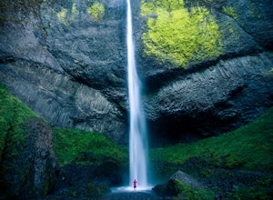
4.72.02 mi / 820 ft gainLatourell Falls is a beautiful and unique waterfall in the Columbia River Gorge in Oregon. This amazing waterfall is just a few hundred yards from the road and parking lot. Once you park, there is a viewpoint for the falls that is straight ahead. The view from there isn't that great compared to ...Read more -
Molalla, Oregon
Huckleberry, Mark's and Looney's Gate Loop
4.03.72 mi / 702 ft gainHuckleberry, Mark's and Looney's Gate Loop is a loop trail that takes you through a nice forest located near Molalla, Oregon.Read more -
Rhododendron, Oregon
Frustration Falls
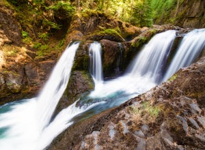
3.08.26 mi / 1854 ft gainThe hike and possible rappel to Frustration Falls begins at the Salmon River trailhead right outside of Welches, Oregon. From the trailhead you follow the trail for about 4 miles at which point you reach Canyon View (Shown in pictures 5-6 above). From the main trail this is the only view of Frust...Read more -
Clackamas County, Oregon
Salmon River Trail
4.54.4 mi / 50 ft gainLargely Flat Trail4.4 Miles roundtripOld Growth ForestRiver Scouting Opportunities There are seven trailheads all off to the right of E. Salmon River Road. All are easily accessible under normal conditions. The hike meanders alongside the river, providing ample opportunities to scout the river's...Read more -
Portland, Oregon
Tryon Creek Outer Loop
4.55.12 mi / 554 ft gainTryon Creek State Park has a fantastic, well-maintained trail system that’s a great alternative to Portland’s downtown Washington Park and Forest Park. It’s a super family-friendly area with a Nature Center that hosts kid’s events year-round. This entire area is relatively small and therefore eas...Read more -
Portland, Oregon
Tryon Creek Triple Bridge Loop
3.35 mi / 479 ft gainTryon Creek Triple Bridge Loop is a scenic approximately 3.5-mile loop with bridge crossings near downtown Portland. This trail is a great way to get outside, stretch your legs, and feel like you're away from the hustle and bustle of the city. This trail is dog-friendly on-leash. If you're look...Read more -
Corbett, Oregon
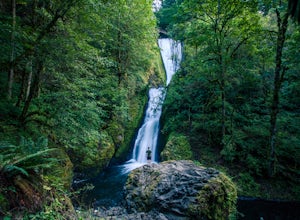
Bridal Veil Falls
4.10.54 mi / 144 ft gainThe trailhead for this short hike is right off of the Columbia River Highway just west of Multnomah Falls. You can't miss the parking lot for it; there is a sign for Bridal Veil and the parking lot is visible from the road. The hike is only 0.6 miles and has hardly any elevation gain (70 feet). ...Read more -
Corbett, Oregon
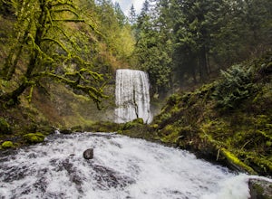
Hike to Upper Bridal Veil Falls
5.00.5 miAt the parking lot for Angel's Rest, turn left uphill on to Palmer Mill Road. Drive for about a mile, and park right past a tributary stream/small waterfall (pictured above) on your left that flows through a small pipe under the road. You will see a small space to park on the right. Park here and...Read more -
Portland, Oregon
Mount Tabor Loop
4.51.88 mi / 325 ft gainMount Tabor City Park is located in the heart of southeast Portland and is situated atop an extinct volcano. It’s comprised of more than 190 acres of beautiful Douglas Fir forest and features several relatively easy routes to the top: the easiest being the road you can drive (but what’s the fun i...Read more -
Bridal Veil, Oregon
Angel's Rest
4.34.45 mi / 1568 ft gainThe Columbia River Gorge is absolutely full of incredible hikes - that said, this is one of the best and requires less time and energy than some of the others. Starting at a paved parking lot right off the Historic Columbia River Gorge Highway (note: it's a very popular trail so arrive early or ...Read more -
Bridal Veil, Oregon
Devil's Rest-Wahkeena Falls Loop
4.09.82 mi / 2779 ft gainThis loop takes advantage of the western Columbia River Gorge's vast network of trails - hidden behind the roadside waterfalls - to allow you to visit several popular attractions without fighting traffic along the historic highway. All told, the loop hits 3 named waterfalls (Coopey Falls, Fairy F...Read more -
Camas, Washington
Run the Round Lake Loop at Lacamas Park
4.26.3 mi / 710 ft gainThis trail is a great option for people who want to escape the city, without actually leaving. Lacamas Park is located right downtown Camas, Washington and offers over six miles of dirt trails popular for cyclists, pedestrians, and runners.Park off of 3rd avenue at the Lacamas Creek Trailhead to ...Read more

