Depoe Bay, Oregon
Top Spots in and near Depoe Bay
-
Cloverdale, Oregon
Cape Kiwanda State Natural Area
4.01.04 mi / 171 ft gainCape Kiwanda State Natural Area is a loop trail that takes you past scenic surroundings located near Cloverdale, Oregon.Read more -
Cloverdale, Oregon
Explore Cape Kiwanda
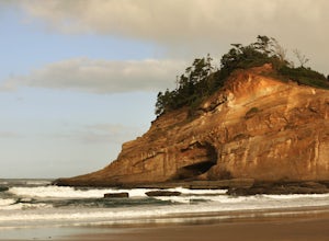
4.8Cape Kiwanda is part of the Three Capes Scenic Route. It offers sea stack rock formations, beautiful beaches, sand stone cliffs, and if you are lucky enough, amazing wildlife. It is the home of the Pacific Dory Fleet.If you are early enough, you can catch the fisherman coming and going in the mys...Read more -
Yachats, Oregon
Camp at Tillicum Beach
5.0The major draw of this campground however is the beach. Many of the campsites overlook the water, but if you don’t have a view from your site it takes less than a minute to be in the sand. We made our trip from the University of Oregon in Eugene. It was a gorgeous 2 hour drive, and after driving ...Read more -
Beaver, Oregon
Hebo Lake to South Lake via Pioneer Indian Trail
14.07 mi / 2697 ft gainHebo Lake to South Lake via Pioneer Indian Trail is an out-and-back trail that takes you by a lake located near Beaver, Oregon.Read more -
Beaver, Oregon
Hike to Pheasant Creek Falls
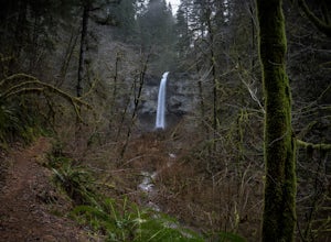
4.04 mi / 800 ft gainHike: The hike to Pheasant Creek Falls is just short continuation of nearby Niagara Falls. After reaching Niagara Falls, continue on the trail for about another 300 feet and you'll reach the more impressive, Pheasant Creek Falls.For more detailed information including a trail map and directions ...Read more -
Beaver, Oregon
Hike to Niagara Falls, OR
4.04 mi / 800 ft gainGetting There Get onto Highway 101. Between Tillamook and Lincoln City at the town of Beaver, turn east near mile marker 80 onto a paved road toward upper Nestucca River. Follow this scenic road 6.7 miles to the town of Blaine. Stay to the right and drive another 4.8 miles; between mile markers 1...Read more -
Lincoln County, Oregon
Amanda's Trail
5.06.05 mi / 1483 ft gainAmanda's Trail in Lincoln County, Oregon, is a well-known hiking route. The trail spans approximately 6.05 miles, making it a moderate hike suitable for most fitness levels. The trail is marked by a variety of natural features, including a dense forest canopy, a variety of local flora and fauna, ...Read more -
Yachats, Oregon
Hike the Cooks Ridge Trail at Cape Perpetua Scenic Area
5.06.5 mi / 1500 ft gainIf you've set up camp at Perpetua Campground, head out toward the Cape Perpetua Visitors Center, head east along the Cooks Ridge Trail. After 3.75 miles and 1500ft elevation gain, head south and then west along the Cummins Creek Trail, eventually ending up at the ocean along Neptune State Scenic ...Read more -
Florence, Oregon
Catch the Sunset at Thor's Well
4.5First check out the tide books and find out when low tide is. At low tide, head to Cape Perpetua State park about 2 miles South of Yachats.Park at the Captain Cook Trail Head and head down the trail South to the tide pools. Look for a hole or well in the rock with plumes of spray shooting up with...Read more -
Florence, Oregon
Hike the Captain Cook Trail
5.00.75 mi / 50 ft gainThe Oregon cost is some of the most dramatic coastline in the Western United States, and the Cape Perpetua Scenic Area hosts an array of unique features arches, chasms, and blowholes like Thor's Well. The Captain Cook Trail is a quick way to take in some of the best features of the Scenic Area, a...Read more -
Cloverdale, Oregon
Cape Lookout
4.54.74 mi / 1135 ft gainCape Lookout is a two-mile long peninsula that juts into the Pacific Ocean from Oregon's rugged coastline. The park features more than 170 campsites, yurts, rustic cabins, and a day-use area, all located a short walk from the beach. There are roughly 10 miles of trails ranging from easy to mode...Read more -
Cloverdale, Oregon
North Trail
3.04.22 mi / 1053 ft gainThe North Trail at Cape Lookout State Park in Oregon is a challenging (hilly) route with beautiful views of the Pacific Ocean. Start at trailhead along Cape Lookout Road. There are 3 trails available, North, Cape Lookout, and South trails. Follow signs for the North trail. The trail drops stee...Read more -
Florence, Oregon
Photograph Neptune State Park Scenic Viewpoint
5.0This state park, just off the 101 near Florence, Oregon, is a cool spot to turn out and check out! Great place to just stop and watch the waves crashing into the rocks as well as all the different wildlife in the area. If you walk further south, Cummins Creek flows into the ocean. Also not to b...Read more -
Corvallis, Oregon
Hike the Fitton Green Natural Area Trail
5.05 mi / 1190 ft gainThis is a moderately trafficked trail near Corvallis, OR. It is great for rainy days as much of the trail is paved or has gravel. It is a popular spot for mountain bikers and hikers alike. Some parts of the trail have little shade. There are amazing views of the tall grassy hills and the town...Read more -
Corvallis, Oregon
McCulloch Peak Loop
5.07.17 mi / 1719 ft gainMcCulloch Peak Loop is a loop trail where you may see local wildlife located near Corvallis, Oregon.Read more -
Corvallis, Oregon
Lewisburg Saddle Upper Horse Trail Loop
4.53.17 mi / 630 ft gainLewisburg Saddle Upper Horse Trail Loop is a loop trail in McDonald-Dunn Forest located near Adair Village, Oregon. The trail is dog, horse, and Mountain Bike friendly. If bringing your pup, please be sure to keep in on-leash with horses and other wildlife potentially on the trail. The loop sin...Read more

