Corbett, Oregon
Top Spots in and near Corbett
-
Cascade Locks, Oregon
Multnomah-Wahkeena Loop
4.35.11 mi / 2162 ft gainThe Multnomah-Wahkeena loop is a classic hike in the Columbia Gorge. Few hikes take you by as many waterfalls, and the tree cover makes it a great hike in the rain. Starting at the Multnomah Falls Parking Area, head to the main viewing area of Multnomah Falls. If you get there early in the morn...Read more -
Cascade Locks, Oregon
Larch Mountain's Summit
4.013.28 mi / 4629 ft gainDone as a loop or one way shuttle (in summer/fall), the full Larch Mountain experience starts at the large (but still always full) Multnomah Falls parking lot. There you'll have the chance to grab a final snack, use the restroom, and fill water bottles before joining all the "tourist" hikers on t...Read more -
Multnomah County, Oregon
Multnomah Falls
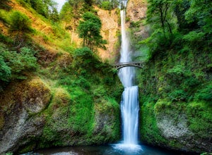
4.22.61 mi / 1214 ft gainMultnomah Falls is worth a quick stop anytime you're visiting the Columbia River Gorge National Scenic Area in Oregon. This waterfall is the tallest in Oregon at 620 feet and the third largest in the Pacific Northwest behind Bridal Veil Falls (1,289 feet) and Green Lake Falls (979 feet) and has a...Read more -
Portland, Oregon
Powell Butte Nature Park Loop
6.22 mi / 1004 ft gainBefore officially becoming a nature park in 1987, Powell Butte was primarily known for being home to four 50-million gallon underground reservoirs. Today, the wide expanse of land is packed with miles of trails-- the perfect place for hikers, mountain bikers, and even horseback riders to get thei...Read more -
Corbett, Oregon
Triple Falls
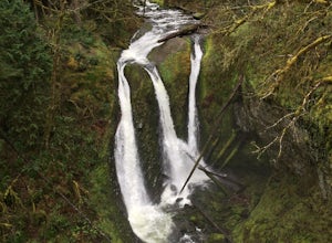
4.53.4 mi / 1168 ft gainAccess to Triple Falls is currently closed. Learn more on the Forest Service Site. This hike, starting at the Oneonta Trailhead is a 3.2 mile roundtrip. You will gain approximately 600 feet in elevation as the trail often switches from moderate flat easy hiking to more difficult elevation gain a...Read more -
Cascade Locks, Oregon
Oneonta Gorge
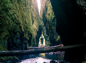
4.80.92 mi / 531 ft gain*Currently closed (except a small portion of the upper trail between Multnomah Spur and Trail #444 on Larch Mountain)...here This hike is very short (1 mile roundtrip) but does take some time to do. The trail leads down from the road into a stream bed. You follow the stream bed upstream through ...Read more -
Cascade Locks, Oregon
Horsetail Falls Loop
4.52.56 mi / 610 ft gainStart off on this loop from Horsetail Falls Trailhead. It never hurts to start a hike with a view of Horsetail Falls. This 2.5 mile loop will start you off on Gorge trail #400 up Horsetail Falls Trail. You’ll encounter a few switchbacks before the trail flattens out and leads you into the valley ...Read more -
Cascade Locks, Oregon
Ponytail Falls
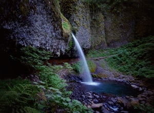
4.60.85 mi / 463 ft gainPonytail Falls is an easy 0.8 mile hike located in the gorge that begins at Horsetail Falls. After hiking up mild switchbacks, continue to your right at the first trailhead intersection. The path levels out before coming around the mountain and opening up to the waterfall. This is the easiest wa...Read more -
Washougal, Washington
Dougan Falls
3.5Does camping right next to an epic swimming hole sound like a pretty good way to spend a hot summer weekend? If so, you need to add Dougan Creek Campground to your list of weekend getaways. The Dougan Falls area of the Washougal River is packed with at least a dozen deep swimming holes, but the ...Read more -
Washougal, Washington
Naked Falls
5.0The family friendly Naked Falls is just 20 minutes outside of Camas, Washington. It is a great introduction to kids of the great Pacific Northwest. It is also a great reminder for cliff jumpers that there are still great spots that aren’t too far from home. A $12 fee per car is required for parki...Read more -
Yacolt, Washington
Hike Silver Star Mountain via Grouse Vista
4.56 mi / 2000 ft gainThe Grouse Vista Trailhead is located through the town of Washougal off of highway 14 just past Camas. Once you leave the city, the road will turn to gravel and dirt though it is fairly well maintained until snow arrive and accessible by most cars so long as you're willing to get drive over loose...Read more -
Portland, Oregon
Rocky Butte
4.2Joseph Wood Hill Park is another under-the-radar gem right in the heart of the city. It’s located on Rocky Butte, an extinct volcanic cylinder cone, and provides a sweeping panoramic view of Portland and beyond. Accessing the park is easy – you can drive directly there and parking is plentiful. ...Read more -
Stevenson, Washington
Beacon Rock
3.61.49 mi / 351 ft gainBeacon Rock is one of the most recognizable landmarks along the Columbia River Gorge. It’s an 848-foot basalt monolith (a singular piece of rock) that was once the core of an ancient volcano. To access the rock, park in a developed parking area at the rock’s base that has room for about 30 cars. ...Read more -
Portland, Oregon
Mount Tabor Loop
4.51.88 mi / 325 ft gainMount Tabor City Park is located in the heart of southeast Portland and is situated atop an extinct volcano. It’s comprised of more than 190 acres of beautiful Douglas Fir forest and features several relatively easy routes to the top: the easiest being the road you can drive (but what’s the fun i...Read more -
Stevenson, Washington
Hamilton Mountain
4.25.61 mi / 2336 ft gainHamilton Mountain has one of the best views in the Columbia Gorge. The hike starts out with a gradual uphill climb through an old-growth forest. After about a half-mile in you will come to a clearing where you can see the ridge line going up to the top of Hamilton Mountain. From there you'll pass...Read more -
Stevenson, Washington
Hardy and Rodney Falls
4.02.17 mi / 699 ft gainLocated along the Hamilton Mountain Trail, the Hardy and Rodney falls out and back hike is a good alternative for those looking for a shorter hike compared to the 7.6-mile hike to the top of Hamilton Mountain. From the Hamilton Mountain Trailhead, you will follow the trail through thick trees fo...Read more

