Clackamas, Oregon
Top Spots in and near Clackamas
-
Tillamook, Oregon
Wilson River Trail
3.018.58 mi / 4879 ft gainThis long trail provides hikers with great views of the corridor in the Coast Range. As the trail follows public land for the most part, there are a couple sections with steady elevation gains to avoid private land: near Lees Camp and Ryan Creek. Although the trail receives some of the most rain...Read more -
Detroit, Oregon
Battle Ax Mountain
5.05.09 mi / 1594 ft gainWith no officially marked trailhead, this hike begins slightly west of Elk Lake in Marion County. Take Highway 22 to Detroit, OR. East of the bridge over Breitenbush River, turn onto (FR) Forest Road 46, with signs pointing to Breitenbush River. After 4.5 miles turn left at a sign for Elk Lake, a...Read more -
Hood River County, Oregon
Camp at Elk Meadows
4.54.5 mi / 1200 ft gainThis is a great trip for those who are new to backpacking. The hike to the quiet, peaceful Elk Meadows is relatively short, but the Newton Creek crossing presents enough difficulty to make this a fun and challenging adventure.Start at the Hood River Meadows Trailhead parking lot. Though there are...Read more -
Carson, Washington
Falls Creek Falls
4.85.82 mi / 1512 ft gainThe trail to Falls Creek Falls is well maintained with a few short moderately steep areas. The trail hugs the creek for the first mile, and takes you through old growth trees for the second mile. Once the falls are in sight, make sure to stop and look up to see the top tier through the trees. It'...Read more -
Stevenson, Washington
Dog Mountain via Dog Mountain Trail
4.56.53 mi / 2858 ft gainThe Dog Mountain trailhead is located halfway between Stevenson and Bingen. Look for the big signed parking area just after milepost 53 (Eastbound). The parking lot fills up quickly, especially during peak wildflower season, so if you can go on a weekday that would be better. There are 3 trails ...Read more -
Stevenson, Washington
Dog Mountain: The Steeper Route
4.55.55 mi / 2858 ft gainIf you know the Columbia Gorge, you know Dog Mountain. It's the ever-rewarding, incredibly challenging, insanely popular, calf-burning 6.5-mile hike that attracts hundreds of people every weekend, especially during May and June when the wildflowers are in full bloom. If you're like me and you h...Read more -
Gates, Oregon
Natural Rock Arch
5.00.68 mi / 449 ft gainThe Santiam Forest is well known for its many beautiful spots, but this one is fairly uncommon. It's likely you will be the only person out here. Since it's such a short hike, just about a mile round trip, you could easily make it a pit stop on your way to or from someplace else and not have to w...Read more -
Cascade Locks, Oregon
Mount Defiance
3.712.55 mi / 5167 ft gainThis hike starts at the Starvation Creek Rest Area. After parking, head west back along the shoulder of the freeway, where you’ll see a wooden sign stating “Mt. Defiance Trail.” Continue heading west along the abandoned Columbia River Highway. Keep going west as you pass the junction with the Sta...Read more -
Cascade Locks, Oregon
Lower Starvation Ridge Loop
3.72.69 mi / 1001 ft gainStarvation Creek Falls is an impressive 190 ft. waterfall just a few feet from the parking lot. If you don't know it's there, you'll miss it. Keep walking past the restrooms, away from the trail head to see this beautiful two-tiered waterfall. There are a couple of picnic tables near the creek to...Read more -
Cascade Locks, Oregon
Starvation Creek Falls
3.5The Starvation Creek Falls drops 141ft down into a naturally formed bowl, cascading past a wooded picnic area and onto the Columbia River. The falls are one of the easiest falls to access in the Columbia River Gorge along with Multnomah Falls, but are far less Crowded. The short 300ft walk from t...Read more -
Cascade Locks, Oregon
Warren and Lancaster Falls
4.51.89 mi / 571 ft gainThe hike along Mt. Defiance Trail to Warren and Lancaster Falls is great if you want to get away from some of the more crowded destinations in the gorge, or just want to catch some shade during the summer. The trail is fairly easygoing, though the last 1/4th of a mile to Lancaster Falls is a bit ...Read more -
Mount Hood, Oregon
Snowshoe to the Tilly Jane A-Frame
5.02.7 mi / 1900 ft gainBuilt in the 1930's, the Tilly Jane A-Frame sits on the North side of Mount Hood at around 6,000ft. The cabin is very popular during winter months as it is located only 1,000ft below the tree line and offers beautiful snowshoeing, hiking, skiing and snowboarding opportunities, yet is also a popul...Read more -
Marion County, Oregon
Gold Butte Fire Lookout
4.32.44 mi / 741 ft gainGold Butte Fire Lookout is a real gem in the Willamette National Forest. At 4618 feet elevation, the nearby Cascade Mountain views are nothing short of spectacular! At the summit, sits a L-4 Ground Structure Type Fire Lookout that was built in1934 to be used as a Fire Lookout. Additionally, durin...Read more -
Tillamook, Oregon
King's Mountain
4.54.47 mi / 2461 ft gainKing's Mountain may be one of the most consistent hikes in the greater Portland area gaining 2,500 vertical-feet over 2.5 miles almost evenly the entire time. The trail starts out at a marked trailhead just west of the Elk Mountain campground (stop there for water and more restrooms in summer &a...Read more -
Hood River, Oregon
Punchbowl Falls
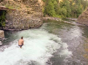
4.50.42 mi / 92 ft gainGetting to Punchbowl Falls is a super quick hike to a fun cliff-jumping swimming hole and waterfall. Be careful hiking the steep trail to the falls. Make use of the rope. Be VERY careful approaching the edge of the cliff higher up and know your limits when it comes to jumping. Always walk down a...Read more -
Carson, Washington
Panther Creek Falls
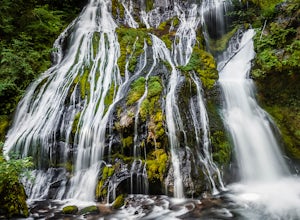
4.60.64 mi / 180 ft gainThis hidden beauty is just north of Carson, Washington. Watch for Panther Creek campground signs and follow the twisting road about 7 miles to a rock quarry and park there. The trail begins just off the road about 50 yards back - keep an eye out for signs for the trailhead and listen for the fall...Read more

