Peninsula, Ohio
Looking for the best hiking in Peninsula? We've got you covered with the top trails, trips, hiking, backpacking, camping and more around Peninsula. The detailed guides, photos, and reviews are all submitted by the Outbound community.
Top Hiking Spots in and near Peninsula
-
Peninsula, Ohio
Buckeye Towpath Loop
7.77 mi / 860 ft gainPlan to park at the Boston Store Visitor Center. From here, head west on W Boston Mill Road, where you'll pick up the Buckeye Trail just after the train tracks on your left-hand side. Follow the Buckeye Trail crossing over W Boston Mill Road and heading north toward Blue Hen Falls. Continue nort...Read more -
Peninsula, Ohio
Blue Hen Falls
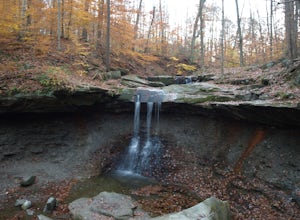
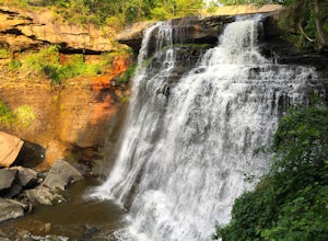
4.62.87 mi / 518 ft gainWithin Cuyahoga Valley National Park lies an amazing little waterfall known as Blue Hen Falls. There are few parking spots at the given address but there is an overflow lot right across the street. After parking you will descend down a semi steep hill and arrive at a bridge. Once you cross the br...Read more -
Peninsula, Ohio
Plateau Trail
5.04.56 mi / 607 ft gainPlateau Trail is a loop trail that takes you by a waterfall located near Peninsula, Ohio.Read more -
Peninsula, Ohio
Wetmore Outer Loop
5.06.32 mi / 673 ft gainWetmore Outer Loop is a loop trail where you may see beautiful wildflowers located near Peninsula, Ohio.Read more -
Peninsula, Ohio
Brandywine Falls
4.53.66 mi / 600 ft gainCVNP only has one designated camping area with five sites, located behind the Stanford House. The Conservancy for CVNP runs the reservations, and they fill up quickly so plan ahead (I made my reservation about 2 months in advance, and it was the earliest I could get in). There is a parking lot at...Read more -
Peninsula, Ohio
Cross Country Trail from Kendall Lake
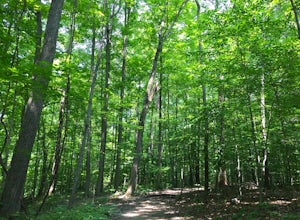
2.71 mi / 325 ft gainCross Country Trail from Kendall Lake is a loop trail that takes you through a nice forest located near Brecksville, Ohio.Read more -
Peninsula, Ohio
Kendall Lake Loop Trail and Salt Run Trail
5.04.27 mi / 597 ft gainKendall Lake Loop Trail and Salt Run Trail is a loop trail that takes you by a lake located near Peninsula, Ohio.Read more -
Peninsula, Ohio
Ledges Trail
4.82.34 mi / 210 ft gainDrive and park in the area shown on the map. If you are in the parking lot near a big open field, you made it to the right place. There are two ways to take the trail from here, south or north. I suggest that you go North first (towards the shelter area). Follow this trail into the woods and ...Read more -
Northfield, Ohio
Hike up Brandywine Creek to Brandywine Falls
4.32 miYou first park in the Brandywine Falls picnic area shown there on the map. There are three ways you go can go right off the start. You want to take the trail to the left named the "Stanford Trail." The trail consists of medium to large stones that are white in color. If you see this you are o...Read more -
Peninsula, Ohio
Towpath Trail via Oak Hill Road
4.03.29 mi / 259 ft gainThe trail starts just south of Indigo Lake along the Towpath Trail near Akron. Head north on the cinder towpath towards Indigo Lake and past the beaver marsh all along the Cuyahoga River. The trail is heavily wooded but runs along the winding road and bike lane that goes through the park, every s...Read more -
Northfield, Ohio
Hike to Contour Falls
4.51 miThis hike begins at the trail-head of Cuyahoga National Park. Once arrived, you will cross a bridge overlooking the Cuyahoga River. You will take the tow-path left, and follow it under the Route 82 bridge (you will pass a manmade waterfall on your right, but still have 0.4 miles to go). You will ...Read more -
Brecksville, Ohio
Deer Lick Cave Trail
4.48 mi / 495 ft gainDeer Lick Cave Trail is a loop trail that takes you by a waterfall located near Brecksville, Ohio.Read more -
Walton Hills, Ohio
Bridal Veil Falls and Tinkers Creek Loop
4.03.54 mi / 489 ft gainThis popular waterfall and gorge in the Cuyahoga Valley National Park are linked by an easy, well-maintained trail. Both attractions are deserving sights – Bridal Veil Falls measures 15 ft tall, with multiple shale layers creating the veiled effect, while Tinkers Creek Gorge, at 896 ft deep, has ...Read more -
Valley View, Ohio
Bike along the Cuyahoga River via Lock 39 Trailhead
5.039.57 mi / 1804 ft gainThe best way to tack the Towpath Trail along the remains of the Ohio and Erie Canal is by peddling it. Start at the Lock 39 Trailhead going south toward the Botzum Trailhead early in the morning before the crowds to ride upstream is the best way to start. Located a little over a mile East of I-77...Read more -
Novelty, Ohio
Hike to Ansel's Cave
1.5 mi / 100 ft gainThe beginning of the hike to Ansel's Cave starts at The West Woods parking lot next to the visitor center. From there, follow the signs noting the Ansel Cave Trail. About 1/4 mile along, the trail splits into two directions; one takes you on the more direct route to Ansel's Cave along a well main...Read more -
Grafton, Ohio
Indian Hollow Reservation
3.05 mi / 105 ft gainIndian Hollow Reservation is a loop trail that takes you by a river located near Grafton, Ohio.Read more

