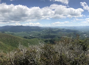
Tellico Plains, North Carolina
Top Spots in and near Tellico Plains
-
Clayton, Georgia
4.0
7.5 mi
/ 2378 ft gain
Black Rock Mountain State Park is Georgia's highest elevation State Park. It is adorned with several waterfalls, sweeping overlooks, blooming Rhododendron's, and plenty of miles of trail. The James E. Edmond trail is the longest and by far most challenging hike in the park. Its medium-long dis...
Read more
-
Gatlinburg, Tennessee
Take Porters Creek Trail, a gravel road alongside Porters Creek. You will pass by an old farmstead and cemetery, as well as lots of wildflowers if you're out during the spring.
In a mile, keep left, then in another half mile or so you should cross over a small (and somewhat harrowing) footbridge...
Read more
-
Knoxville, Tennessee
This park is located in south Knoxville. The wildlife management area is very popular in the sunflower season. This area offers many activities including biking, hiking and photography. There are several trails that run through the area but some of them are closed in hunting season so make sure t...
Read more
-
Knoxville, Tennessee
This trail is located at the Ijams Nature Center. Ijams Nature Center is only 10 minutes from downtown Knoxville and is a great place to escape city life and enjoy the outdoors. The parking lot here is quite large and in the busy season it has an overflow lot too. Ijams Nature Center has many hik...
Read more
-
Highlands, North Carolina
This is an awesome waterfall that offers views from several different spots along the road as well as a quick hike down to the base!
The small pull-off area is located towards the top of the falls. There isn't much space (3 maybe 4 cars at a time), but there are additional pull-off areas further ...
Read more
-
Knoxville, Tennessee
This greenway starts at the Island Home Park and goes through Ijams Nature Center and the Forks of the River Wildlife Management Area. The trail is almost 4 miles one way so it makes for a great half day trip. From start to finish it is 8 miles long. The trail is mostly paved with only a small bi...
Read more
-
Cherokee, North Carolina
4.2
0.22 mi
/ 148 ft gain
Although it is not much of a hike at just 0.3 miles, it is accessible to people of all fitness levels. A climb up a series of stairs leads you to a trail overlooking Mingo creek. You will then find a 20 foot wide bridge which serves as the viewing platform of the falls.
If you care to advent...
Read more
-
Knoxville, Tennessee
This park is located just 10 minutes from downtown Knoxville. The parking here is massive and has near 100 parking spots spread out over the park. The park offers many activities and amazing views. The main attraction of the park is the greenway and the disc golf course. The greenway runs all the...
Read more
-
Gatlinburg, Tennessee
4.9
7.83 mi
/ 2190 ft gain
This multi-tiered waterfall is known as the tallest in the park – a worthwhile reward for the steep and sometimes tricky terrain you'll face on the way up.
The popular route to the falls also passes through an impressive old-growth forest, which apparently boasts some of the tallest trees in the...
Read more
-
Kodak, Tennessee
Begin your trip by putting your kayak in the water at Kelly Lane. The parking area is large and grassy. The trip is 4 miles and takes about two hours. On your journey you will have views of flower fields and rock walls.
Once you get to the island paddle around and see the wildlife. There is a sec...
Read more
-
Dillard, Georgia
Starting at the trailhead you begin by following the yellow blazes. The trail isn't well marked so keep an eye out for the blazes you see. The trailhead starts at the dead end of Kelsey Mountain Trail. The path immediately starts to incline and doesn't stop. A few minutes in you will come to a fo...
Read more
-
Bureau of Indian Affairs Highway 506, North Carolina
5.0
1.21 mi
/ 400 ft gain
Your hike will start at the base of the Blue Ridge Parkway just a few miles from the start in Cherokee. The trail starts right off of the parkway in a very small easy to miss dirt road. There is a small area to park that then you start your hike up the dirt road right after the gate. The hike to ...
Read more
-
Highlands, North Carolina
Dry Falls is located off of Hwy. 64, which has been designated as the Mountain Waters Scenic Byway, and the road does not disappoint. Hwy. 64 is a two lane road which hugs the northern side of Cullasaja Gorge, which has been carved by the Cullasaja River. Besides Dry Falls, Hwy. 64 leads you past...
Read more
-
Kodak, Tennessee
This is a great and easy hike through the Seven Islands Birding State Park. This park is located in east Knoxville and is one only 20 minutes from downtown Knoxville. The trail starts at the Seven Islands Birding Park parking lot that has a beautiful garden with lots of wildflowers. The trail is ...
Read more
-
Kodak, Tennessee
This trail is located in the Seven Islands Birding State Park. This park is east of Knoxville only about 20 minutes from downtown Knoxville. The park is small but there is plenty of beauty and lots of hiking trails in the area. At the beginning of the trail there is a gorgeous flower garden and a...
Read more
-
Sylva, North Carolina
5.0
5.98 mi
/ 2142 ft gain
Heading out from the parking area, head north on this challenging hike. For the majority of the hike, you'll have a pretty steady uphill charge. There are some flat parts between climbs, so be sure to catch your breath and get some water in during these times. Once you reach the fork, where you'...
Read more


