North Carolina
Looking for the best photography in North Carolina? We've got you covered with the top trails, trips, hiking, backpacking, camping and more around North Carolina. The detailed guides, photos, and reviews are all submitted by the Outbound community.
Top Photography Spots in and near North Carolina
-
Canton, North Carolina
Tennent Mountain
5.03 mi / 285 ft gainPark at the Lot at the end of Black Balsam road, and start your morning in the dark, down the old dirt road at the end of the lot. Take this road until you get to Ivestor Gap and make a right onto the Art Loeb, try and time it so the sun is just about to rise here. Hike or trail run The Art Loeb ...Read more -
Bryson City, North Carolina
Andrews Bald
5.03.55 mi / 1200 ft gainThe trail begins at the Clingmans Dome parking lot, just to the left of the paved walkway up to Clingmans Dome. You will start the hike at an elevation of 6130 feet which is only 334 feet less than Clingmans Dome which is the highest point in The Great Smoky Mountain National Park, and the second...Read more -
Lake Santeetlah, North Carolina
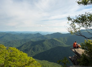
Huckleberry Knob
4.81.77 mi / 295 ft gainHuckleberry Knob is the highest point in the Cheoah Ranger District at 5,560 feet, and it offers expansive views of the surrounding Cherokee and Natahala National Forest. The hike is 2.4 miles roundtrip and begins at the parking lot between mile 8 and 9 up an old dirt road. You will go up the di...Read more -
Traphill, North Carolina
Hike the Stone Mountain Loop
4.5This is a strenuous 4.5 mile hike beginning from the Lower Parking Lot in Stone Mountain State Park (for a 5.2 mile hike, begin at the Upper Parking Lot). From the lot, take the trail by the bathroom. Keep right at the first trail intersection, then left at the second trail intersection to stay ...Read more -
Fontana Dam, North Carolina
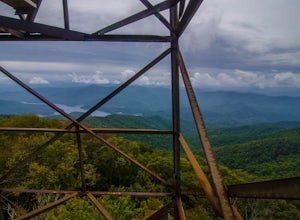
Shuckstack Fire Tower
5.08.84 mi / 2605 ft gainYour Shuckstack adventure starts at the Fontana Dam outside of Bryson City, NC. As the highest dam East of the Rocky Mountains, it's a sight on its own. This will be your last chance to fill up water bottles and use the restroom so take advantage. You can leave on foot from the dam and continue ...Read more -
Otto, North Carolina
Hike to and Climb Pickens Nose
4.81.5 mi / 200 ft gainFrom the parking area (fits about 6 cars) follow the trail on the same side of the road up the ridge through dense rhododendron. Several spur trails branch off of the main trail and lead to rock outcroppings with excellent views. Getting to the parking area is slow. The narrow gravel road winds...Read more -
Marion, North Carolina
Camp in the Linville Gorge via the Pinch In Trail
1.5 miWe are pretty notorious for passing up a good campsite but we are learning our lessons. We got a late but interesting start on Pinch-In trail. We climbed down a steep 600+ feet after passing this ledge only to climb right back to it a third of a mile in. If we come up to an awesome spot, we somet...Read more -
Canton, North Carolina
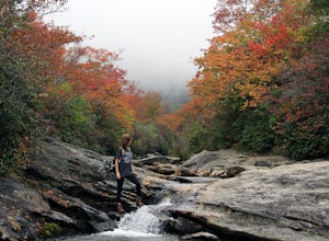
Explore Lower Falls at Graveyard Fields
4.3Graveyard Fields got it's name years ago from wind-thrown tree trunks that gave the appearance of a graveyard, until 1925 when an intense fire swept through the area, destroying the stumps. The forest has been recovering ever since.The parking area for Graveyard Fields is located at milepost 418....Read more -
Franklin, North Carolina
Nantahala National Forest via the Appalachian Trail
4.027.11 mi / 5420 ft gainWinding Stair Gap on Highway 64 is the starting point for this spectacular backpacking trip through the Nantahala National Forest. It's right outside the hiker friendly town of Franklin, NC, so the town is your last chance for a hot meal and any last minute supplies. There is a parking lot at the...Read more -
Mount Gilead, North Carolina
Dutchman's Creek Trail, Uwharrie NF
3.811.31 mi / 1407 ft gainThis hike starts with mellow terrain changes allowing you to get a feel for the trail. For the first 5 miles you will have one or two steep inclines that take a toll on the calf muscles. The remaining 6 miles include a more difficult terrain including a section of the hike called Hallucination Hi...Read more -
Blowing Rock, North Carolina
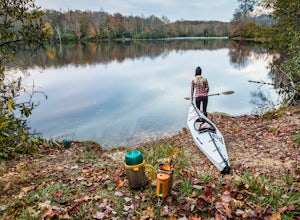
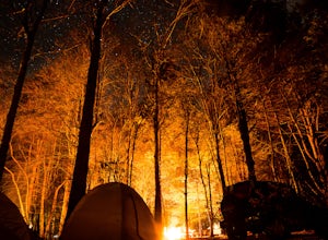
Camp and Paddle at Price Lake
This campground is all kinds of amazing, and if you get one of the sites in the A loop, you will have lakefront property (just be warned, if I see you there, I'll have to crash with you ;-). Price Lake is a gorgeous lake right off the Blue Ridge Parkway in North Carolina and perfect for canoeing...Read more -
Sylva, North Carolina
Waterrock Knob Trail
5.01 mi / 407 ft gainThe trail begins paved and quickly climbs up into a heavily forested area. Once at a 1/4 of a mile in, you will come to a nice overlook that will give you your first real good view of the surrounding mountains. The trail then continues on, though now unpaved, with great views off to your left as ...Read more -
Brevard, North Carolina
Camp at Davidson River Campground in the Pisgah National Forest
4.5Pisgah National Forest, in my opinion, is one of the best national forests in the United States. Being just a short drive from Great Smokey Mountain National Park it has all the feel of being in the smokies with more to explore. Pisgah has anything you could want to see or do from tens of water...Read more -
Waynesville, North Carolina
Explore Cataloochee Valley
5.0History, solitude and wildlife abound in this quiet corner of Great Smoky Mountains National Park, but getting here is not easy. Take the scenic route via Cove Creek Road from Cosby, TN. Drive 40 miles along the twisting, gravel road to Cataloochee, NC. The scenery along the way is outstanding, b...Read more -
Gastonia, North Carolina
Hike Crowders Mountain
4.64.2 mi / 1100 ft gainCrowders Mountain State Park is the closest green space to downtown Charlotte and it will not disappoint. There are two peaks worth checking out: The Pinnacle and Crowders Mountain. Crowders Mountain stands at 1,600' offering incredible views of the surrounding area and on a clear day you can see...Read more -
Pinnacle, North Carolina
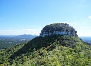
Hike the Jomeokee Trail at Pilot Mountain SP
4.30.8 mi / 100 ft gainThis unique peak, also known as the Big Pinnacle, is in Pilot Mountain State Park. From the main parking area on top of the mountain on Pilot Knob Park Road, you can first view the Big Pinnacle from the overlook attached to the parking lot. The prominent mountain behind the Big Pinnacle is Hang...Read more

